Friday, October 16, 2020

The Troup-Lyvia Traverse


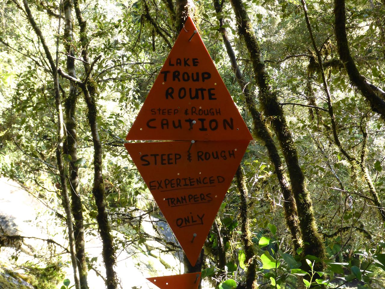
Above Deep Cove in Middle Fiordland lies a striking mountain called Mt Troup (1512m) with an enchanting lake nestled at the bush line on its northern flank. Last year, some of our team recut the track from Hanging Valley so I was keen to use this to traverse Troup.

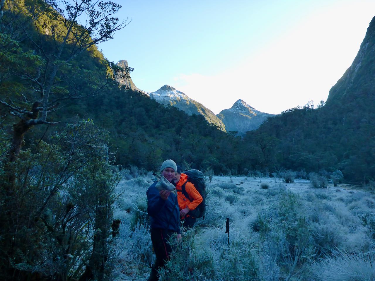
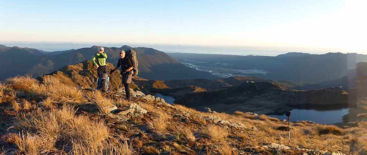
On 8th October, Sally, David and I boarded the 6.30 am Meridian boat over to West Arm. The weather was fine and the omens favourable. Bob Hughes met us on the other side and whisked us over to Deep Cove. By 9.00 am we were ready to start up the track. Bob asked us for a photo and offered us a radio but I declined as we had 2 PLB’s with us. I, matter of factly, told him to give us 7 days before sending out any search parties and true to his word he later told Alastair and Annabel that “Stanley said to give him another 7 days if they did not return by Sunday evening and that I did not want to hear the sound of a helicopter”.

Our packs were relatively light this time minus packrafts so we reached the bush line in just over 3 hours. The day was sunny with a cool breeze. There are some waratahs marking the route from the open slip in the bush through clearings to the bush line. I carried up a large orange triangle and some wire and we put it up on a waratah.


Ahead of us was the summit of Troup with about 200m of snow which I did not expect. Earlier I had been told there was little snow up there so had decided not to take crampons or ice-axes. We had lunch in the tussock and then carried on towards Troup. We sidled well above lake Troup to a buttress on the right-hand side. This was easily ascended to snow slopes. Then it was a sidle out left and upwards through soft snow often knee deep.

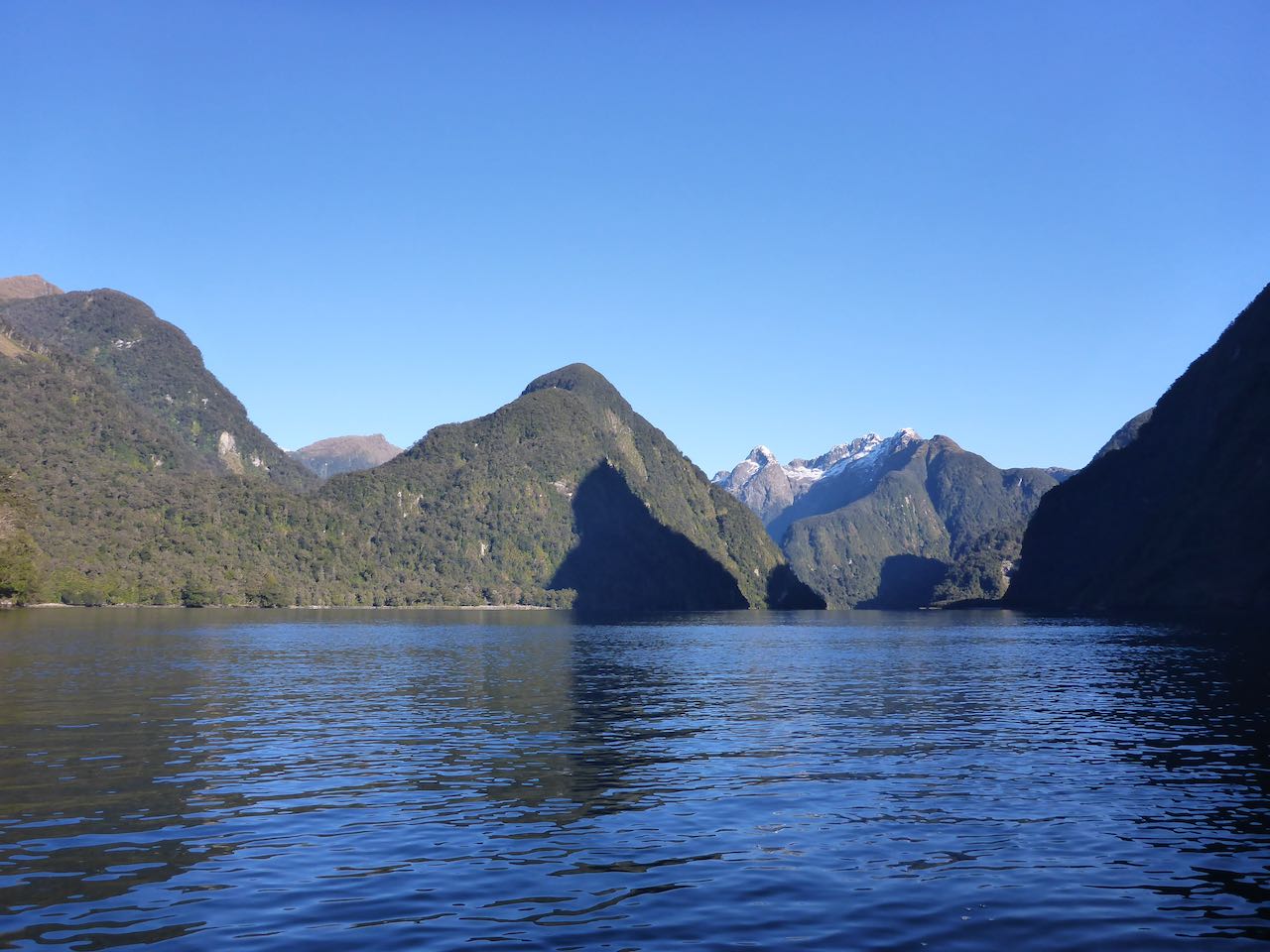
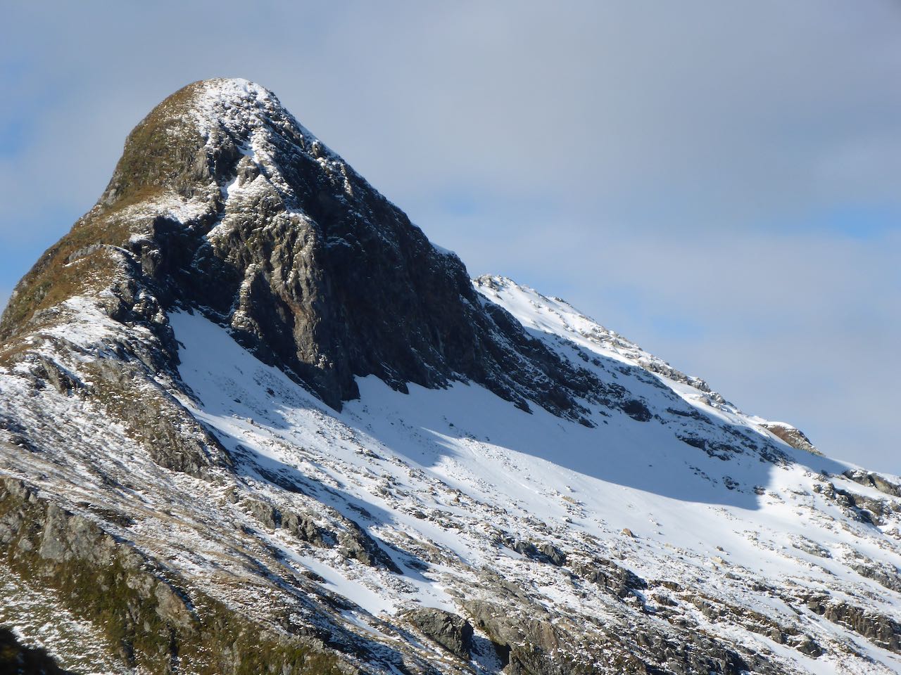
The summit was specious with great views down Doubtful Sound, and back to the Black Giants to the south. It was cool on the summit and overcast so we did not linger. A sharp snow ridge slopes off to the SW ending in a huge steep buttress. To avoid this, we descended extensive moderately angled snow slopes towards the Lyvia. I still could not see around to our ridge route until down about 300m but all was straightforward to a lovely campsite at around 1100m. David and Sally were powering along.


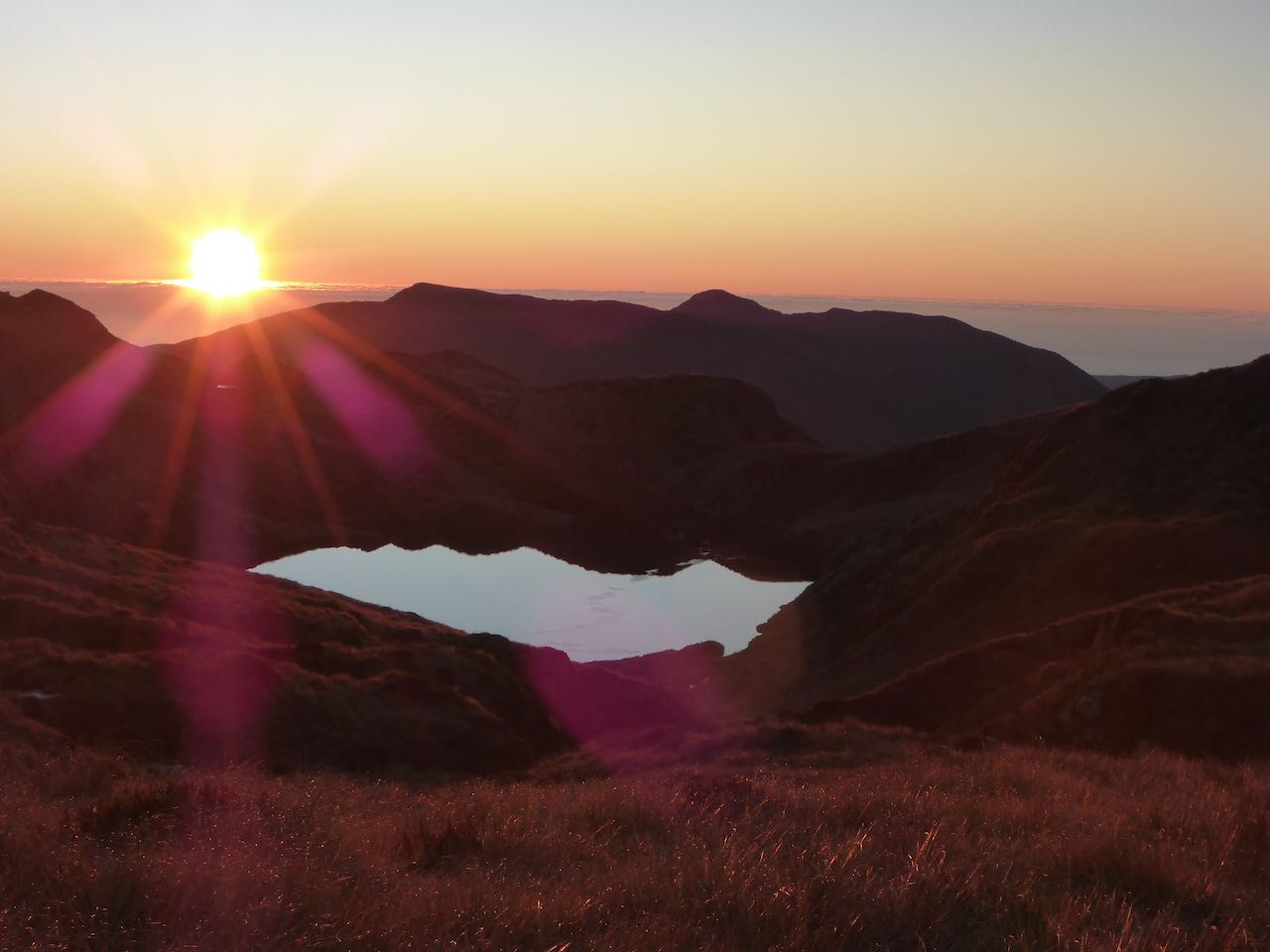
We set up camp on a dry spot beside some tarns. Below us was the Lyvia Valley and beyond the impressive Black Giants. It was a cool night with a frost and ice on the tarns. The next day dawned fine, a cerulean sky and delightful tussock ridge in front of us extending to Livia Tarn in the distance. There were many up and downs through some impressive ‘gaps’ cutting across the long ridge. One necessitated a scrub bush downwards into a gully and then an easy climb out. Further on, we came up against some cliff lines which we pitched. Optimistically, I told the others we’d be at Livia Tarn by lunchtime but then we came onto an exceedingly steep buttress on peak 1249m. Steep scrubby slopes dropped down to what looked like an overhanging wall and there 15-20m below that was the continuation of the easy ridge. I cursed my skinny rope which clearly would not reach the ridge below. Off to the right was a steep gully which I downclimbed for a short distance and spent some time pondering the possibilities. I might have given it a go by myself but there was no way I could take Sally or David down those vertiginous slopes. 


 The view down to the valley floor in the creek to the north, several hundred metres below, was awesome and seemed to be bordered by vertical rock. I could not see any possibility of down climbing it. About a kilometre back was a gap at 900m so we decided to head down from there into a creek heading north to the aforementioned valley. The map looked fine but it was a brutal effort with a huge drop off to our left. It took us 2.5 hours to reach the valley floor at the junction of two creeks. We were fortunate to find enough space for our two tents. 


Day 3 was fine and warm as we set off up the main creek. At first scrubby, this transited into open forest and took us to the bush line without any difficulty. From here easy tussock slopes led to peak 1145m where the views were outstanding in all directions. Below us was Livia Tarn. To our right was an awesome drop to a valley leading to the south end of Halls Arm over a thousand metres below.  A striking mountain called Mt Crowfoot dominated the southern aspect. Some keas paid us a visit. The descent to Livia was easy. We walked around the lakes and stopped for lunch at the bush edge. We pulled out our sodden tents to dry them. A weka came to check us out.


Deer trails led down through the scrub until we got into some tall crown ferns, tree fuschia and beech forest. 3 hours later, we arrived at on old slip on the TR covered in Olearia. We’d done enough that day so we set up camp after some gardening. It clouded over and that evening the rain arrived. For the next 40 hours we were tent bound but by Monday morning it had eased off and as the rivers did not look too swollen, we pushed down valley. It was a long day tramping along the wet valley floor trying to find deer trails, crossing swampy clearings until we struck an amazing deer trail that dropped 200m along a steep descent to the junction of the main Lyvia and its south branch. This branch looked quite deep but by holding onto each other and pushing across a stony bottom where the current slowed, we made it across even though it was waist deep.


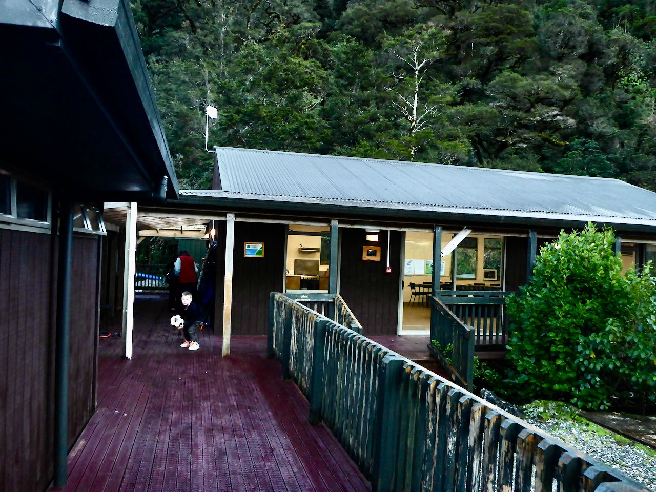
Another hour took us to the Lyvia track and later the Wilmot Pass road. David had gone ahead and PC met us in the vehicle to drive us back to the hostel. The next day we were on the traplines.

Acknowledgment: To David and Sally for a sterling effort in somewhat trying conditions.

Thursday, August 6, 2020

From Hall Arm to the Jaquiery Pass, 16-18 July 2020


In February 2006, Simon and I paddled up Vancouver Arm of Breaksea Sound to camp near the tidal flats, leading to the Jaquiery Pass, our intended route. We found that the valley floor was covered in a dense podocarp forest of Pungas, Coprosma, Vines, Crown Ferns and fallen, rotten trees. Too early, we left the valley floor for a rockfall on the right-hand side. Higher up, we planned to sidle leftwards to a slip where we thought there might be deer trails heading over the Jaquiery Pass to Hall Arm. However, the going was very steep, and it proved impossible to sidle the face. The going deteriorated into a vertical, vegetated grovel up mossy cliffs, and fallen rotten trees carrying our massive packs and inflatable boat. At 330m we could progress no further, being blocked with a vertical bare rock. After a bewildered look at Simon, and muttering deprecations, we started down to try plan B.


Fast forward to July 2020 and our conservation trip to Deep Cove. The plan was to work on our trap lines for 5-6 days and if the weather held to run a reconnaissance from Hall Arm to the Jaquiery. I had intended to flag a route in preparation for a major effort south this coming summer and the crux was the passage to Vancouver Arm.


There were four of us from our trapping team: Sally, David, Gavin, and me. Bob who was the relief caretaker at the hostel, along with Bronwyn, his trainee/assistant, launched the boat and took us on a sunny morning down Deep Cove past Pridham Point into Hall Arm. Bob is a great character and has an encyclopaedic knowledge of the area. Ahead of us was the sentinel Commander Peak and he told me about a fisherman friend who once noticed 2 dots on its summit and looking back at me said “and who do you think they were? “. “Tara and Keith” I replied. Yes, I heard about it – south ridge, a desperate leap on a vertical step to grab a root and a pull-up.


Near the top of Hall Arm, Bob slowed the boat and drifted in towards some rushes in shallow water. Then it over the side into cold water to wade ashore into the damp, frigid bush. With a roar, Bob disappeared back down the sound leaving us in quiet contemplation. We pulled out our packrafts and left them in plastic bags in the bush, then loaded up and set off on ubiquitous deer trails heading up the valley. The bush was quite dense in places and cold as no sunlight entered this deep U-shaped valley, shaded by the surrounding high mountains. About 2 kilometres in, we crossed a large tributary coming in on the TL. Here the valley starts to climb more steeply and the terrain becomes more difficult with tall crown ferns, rotten logs and concealed holes.


We started flagging our route. Ahead was a steep spur coming down from the TL and the valley curves around this in a northerly direction. We climbed some cliff lines and found some open slabby leads, which was a relief. This led to a level section but it was very slow going. Somewhere ahead at around 500m altitude and 4 pm, we stumbled on a small open space with enough room to pitch our 3 tents. It was dark at about 5.30 pm and too cold to hang around so it was into the tents for a very long night. During the night we were woken by two Kiwi calls, loud and piercing, nearby.


Around 7 am, I jumped up and fired up the stove for a hot drink for Sally and Gavin. Shortly after 8 am, we were off climbing up to the next level where it was a bit more open. This led to a partially frozen lake surrounded by frosted tussock and bog. We initially tried to get around the TL but this led nowhere, so then it was back to the mouth of the lake where we crossed to the TR. About 160 m above, the pass bathed in life-enriching sunlight. Leaving our packs, we moved swiftly up through the bush to arrive on the scrubby saddle. The view was very restricted, though we could identify Vancouver Arm far below us. It looked easy enough down the next 200m or so of bush through the scrubby forest but beyond this there was no view down to the valley floor. It just seemed to be a herculean struggle to head down this to check out the route so I suggested, we hope for the best next time and retreat.


Then it was back to the packs and off down the valley following our flagging tape. This went mostly well and around 4 pm, we were close to the large tributary on the TL at about 120m. David suggested that we cross the river to a level bushy area on the other side. This was a prescient thought as we immediately found enough open areas to camp again.


On our last day, we reached the sea in 2 hours, launched our packrafts onto a wind still fjord, paddled through rafts of thin sea ice, reached the long-sought sun, and in harmony and good fellowship, paddled back the 8 km to Deep Cove. Hopefully, there will be a sequel to this adventure next summer.


Acknowledgment: My gratitude to Sally, David, and Gavin for joining me on this wee trip and to Alastair, Fleur, and John for continuing the conservation work over in Deep Cove in our absence.

Friday, July 3, 2020

A Traverse of the Northern Olivine and Thomson Mountains from the Cascade River to Martyr Hill and Lake Clarke, 20-25 June 2020.


By coincidence, Neil and I dreamt up this trip separately and then joined forces along with Gavin for a winter traverse in a great spell of settled weather. 2020 has been an extraordinary year, full of major cataclysmic events such as the Fiordland Deluge on 3-4 February which cut off Milford Sound and destroyed the Lower Hollyford Road and Gunns Camp, followed by the lockdown in March-April brought on by a Pandemic. Plans and dreams were put on hold and then one day, we had eliminated the beast and suddenly the mountains were beckoning. But winter was upon us and I still remember our frigid trip to South Westland exactly a year ago so we settled for this shorter, less acerbic traverse.

Friday night saw me drive up to Arrowtown and stay with Carol and Gavin. Then the next morning, we drove to Albertown, picking up Neil and continuing over the Haast to Hannah’s Clearing, where we stopped to see Ruth and Wayne for a social visit before continuing to Martyrs. Just past Carl Creek, we hid a bike in the bush. At the road end, we briskly walked to the Cascade River to see if we could find my split paddle that I had left there the previous March. Amazingly, it was still lying in the grass where I had rolled up my packraft.

About two kilometres up from the lock gate, we left the car at the start of the old track down to the Big Bend and tramped up the Cascade for two hours to camp on a pleasant flat under the beech trees that evening. Shortly after 5 pm, it was dark and too cold to hang around so we dived into the tent. Gavin had brought along his old Fairy Down alpine tent which was much warmer than the Copper Hotel with its mesh inner. Neil had taken his Macpac Minaret.

I jumped up before dawn and got the stove going for a hot drink for everyone. Then after packing up, we set off for Woodhen Creek, an hour away. A rocky creek bed led to the first tributary on the TR and this provided easy access to the bush line. The sun was slipping down the slopes towards us which we reached at 650m. The valley eased off and we stopped on a stony plain at 800m for lunch. A short scrub bash and we were climbing up a stony ridge to the top of Martyr Hill at 1031m. To the south were the russet-coloured slopes of bare Mt Richard and Mt Raddle–part of the ultramafic zone, a hard landscape bare and bony with only a whisper of grass.


Ahead was a band of beech forest and we pushed through this up to a peak at 1207m. A bit further on we sidled down into a shallow valley on our left that led to twin lakes and camped on a rise just before the further one. There was a lovely alpenglow as the sun melted into purple clouds on the far western horizon. I turned around and the tussock had turned russet against a silver sky.  A bright planet appeared either Jupiter or Saturn. Later during the night, I went outside and watch a spectacular display of the Milky Way and the Magellanic clouds to the east, galaxies frozen in a moment of time in a limitless domain beyond our comprehension.


We were away before 8.00 am next day climbing up to peak 1449m overlooking Staircase mountain and the ridge to Dagon. We dropped down to a col at 1259m and decided it was too far to climb Staircase Mountain and have enough time to reach a bivvy site under Dagon. So we descended easily down to the lake to the NE at 840 m. There was about 180m of bush on the TL of the creek at the bottom that went easily. The valley floor was boggy and we crossed this to a drier place on the far side where we stopped for lunch.


We wandered up the creek towards Dagon around hill 984m following an amazing deer trail through cliffs on the TL. This led to a hanging valley with some fractured giant rocks which gave us trouble and beyond them a frosted bowl which the sun never reached. It was now 3.30 pm and the sun was retreating up the slopes of Dagon, so we carried on up to a lovely sunny platform at 1200m where we camped. It was much warmer up there, great views, and a splendid place to camp.
  
The plan next morning was to climb to about 1300m and leave our packs while we ascended Dagon and after returning to sidle up across a shelf to the north to peak 1478. The gully we followed turned a bit icy higher up as we made for a pinnacle on the left. Alas, this was not the summit which was further east. The snow slopes were quite frozen and required care as we did not have crampons or ice axes. Backing off, we found a snow gulley that took us easily to the summit. A ceiling of grey cloud obscured the summits though we could discern the Bonar Glacier cascading into the Waipara.

The descent was straightforward back to the packs as was the sidle to the north though further on, we ran into very fractured slabs which were hard going. From peak 1478 we descended to a col linking onto the Thomson Range. Below peak 1193, we dropped down to tussock benches to the west and camped near some tarns. Neil went off to take some photos while we sorted out our camp and got dinner on before the cold drove us into our tent.


I was up well before dawn firing up the stove and getting organized. It was just over a kilometre to the bush ridge to Lakes Dan and Leeb. we followed deer trails along the ridge which was covered in beech forest with an understory of coprosma. I was plodding along in a desultory manner when all of a sudden, we came face to face with 2 women trampers coming in the opposite direction–Frankie and Emily who Neil knew from Hawea. I think they were just as startled to see us as we were. We swapped our route plans and I was impressed with their trip and time frame. Then they were gone and we started climbing up to Lake Dan and just beyond it to Lake Leeb. The sun was blazing down and it was rather Arcadian especially looking back across the lake with Mt Aspiring as a backdrop.


We climbed a small hill to Sweetheart Creek and walked down this to Lake Clarke. On a spur to the west of the outlet, we camped in the lee of the bush as a frigid wind was blowing from the south. Just across from us we found a large, wrecked tarp and ropes in the trees likely left by helicopter assisted hunters– a disappointing sight in such a pristine setting.


The next day, we headed back to the lake, crossing near the outlet and climbing up the hill on a deer trail to circumvent some deeply incised vegetated gullies that crossed the flat on the other side. Then we were at the bush line and following down a bush spur on the TR of Carl Creek to Moonlight Creek. From here it was in the rocky stream bed, picking our way down to the Jackson River where we forded just up from the Carl Ck junction. Then Neil retrieved his bike and briskly sped away to return an hour later with my car.