Monday, June 28, 2021

A Winter trip to Dusky Sound 27 May- 4 June 2021


How did this come about? It started back in February when we did a conservation trip to Mamaku/Indian Island for Pure Salt Charters. It was a memorable trip with an eclectic party, with fine weather in a fabulous location. Initially, I had thought we’d offer to go again in spring but should we be cherry-picking our trips? The 27th of May saw our party of 5 including Sally, Belinda, Gavin, David and I lift off from the Te Anau-Manapouri airport and head into the dark mass of clouds smothering the Fiordland Mountains to the west. The weather thickened as we wove our way up the Spey Valley among foreboding peaks, wreathed in shifting clouds. I was nonplussed when our pilot said “Don’t take any photos once we get into the clouds” . . . why I wondered? We seemed to skim over dark-green, umbrageous forest and soaring bush-clad ridges disappearing into a grey mantle of storm wrack. Then, we were plunging towards the steel-grey waters of Supper Cove as the rain slanted down. We seemed to hover over the water and settled onto some logs underwater which I gather was the helipad at high tide. Well, this is going to be interesting, I thought as I pulled off my boots, preparing to wade ashore. By providence, B2 arrived in the inflatable, wading it towards the open door so we could jump in without getting soaked.


Once ashore, we waited in the dripping rain as B2 and the pilot moved our pile of gear into the boat and then ferried us out to the Flightless, looking forlorn out in the gloom. Soon we were aboard to be greeted by the ever-affable, imperturbable Sean. He soon disappeared into the wheelhouse so we took off our boots and made ourselves comfortable in the lounge as we steamed down the Bowen Channel towards Mamaku Island.


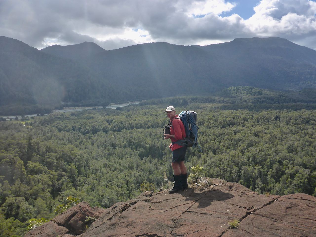
It was not unpleasant sitting in the cabin staring out at the strong northerly whipping up the seas outside. I wondered how we were going to get ashore on the rocky northern coast of Mamaku. If anything it became more violent outside as we progressed westwards. There was no option but for the Flightless to drop us off on the more sheltered side at Waka Cove. Even that was not an easy task but B2 managed it skillfully. Time had flown and as it was about a kilometre to our campsite, we set off with as much gear as we could carry on the trapping tracks. Now it would not have been too bad if the tracks went in a straight line but they zig-zagged all over the place so that we only got to our old campsite just before dusk. Just as I was walking up the track, I was startled by a large kiwi rushing past. We got our tents pitched and put up our two tent flies to make a kitchen.


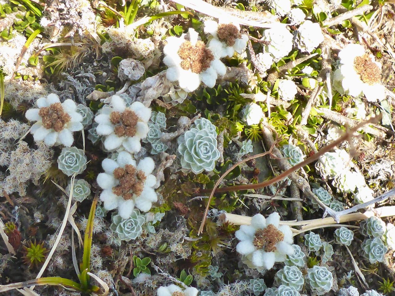
The next day, we retraced our steps to Waka Cove to uplift the rest of our gear and on the way back started to rebait some of the traps. Once back at camp, we split into two teams to start checking different trap lines. It was overcast and relatively mild. Belinda, David and I worked the trap lines to the west while Sally and Gavin took the ones to the east of the creek.  We were all back in camp before dark which was at 5.30 pm. The next day, Sally and Belinda and I worked the trap lines on the southwest of the island while David and Gavin covered the high hill ones. It was a strenuous day covering a lot of territory. The following day, we were able to finish the rest of the traps noting that the junctions near the lake were not well marked and easily confused – we plan to remark them next time. The day had been warm and some blue sky and sun had appeared briefly. The afternoon was spent relaxing around camp and on the shore rocks, David went for a paddle around the island. We got a message on our InReach that the Flightless would pick us up early the next day on its way to Supper Cove.


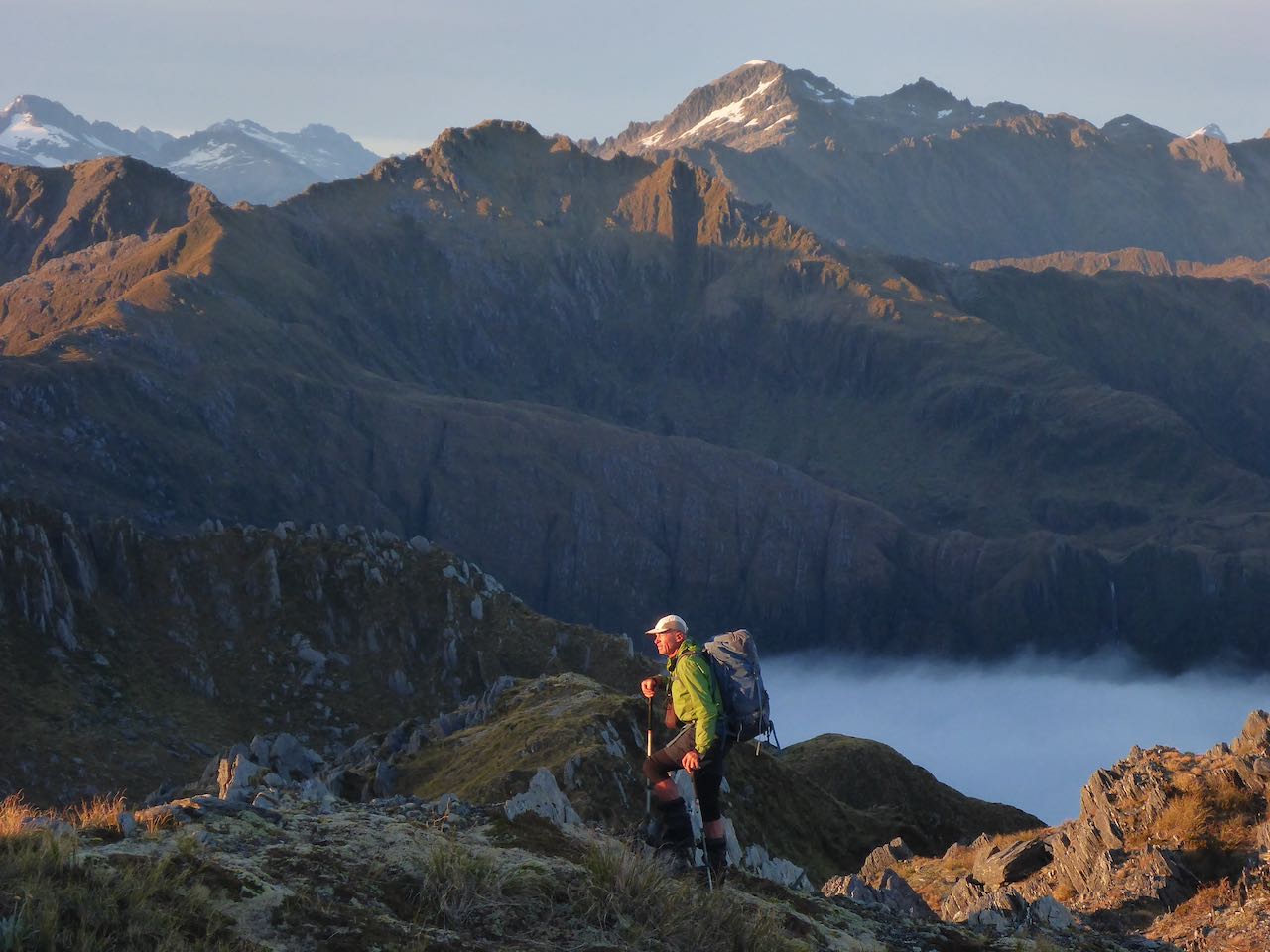
A calm sea greeted us as we lugged all our gear down to the rocks. It was just getting light and far away, in the direction of the Acheron Passage the Flightless was making directly towards us. Soon we were aboard and heading east to Supper Cove. The other guests were a hunting party. Once at Supper Cove, we were dropped off and said goodbye to the crew. We loaded up and set off along the mossy, slippery, rocky track to Loch Maree. It’s about 12 km away and as it was already approaching noon, we deemed it wise to make haste. It was drizzling and cooler here as we steadily marched along the sodden track. It was all of a bit of a blur, a mindless, unremitting, plod in the liquid forest amid the sound of falling water. David disappeared ahead of us.  On and on it went, winding our way up a bluff above Loch Maree and then a descent into a gully where the route disappeared in the fading light with the prospect of a bivvy looking increasingly likely. But by back-tracking, we picked up the route again and carried on now with headtorches and with renewed vigour. Then half an hour later, we arrived at the pitch dark but welcoming hut.


Sally’s parka had given up and she was soaked . . . a plastic rubbish bag was pressed into service as an undercoat. It was raining the next day as we left for Kintail about 10 km away. It was an acerbic, cheerless plod through mud, swamps and dripping bush but despite this, the rain forest was quite beautiful. I walked this with my mind on mute – it was type-two fun. I do remember seeing Kintail and that thank God feeling. The wood was very damp and the fire like our demeanour was . . . mute.


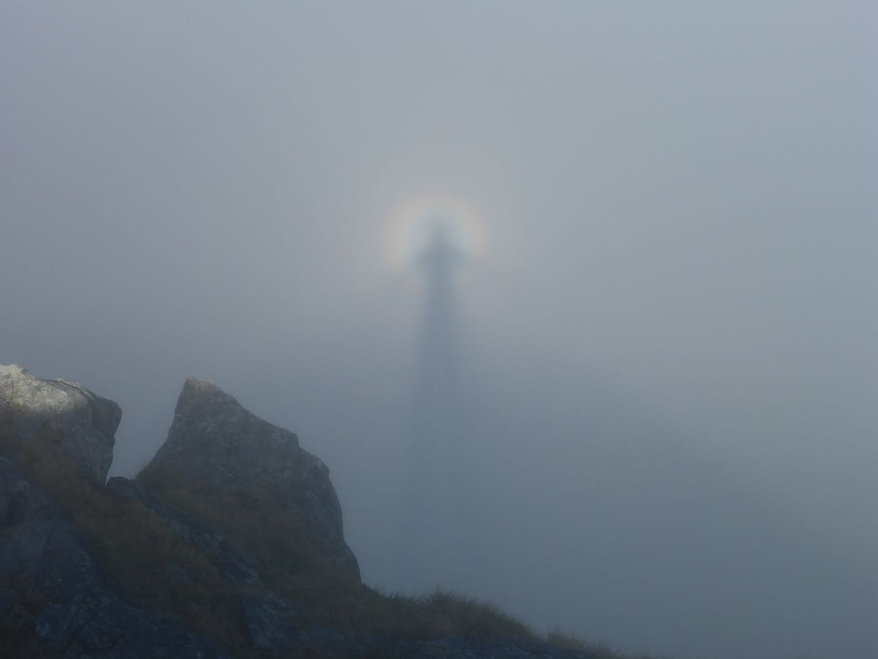
Day three saw us off early for the crossing of Centre Pass, a 700m climb in the persistent . . . rain. Our low-carbon route was losing its appeal. Our spirits lifted for awhile once we cleared the bush line but fell again as the pass disappeared in yet more ragged cloud. Even the keas had scampered as we plot upwards into the murk, rain and wind. Then it was down the zig-zags into the subalpine scrub and later more stately forest. The Warren Burn eventually decided to plunge off into the Spey Valley where we found the Upper Spey Hut. There was little dry wood for the stove and a broken hack saw blade did not make it any easier so it was another cheerless mini-fire.


The last day saw us off down the Spey on a better track, across several wire bridges and a steep pull up to the road for the final few kilometres to West Arm. The skipper on the RJ boat demanded cash for our ride across the lake and for a minute I thought he’d kick us off but Mike MacManus (God bless him) came to the rescue.


Acknowledgments: A big thanks to the team of Belinda. Sally, Gavin and David. Thanks to Sean and the awesome crew of the Flightless. Thanks to Mike MacManus for saving us from packrafting home across Manapouri. The last 4 photos were taken by Belinda.


Saturday, March 27, 2021

Traverse of the Northern Olivine Mountains


My first acquaintance with the Northern Olivines was in June 2020 when Gavin, Neil and I did a trip from the Cascade River to Martyr Hill, Mt Dagon and the Thomson Mountains. It took us 5 days and was a delightful excursion.

http://mulvanyadventures.blogspot.com/2020/07/a-traverse-of-northern-olivine-and.html


After this, we plotted a route further up the Cascade River, past McKay Creek, to the next creek south, then up to Mt Raddle to Bald Peak, Tararua Peak, Staircase Mountain, Martyr Hill and down the Martyr Spur, back to the road. In February, I spent a month in Fiordland and I was keen to see some different country. South Westland beckoned. The forecast promised a settled spell of fine weather starting on St Patrick's day, 17th March. I rang Sally and Neil to see if they were available. Then Sally had to drop out and Neil recruited Joanne William to join us.


I drove up to Albertown on 17th, marvelling at how quiet the roads were without the masses of overseas tourists driving their rentals. Neil took his car and when Jo arrived, we were off for the drive over to Haast, then south to the Martyr lookout above the ‘Bend’. The day was sunny and warm as we ambled down the track to the Cascade River. A couple of hours later, we camped at our old campsite before Woodhen Creek. This was tucked in at the forest margin and very pleasant.


There was a dew overnight but relatively dry under the trees. We set off for Woodhen Ck just around the corner, then on along the mossy, riverbank rocks to the start of the gorge. I’d been down it twice before so knew the best route. Just below the rock garden, we climbed up about 125m and then sidled along at this level finding small deer trails until we got around the bend on the south side. From here it was back to mossy, riverbank rocks to McKay Ck. We saw the remnants of some deer that had been shot. A bit further on, we started up the next creek and followed this up to cliffs of red ultramafic rocks. These are igneous, low in silica and rich in ultramafic minerals such as peridotite, kimberlite, lamprophyre, lamproite, dunite, and komatiite. We scrambled up these cliffs with aplomb and insouciance. The vegetation had thinned and at 600m, we had cleared the scrub line to find a reasonable campsite on a flat terrace. I cleared away some stones and pitched my single tent while Neil and Jo found a spot for their Olympus tent beside me.  Scattered cumulus clouds covered the peaks. Bonzai rata added a splash of colour along with white berries of Mingimingi. There was no wind or noise apart from the cascading water of the nearby stream.


The next morning, we set off up the hill, following a clear route on the red rocks to small lakes at 920m. The sky was a cobalt blue and an evanescent, diaphanous veil lifted off the Cascade Flat far below. We reached the summit of Mt Raddle covered in jumbled red rocks. There was a steep drop off to the next peak where the ultramafic abruptly stopped and the tawny tussock started. Mist was drifting over Bald Peak as we ascended it. On the NE side, we descended along a ridge with a stupendous drop to our right, falling to the Arawhata. Further along before Tararua Peak, we found a tarn and a nearby flat dry site for our camp. Neil was in high spirits and taking lots of photos. Jo was experimenting with her new Canon camera and getting tips from Neil. It was a photographer’s paradise. From the ridge, there was a superlative view of Mt Aspiring/Tititea across the void of the mighty Arawhata River. Gossamer strands of mist drifted over the ridge from the west. 


The next morning, the clouds had settled into the valleys as the rising sun lit up Tititea and the Haast range. Dew had settled during the night, delicate droplets dripping off the tussock and flowers. There were clumps of gentians still cloaked from the cold awaiting the warmth of the sun to greet the world. Violet harebells, Celmisias and the large green leaves of wilted Ranunculus lyalli were scattered among the tussock. The inversion started to dissipate as we approached Tararua Peak. We decided to sidle under peak 1533m and gain the col leading to Tararua Peak. Unfortunately, a cliff cut off the approach and forced us to scramble up steep rocks and tussock to circumvent this. From the col, we climbed up an easy gully that took us to the summit ridge. Reaching a level spot, we pulled out our wet tents and left them to dry in the sun while we scrambled up the last section. In the afternoon, we carried on towards Staircase Mountain and decided to camp on top of peak 1488 where there were some small pools of water and a level camping spot. It was a spectacular location with a near-vertical drop to the south and a narrow ridge running over a series of rocky bumps to peak 1571m. We set up camp and then Neil went along the ridge to check out the descent to the col beyond. I lazed around in a desultory manner chatting to Joanne. She is from Enniskillen in Northern Ireland and a physio in Wanaka. She was also a multi-sport athlete and was enjoying this wee ramble in the mountains. Neil came back later and told us there was no easy way down from peak 1571m to the col before Staircase Mountain. We decided the best plan was to go back a little and drop down to a terrace at 1300m below us to the NW and sidle across to the bottom of the couloir running up to the col.


Dawn was a spectacular panorama, the night sky slowly fading, an orange glow spreading into a cobalt blue sky over a quilt of woolly inversion, cloaking the valleys below. Tititea dominated the horizon to the east. The descent to the shelf beneath us was straightforward and then we sidled over to the couloir and up to the col. From there, gulleys led us through the cliffs and eventually to the rocky summit surrounded by a huge level rocky slab, the size of a tennis court. We took a group photo and Jo a few selfies of her leaping into the air. Then it was down into the trough on the north side. At the top was a narrow gully and when I was making my way down, a chamois leaped across it, just in front of me. We had lunch at the bottom of this near an inviting pool in the creek. Jo and I had a splash in this, separately. The climb to peak 1462m was easy and here we camped for the night as it was above the inversion and well-appointed with level ground and a pool of water. We saw an amazing brocken spectre with the three of us under a rainbow.


On our last day, we cruised down the ridge past twin lakes to Martyr Hill leaving the sun for a cool, clammy mist. The GPS was now our guide as we made our way to the north, down the Martyr Spur. Surprisingly there were lots of ups and downs but it was pleasant enough.  At 850m, we came out of the cloud into the sunshine and continued down to the bush line at around 500m. Here, we picked up an excellent deer trail that went all the way to point 472 where it abruptly vanished in the crown ferns. From here, we crossed a relatively open forest to the NE past the creek that drains to the Martyr River, getting a bit lost but eventually reaching the Martyr River. This was deeper than it looked so it was as well we lined up for an assisted crossing. A short distance further we reached the road and back to the car. 


Acknowledgment: To Neil and Joanne for a great trip and company.