Saturday, March 27, 2021

Traverse of the Northern Olivine Mountains


My first acquaintance with the Northern Olivines was in June 2020 when Gavin, Neil and I did a trip from the Cascade River to Martyr Hill, Mt Dagon and the Thomson Mountains. It took us 5 days and was a delightful excursion.

http://mulvanyadventures.blogspot.com/2020/07/a-traverse-of-northern-olivine-and.html


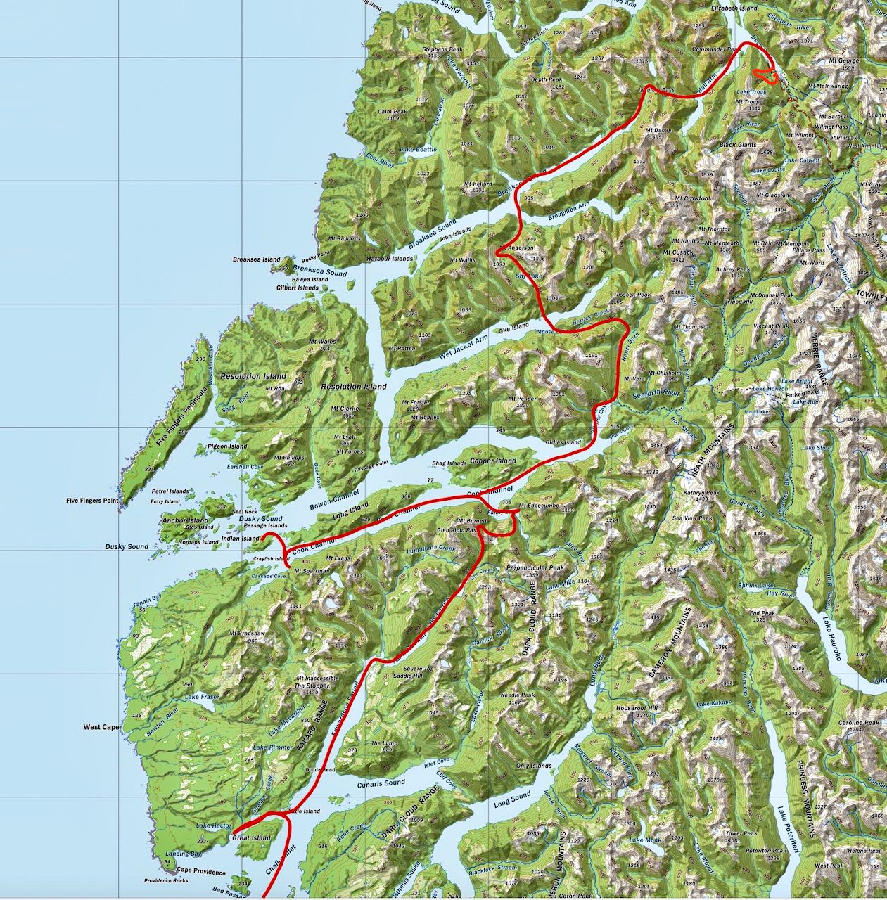
After this, we plotted a route further up the Cascade River, past McKay Creek, to the next creek south, then up to Mt Raddle to Bald Peak, Tararua Peak, Staircase Mountain, Martyr Hill and down the Martyr Spur, back to the road. In February, I spent a month in Fiordland and I was keen to see some different country. South Westland beckoned. The forecast promised a settled spell of fine weather starting on St Patrick's day, 17th March. I rang Sally and Neil to see if they were available. Then Sally had to drop out and Neil recruited Joanne William to join us.


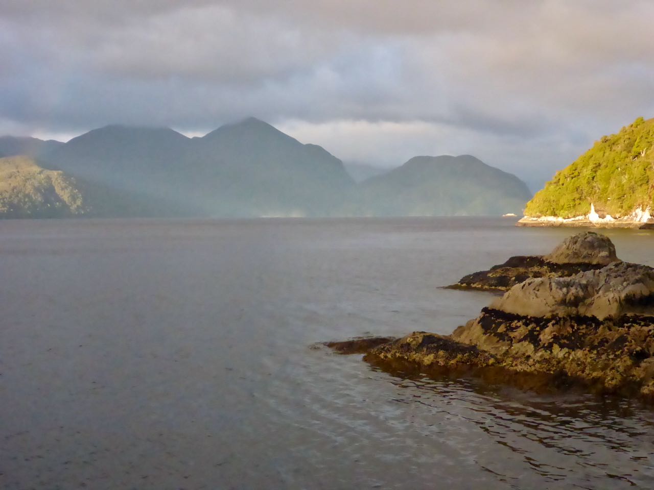
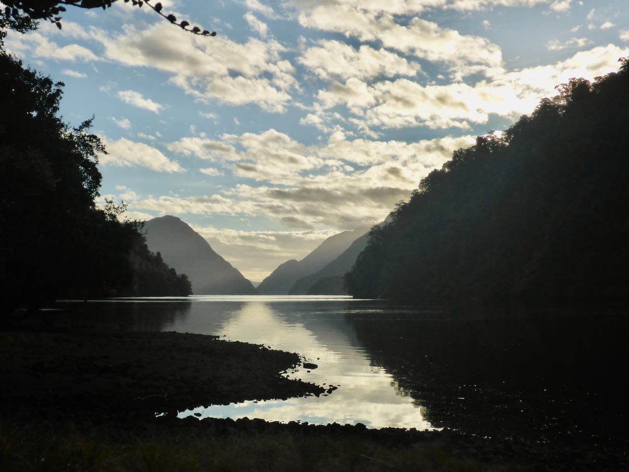
I drove up to Albertown on 17th, marvelling at how quiet the roads were without the masses of overseas tourists driving their rentals. Neil took his car and when Jo arrived, we were off for the drive over to Haast, then south to the Martyr lookout above the ‘Bend’. The day was sunny and warm as we ambled down the track to the Cascade River. A couple of hours later, we camped at our old campsite before Woodhen Creek. This was tucked in at the forest margin and very pleasant.


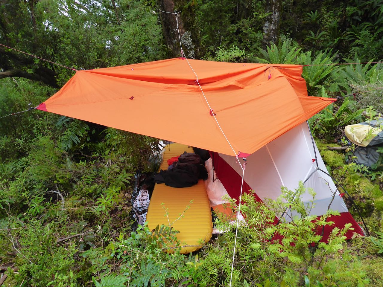
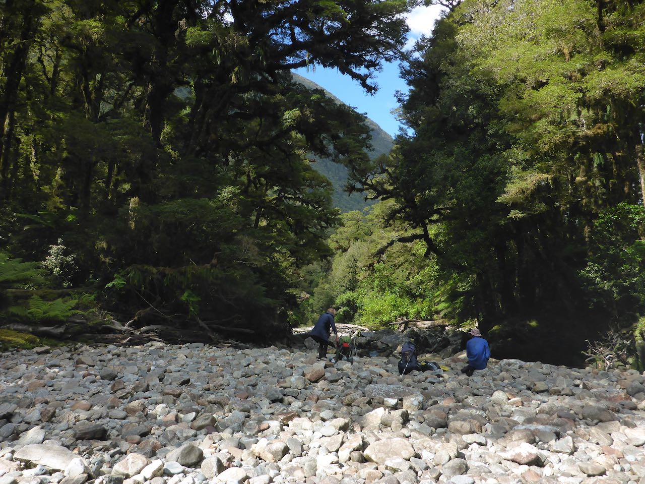
There was a dew overnight but relatively dry under the trees. We set off for Woodhen Ck just around the corner, then on along the mossy, riverbank rocks to the start of the gorge. I’d been down it twice before so knew the best route. Just below the rock garden, we climbed up about 125m and then sidled along at this level finding small deer trails until we got around the bend on the south side. From here it was back to mossy, riverbank rocks to McKay Ck. We saw the remnants of some deer that had been shot. A bit further on, we started up the next creek and followed this up to cliffs of red ultramafic rocks. These are igneous, low in silica and rich in ultramafic minerals such as peridotite, kimberlite, lamprophyre, lamproite, dunite, and komatiite. We scrambled up these cliffs with aplomb and insouciance. The vegetation had thinned and at 600m, we had cleared the scrub line to find a reasonable campsite on a flat terrace. I cleared away some stones and pitched my single tent while Neil and Jo found a spot for their Olympus tent beside me.  Scattered cumulus clouds covered the peaks. Bonzai rata added a splash of colour along with white berries of Mingimingi. There was no wind or noise apart from the cascading water of the nearby stream.


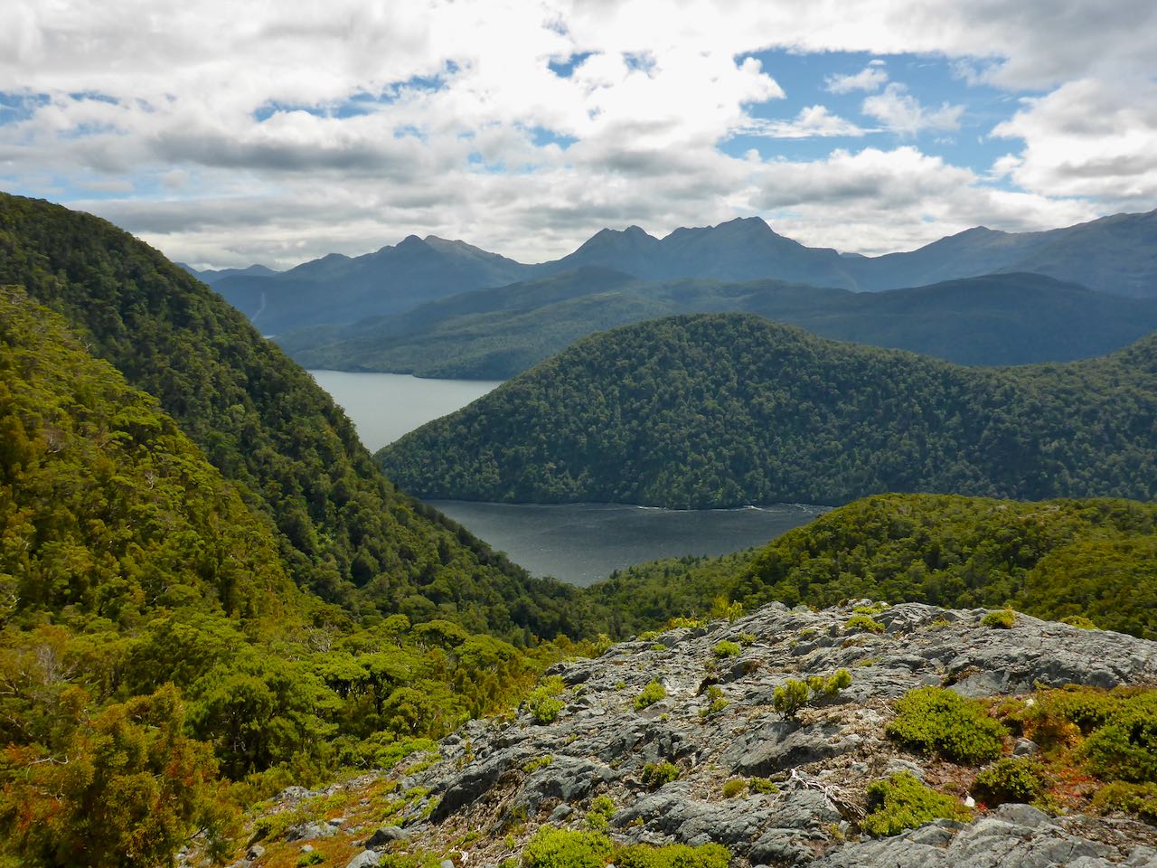
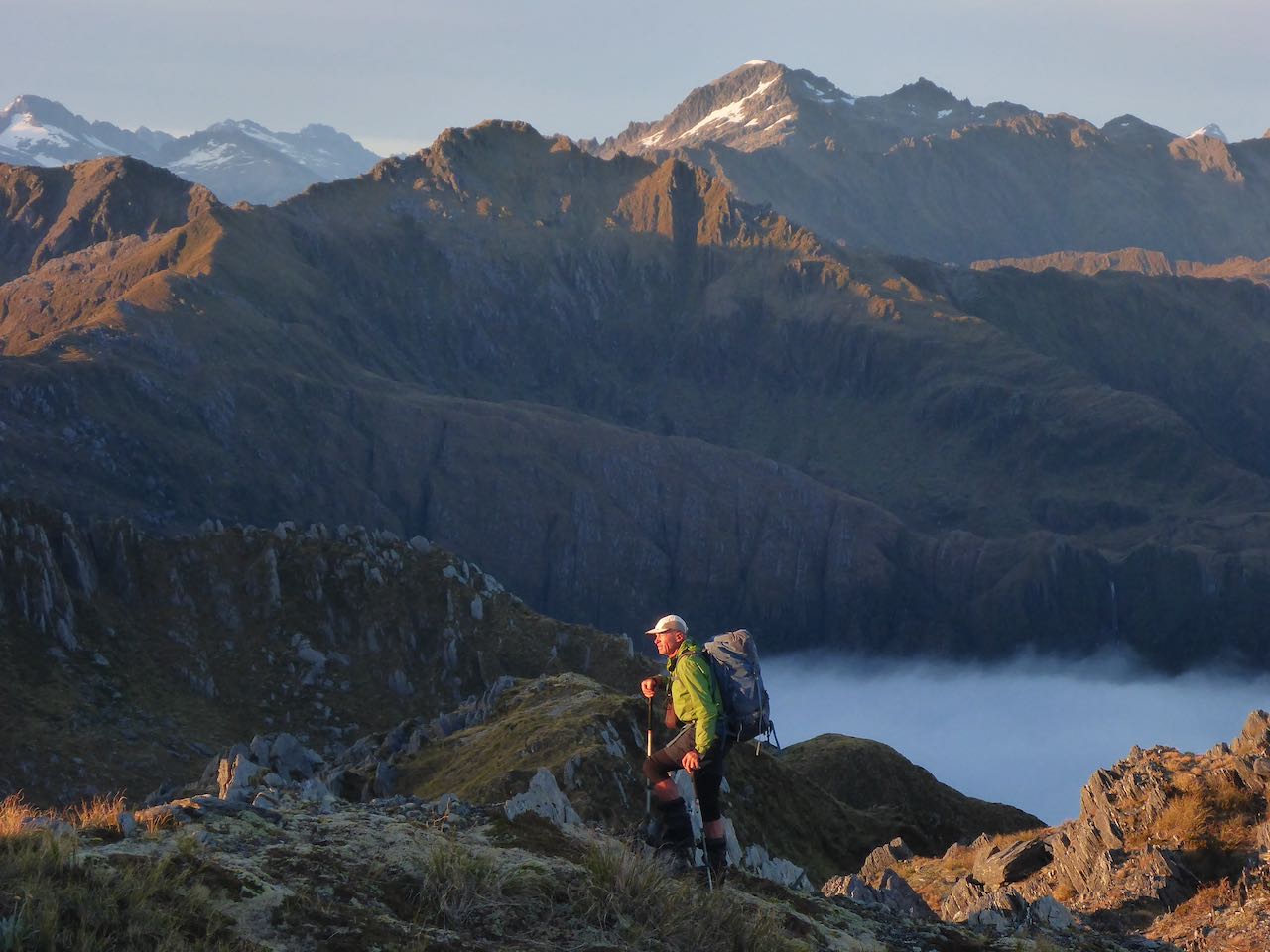
The next morning, we set off up the hill, following a clear route on the red rocks to small lakes at 920m. The sky was a cobalt blue and an evanescent, diaphanous veil lifted off the Cascade Flat far below. We reached the summit of Mt Raddle covered in jumbled red rocks. There was a steep drop off to the next peak where the ultramafic abruptly stopped and the tawny tussock started. Mist was drifting over Bald Peak as we ascended it. On the NE side, we descended along a ridge with a stupendous drop to our right, falling to the Arawhata. Further along before Tararua Peak, we found a tarn and a nearby flat dry site for our camp. Neil was in high spirits and taking lots of photos. Jo was experimenting with her new Canon camera and getting tips from Neil. It was a photographer’s paradise. From the ridge, there was a superlative view of Mt Aspiring/Tititea across the void of the mighty Arawhata River. Gossamer strands of mist drifted over the ridge from the west. 


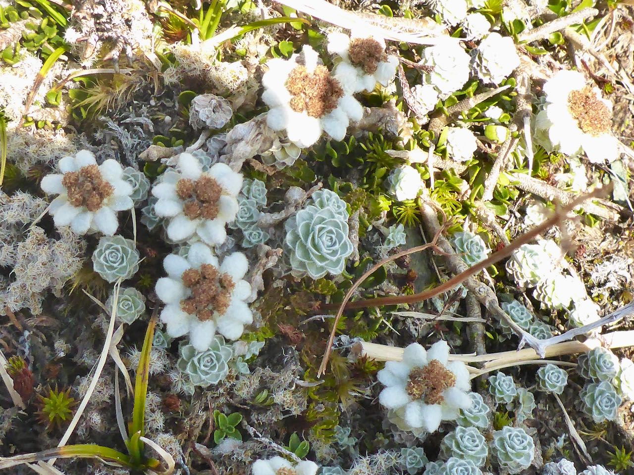
The next morning, the clouds had settled into the valleys as the rising sun lit up Tititea and the Haast range. Dew had settled during the night, delicate droplets dripping off the tussock and flowers. There were clumps of gentians still cloaked from the cold awaiting the warmth of the sun to greet the world. Violet harebells, Celmisias and the large green leaves of wilted Ranunculus lyalli were scattered among the tussock. The inversion started to dissipate as we approached Tararua Peak. We decided to sidle under peak 1533m and gain the col leading to Tararua Peak. Unfortunately, a cliff cut off the approach and forced us to scramble up steep rocks and tussock to circumvent this. From the col, we climbed up an easy gully that took us to the summit ridge. Reaching a level spot, we pulled out our wet tents and left them to dry in the sun while we scrambled up the last section. In the afternoon, we carried on towards Staircase Mountain and decided to camp on top of peak 1488 where there were some small pools of water and a level camping spot. It was a spectacular location with a near-vertical drop to the south and a narrow ridge running over a series of rocky bumps to peak 1571m. We set up camp and then Neil went along the ridge to check out the descent to the col beyond. I lazed around in a desultory manner chatting to Joanne. She is from Enniskillen in Northern Ireland and a physio in Wanaka. She was also a multi-sport athlete and was enjoying this wee ramble in the mountains. Neil came back later and told us there was no easy way down from peak 1571m to the col before Staircase Mountain. We decided the best plan was to go back a little and drop down to a terrace at 1300m below us to the NW and sidle across to the bottom of the couloir running up to the col.


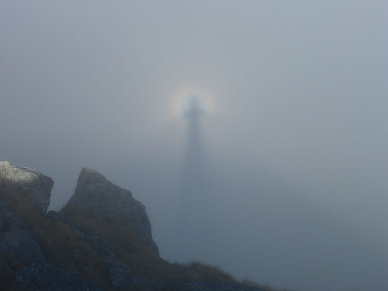
Dawn was a spectacular panorama, the night sky slowly fading, an orange glow spreading into a cobalt blue sky over a quilt of woolly inversion, cloaking the valleys below. Tititea dominated the horizon to the east. The descent to the shelf beneath us was straightforward and then we sidled over to the couloir and up to the col. From there, gulleys led us through the cliffs and eventually to the rocky summit surrounded by a huge level rocky slab, the size of a tennis court. We took a group photo and Jo a few selfies of her leaping into the air. Then it was down into the trough on the north side. At the top was a narrow gully and when I was making my way down, a chamois leaped across it, just in front of me. We had lunch at the bottom of this near an inviting pool in the creek. Jo and I had a splash in this, separately. The climb to peak 1462m was easy and here we camped for the night as it was above the inversion and well-appointed with level ground and a pool of water. We saw an amazing brocken spectre with the three of us under a rainbow.


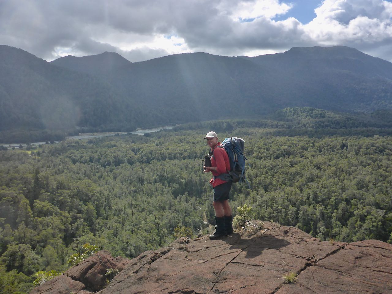
On our last day, we cruised down the ridge past twin lakes to Martyr Hill leaving the sun for a cool, clammy mist. The GPS was now our guide as we made our way to the north, down the Martyr Spur. Surprisingly there were lots of ups and downs but it was pleasant enough.  At 850m, we came out of the cloud into the sunshine and continued down to the bush line at around 500m. Here, we picked up an excellent deer trail that went all the way to point 472 where it abruptly vanished in the crown ferns. From here, we crossed a relatively open forest to the NE past the creek that drains to the Martyr River, getting a bit lost but eventually reaching the Martyr River. This was deeper than it looked so it was as well we lined up for an assisted crossing. A short distance further we reached the road and back to the car. 


Acknowledgment: To Neil and Joanne for a great trip and company.


Friday, March 12, 2021

Over the ranges from Chalky to Deep Cove – a month-long journey in Southern Fiordland, February 2021


The real story is in Tamatea/Dusky Sound, the jewel of NZ conservation, a world-class biosphere. This is where the action lies and it's been on my radar for some time. We were to go there last year and had prepped Fanny Bay with an anticipatory food cache but then Covid hit and blew that away. By chance, I met Sean Ellis at Deep Cove last October. He is the skipper and owner of the Pure Salt charters along with Maria Kuster. They organise a conservation initiative on Mamaku/Indian Island where they have 240 traps in an extensive network of trap lines and are developing more on Long Island. I said we’d be keen to help.


And so on 4th February, I received a text at 6.30 am from Maria as I was having an early breakfast. It said simply “we’re in Bluff”. I rang back and confirmed the rendezvous time of 10.30 am at the wharf at Bluff harbour.  Then I rang the team and passed on the message. The team was Sally, Reece and Gavin . . . stalwarts from many adventures with me. The sky was a scintillating ice-blue and a fresh Easterly whipped up the sea into a blue frenzy as we boarded the “Flightless”. We were warmly greeted by Sean, Maria and their crew. 


We cast off at 1.30 pm and headed out into a boisterous sea laced with white horses and set a westerly course. We sat outside on the afterdeck enjoying the widening vistas and the rolling seas. Mollymawks glided effortlessly in our wake among the troughs and swells enjoying the free ride. We seemed to take ages to reach Green Isles which I knew were only 15 km from Puysegur Point. Later, I noticed the white lighthouse standing resolutely on a headland, like a sentinel before the storm.


We sailed around the western side of Coal Island towards Gulches head and into the Eastern Passage of Chalky Sound where finally the seas eased and the westering sun slipped into a darkening sea. At the northern end of Great Island, we ran into North Port and anchored near some other boats. An obsidian blackness enveloped us like a moment of death.


It was a calm, sunny morning with an azure blue sky as we got into the inflatable for Brad to take us ashore. Our destination was Fisherman's Bay around Mosquito Point on the mainland. Gavin was keen to see Lakes Esau and Dobson on Great Island so we set off in the packrafts to a beach over there. Leaving them, we climbed up deer trails en route to Lake Esau.


The next day, Gavin and Reece set off to climb “The Brothers”. Sally and I moved our camp from the dunes into the forest to the west where there were fewer sandflies and where it was cooler.


On 7th we paddled around Mosquito Point to North Port and Little Island where we saw some fishing boats and the wreck of the Stella. Ahead we could see the sun-sparkled waters of Edwardson Sound as the morning sunlight crept down the surrounding forest slopes. Once past Little Island, we turned NE following the coast while off to our right the Small Craft Harbour Islands were shadowed by the rising sun behind on Cunaris Sound. After about 9 kilometres, we had just paddled past a hook of land pointing south, when the wind turned into a northerly. This very quickly increased in strength virtually stopping us. Reece and Gavin, being much stronger, carried on slowly to our campsite, 3 kilometres further along past Mt Inaccessible. Sally and I reached a tiny cove and found a poor campsite for 1 small tent and a small stream close by so we decided to camp there. The next day we made it to the campsite and spent 2 nights there in the rain. 


On the 10th we set off for Lake Cadman. A Southerly wind was blowing and pushed us along. Then it started to rain again. The wind rose, the rain was steady as we pushed on into a grey oppressive miasma of malign intent. Ragged clouds wreathed the peaks, a cheerless, uninviting day. I was soaked and wishing it would end but no . . .  on and on, it went. Then we were at the river joining Lake Cadman to Carrick. There was a bit of a current against us but easy enough to paddle through. Lake Carrick opened out, grey curtains of rain spilling from a sallow sky. I made for a beach at the far end and once ashore, carried the packraft into the forest to roll it up. I was soaked and chilled like I'd swum up the lakes. The rain now intensified and our spirits fell as we gained height. After maybe an hour of toil, Purser hove into view. We reached the Oho and went about 100m up the TL to camp on a level place under tree ferns.


It rained all night, pattering on the fly but we were dry in our tents. I awoke numerous times during the night listening to the sound of . . . running water, the land’s wild music played out in all its glory. I wondered if the river would burst its banks and then what? We spent 2 nights there in the rain before it eased. Then on the 12th we set off and climbed up the spur to Lake Gumotex at 850m to camp.


Dawn revealed a sallow, grey overcast sky and to the east, a wrack of purple clouds against a backdrop of pale orange sky. It looked rather portentous so we were keen to move. We set off in an easterly direction following the ‘Matt Briggs’ route to Fanny Bay. At the head of the bay, we found a nice hunter’s campsite among the trees complete with camping chairs and clotheslines so we settled in. The sun was out and with the wind, we had our clothes dry in no time. Life felt good again.


The next morning, Gavin reported a large white catamaran has come into Fanny Bay and anchored. This was the “Surreal 2” owned and skippered by Captain Allan Boyce. I suggested to Gavin that he ask them for a lift to Cascade Cove if they were going that way. The answer was yes if we could get packed up in half an hour. So we rapidly did that. Their friend Keith Murray came over in the inflatable and took us out to the yacht where we met Allan and Lynn Boyce and their friends, Keith and Lynley Murray along with Amber who was the step-daughter of Lynn. We were warmly received, plied with hot drinks as we sailed off down Cook Channel. They dropped us off in Cascade Cove where we set up a nice camp. The following afternoon the Flightless picked us up and took us to Mamaku/Indian Island where we spent 2 days rebaiting the traplines. 


On the 19th we rejoined the Flightless to be dropped off at Supper Cove. From there we went up Henry Creek and crossed over to Herrick Ck. On 21st we descended Herrick Ck to Wet Jacket Arm and crossed over it to camp at the mouth of Shy Ck.


I had a dreamless, restless slumber so was glad to be up early. We followed a deer trail upwards but this disappeared in steep bush further along. At first, we kept about 50m above the creek but later on, we dropped back to river level. Here we found an old slip on the TL that we followed up and made for easy height gain. A sidle leftwards took us back to the river underneath a cliff line. The going was easy until we reached the top of Shy Creek where it tumbled out of a gap in the cliffs on either side. By malfeasance, we ended up climbing a cliff on the TL at the outlet. It was an acerbic grovel but we made it to the lake. Crossing this we carried on to the open tops ahead. The rain started again so we sat out 2 days up there in bad weather.


Thursday 25th was misty at first and then this slowly lifted to a lovely day. We set off for the open tops to the west following a cut track. On reaching peak 1093m, the route continued northwards to a big sidle under peak 1068m. This took us down to a spur which dropped steeply to a valley that ran down to Duck Head Cove. From the cove, we paddled down Broughton Arm into Vancouver arm to its head where we set up camp. It was a gorgeous evening as the wind died leaving a windstill sea, reflecting the shadowy forest under a cobalt-blue sky, flecked with scintillating white and grey cumulous.


The weather held the next morning as we packed up in the dark. Today was the day for the Jaquiery Pass. I felt nervous as back in 2006, Simon and I retreated from this formidable crossing. What if we failed again – a return to the “Valley of Sorrows”, Dagg Sound and Crooked Arm? I shuddered at the prospect but then I reasoned if anyone could succeed, it would be this veteran team. We had come through thick and thin – we needed faith – we must stay the course. And we did . . . we had a plan and it worked. The key was an old slip 2 km up the valley, not easy but doable. On the far side, we descended our old flagged route to camp at our old campsite at 500m.


The next day, we reached Halls Arm, did the 5-highs and paddled into Deep Cove. On Sunday 28th, Alastair and the rest of the crew arrived from West Arm bringing good company and real food. The plan was to check and rebait all our traps at DC so we mostly got this done on Monday. Gavin and I were fortunate to get a lift out with Mike on Tuesday and the rest of the team the next day.


Acknowledgments: To my great team of Sally, Gavin and Reece. You were always cheerful (apart from that episode when Sally was hanging off a tree over a humungous drop on the Jaquiery and crying out that she was about to fall off).  You had faith and persevered! To Sean and Maria and their crew who made this possible by taking us from Bluff to Chalky on the Flightless and all the wonderful hospitality on the voyage and the opportunity of working on Mamaku Island. To Alastair and crew for agreeing to meet us in DC and help with our traplines and the Lyvia track cutting. Lastly, to Billy, the caretaker at Deep Cove, to the trustees of the DC Outdoor Education Trust for your support and the vision to turn the tide on introduced predators and save our precious avifauna and biosphere.


Stanley Mulvany

13/3/2021