

Ahead of us, the river narrowed into a rapid with a wave train that looked interesting. I went in first, expecting a few bumps but then there was a sudden jolt from behind as David careered past and rolled over. The blow slewed me sideways and only a concerted effort prevented me from following him into the water. Unseen behind me, Gavin had nearly capsized as his raft was violently swung around . . .
How did this all come about . . . as usual by an idea? In 2008, I completed the 2nd Gumotex expedition with Simon. We had kayaked up the South Fiord and gone up Gorge Burn over Fowler Pass to the Camelot. South of Fowler Pass lay a mysterious lake called Lake Minerva named after the Roman goddess of wisdom and war and over the range a curious lake called Herries, like an Arctic tern flying to the goddess . . . an alluring and cryptic patina.
The original plan was to take sea kayaks up the South Fiord to the Gorge Burn, head over Fowler Pass and turn south to Minerva, climb over the intervening range to the NW arm of Herries, pack raft to the NE Arm and climb to the Herries-Delta Burn Saddle and descend back to the South Fiord. But the weather remained unsettled and I vacillated about the wisdom of this venture. Would we be able to cross to Herries, lugging our heavy packs over possibly technical ground? Then another approach dropped onto my radar . . . why not pack raft to Moterau down the Waiau River, tramp to the top of the Iris Burn, up the gut and around to the Delta Burn-Herries saddle and reach it that way. Then we would walk out over the Kepler Mountains back to the Kepler Track.
It was a sunny Saturday morning as I drove up to Te Anau to pick up David and drive to the Control Gates on the lake. Gavin duly arrived and we set off in our pack rafts along the swift but easy Waiau. There was a southerly wind in our faces that grew worse later. Near Rainbow Reach, we arrived at a rapid and here David capsized, and Gavin and I almost followed suit. He had a long swim and eventually got ashore to empty his raft. Then it was onwards into an increasing wind to the lake. Needless to say, the lake was littered with whitecaps, white horses riding the southerly swells. I could smell trouble. Pushing out into the lake, we kept close to the eastern shore but the waves got too boisterous so we went in before Moterau Hut which was not far away.


The walk to the Iris Burn is through a majestic forest with shafts of sun piercing the cathedral-like canopy. The hut was full of tourists and after a short rest, we set off up flats on the TR of the river to camp on a flat further on.
An overcast morning greeted us as we set off through crown ferns and scrubby forest. We crossed over to the TL to pick up the track to the waterfall, a kilometre further on. Here we crossed the mouth of a deep pool and struck up a faint track to the top of the falls where we found a line of blue trapping track disks. I think this is one of Michaels Fisk’s trapping projects. We followed this line to the flats another 2 km away. The flats were boggy and a slow tiring slog. It was drizzling and the weather deteriorating. We stopped on the river bank for lunch, a cheerless stop in this gothic landscape. Then we set off along more sallow, ineluctable flats covered in wet, clinging tussock and scratchy scrub. The rain increased as my spirits reached their nadir. I suggested we camp but where in this bog? By serendipity, we stumbled on a dry patch of forest in a tongue of bush between two flats and here we stopped in the early afternoon to camp.


By the next morning, the rain had stopped and the sun was out as we set off up the remaining flats. The goblin forest welcomed us and there was the blue line of disks. A shrill cry and 3 Whio glided around a pool under a rock face. The forest was more open as we climbed steadily towards a branch of the river on our right. The sun was bright and hot, the forest floor resplendent in verdant green and high above were glimpses of castellated ramparts above gilded tussock slopes. At an open slip, I suggested that we climb to the bush line only a hundred metres above us and sidle into the top of the valley. Alas, this was a wasted effort as bluffs forced us down further on. The head of the valley was easy going and a tongue of bush helped us avoid the worst of the scrub to reach the gut leading to the col at 1260m. The final climb was on easy rocky slopes. From the col, we dropped down to a lake 100 metres to the west and camped.


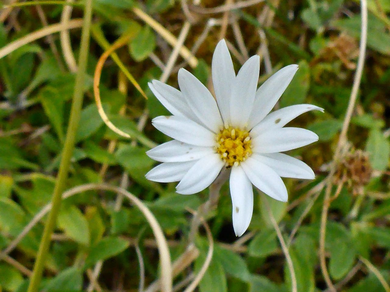
We decided that we’d climb a peak to the south of our camp from the col instead of descending to Herries and start down the Kepler Range the next day. I spend the afternoon in a desultory manner wandering around the camp, pleased to have shed the mighty load that I had hauled from the lake. Around our camp was a delightful display of alpine flowers including Hebe hectori. Bulbinella, Celmisia, Harebell, Snow marguerites and Craspedia


The next day after an easy climb back to the col, we left our packs and strolled up peak 1548m that had a resplendent view of Lake Herries and the surrounding peaks. To the north, Mt Irene dominated the horizon. This was the mountain that Simon and I circumambulated back in 2008 on the G2 expedition. I studied the peaks to the east and intuited there would be some problems there . . . Descending, we picked up our packs and headed over the next col to the east dropping down to an unnamed lake on our way to Mt Pickering. There was a cool breeze though the sun shone with powerful intensity. I marveled at delicate alpine flowers living in splendid isolation on the edge of desolation among boulders and sere tussock.


We reached a col between Mt Pickering and peak 1630m and with relief a scree and stony scree slope carried on down to the next col to the east. Far below a small lake scintillated in a basin below the next col. Leaving our packs, we made our way across several bumps to the summit of Pickering where there was an awesome view to the head of the South Fiord revealing the wide delta of the aptly named “Delta Burn”, Gorge and McKenzie Burns. We also morosely studied the vertiginous western face of peak 1527.


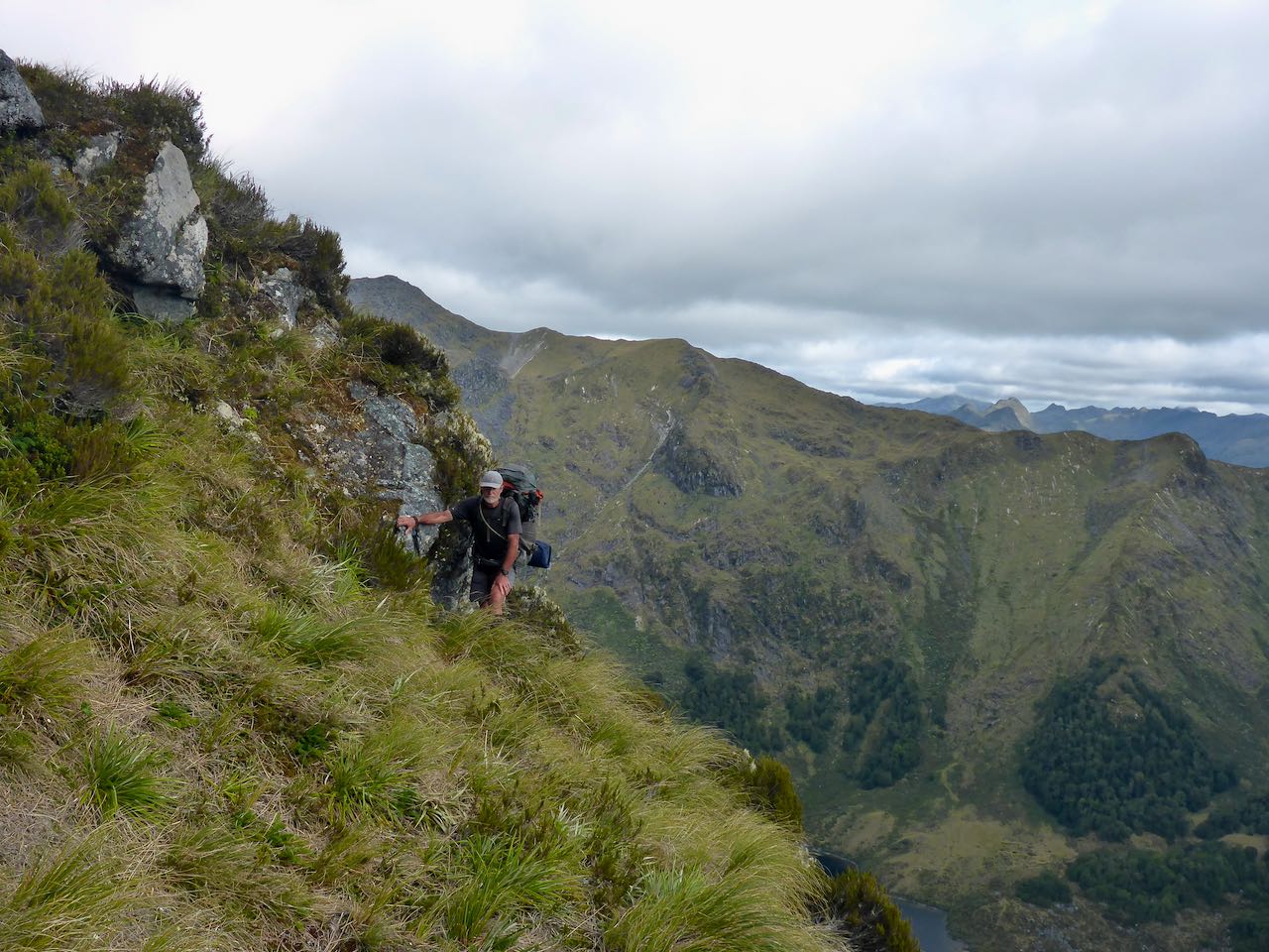
The descent to the next col was straight forward. A gendarme blocked the ridge and we found ledges to bypass this on the north. Closer to the next peak there appeared to be few easy options. The best bet we surmised would be up a ramp to the left but this ended in a 20-30 m vertical step and this was not a packing route. An alternative route might be down to bluffs above the lake far below where it appeared to be an animal trail but this disappeared into vertical cliffs and seemed unlikely to go. Opinion raged back and forwards but it was obvious this was not going to be easy. Perversely, I was enjoying the challenge though my companions were more restrained.

The best route appeared to be a series of terraces across a steep slabby face angling towards the NW to peak 1464m. At first, this went well but then the inevitable happened and we met a vertical-sided gully that split the face down to the valley floors hundreds of metres below. Muttering deprecations, I suggested we climb upwards over steepish tussocks and rocks to get around the top of this. It took a while but we did it and were able to reach the summit of peak 1464m. From here we continued down the ridge crossing some awkward steps to arrive at a nice tarn just off the ridge where we decided to camp.


Looking over to peak 1527 there appeared to be an animal trail around the base of the upper cliffs but a black wall split it. I pondered this for a long time and decided the likely explanation is that deer had come in from both directions and when they saw the vertical wall above a horrendous drop had muttered an imprecation and turned around . . . We set up camp and David his tarp. Then it got very windy and a bevy of 6 Keas (aka Nasguls) arrived but surprisingly were not a major nuisance. Eventually, they left and the wind died so we had a peaceful night.
Dawn brought an orange luminosity on the underside of purple clouds as we packed up. We followed down an easy spur dropping steeply to a deep blue lake in the basin far below us. We crossed the mouth of this and after a tussle with some scrub, we broke into a more open forest that took us to a clearing that ascended steeply beside a stream coming off the far range. It was a 450m climb back onto the ridge that presented no difficulties. The more difficult peaks were now behind us as we traversed along pleasant rolling mountain tops to a pleasant tarn about 2 km past Mt Tinsley where we camped.


It rained during the night but had cleared away by dawn. An hour after we started, we arrived at Hanging Valley Shelter to be greeted by a lone kea. From here we sped along the well-graded track to Mt Luxmore Hut where we stopped for lunch. Then it was down to Brod Bay meeting some tourists sweating their way upwards in the heat of the day. A breeze on the lake made us think about the wisdom of paddling back so a brisk walk saw us back at the cars in an hour.
My appreciation to Gavin and David for the great company and a memorable trip.