
In February 2010 Simon and I concluded our G3 expedition
when we arrived in Milford Sound. Since then we’ve had a hankering to have
another trip in Fiordland and the logical place would seem to be in middle
Fiordland. Studying the map showed a lot of unknown country west of the
Murchison Mountains and it seemed we’d have no choice but to retrace some of
our steps for at least some of the way.
A look at the map showed a possible route from the Junction
Burn Hut in the SW arm of the Middle Fiord to Lake Bloxham, over the tops to
Lake McKinnon, down the Large Burn to Lake Marchant, Caswell Sound, Lake
Shirley, over the Shirley Saddle to Marjory Creek and the Irene River. From
there we could ascend the Irene River to the Irene Saddle, climb Coronation
Peak and either go over the Te Au Saddle to the Forster Burn or alternatively
traverse the tops to Esk Saddle and down the Woodrow Burn back to the Junction
Burn Hut. Simon was keen so a trip was born.
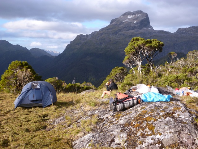
We started on Monday 25th February. I drove to Te
Anau and picked up Simon and headed to Te Anau Downs. Leaving our car at the
Fiordland National Park Lodge/Motel we kayaked across a flat lake to the middle
Fiord. Soon after entering the sound I heard the wind and sure enough a strong
wind greeted us. Then it was an increasing wind we struggled into all the way
to the start of the SW Arm. By now it was dusk as we raced to reach the hut
before dark. It had taken us 8 exhausting hours to the hut.
I was feeling quite tired as I had just returned from a trip
to Mt Hooker up the Clarke River and had done several other trips prior to
that. In addition I had sprained my knee and it had not fully recovered.

But after a good nights sleep, I was feeling better as we set off up the Junction Burn. It was somewhat confusing to pick up the right track as the Woodrow Burn joins it. A short distance up the creek I noticed a yellow Personal Locator Beacon sticking out of a pile of drift debris. I put it in my pack and carried on. Further on we came to a hut and the track became more difficult to follow. Later we took a compass bearing and discovered we were in the Jennings Burn having missed the turn to the Junction Burn. A look at the map showed it did not matter as we could easily reach the mountains west of Lake Bloxham from the head of the Jennings Burn.

But after a good nights sleep, I was feeling better as we set off up the Junction Burn. It was somewhat confusing to pick up the right track as the Woodrow Burn joins it. A short distance up the creek I noticed a yellow Personal Locator Beacon sticking out of a pile of drift debris. I put it in my pack and carried on. Further on we came to a hut and the track became more difficult to follow. Later we took a compass bearing and discovered we were in the Jennings Burn having missed the turn to the Junction Burn. A look at the map showed it did not matter as we could easily reach the mountains west of Lake Bloxham from the head of the Jennings Burn.
We were having lunch when I heard a loud beeping noise.
Mystified I traced it back to my pack and to my horror found the salvaged PLB
was flashing and sending out a signal. What to do? As we had no screwdriver, we
could not removed the cover so Simon jumped on it smashing off the cover and
pulled out the wires. I had visions of a
helicopter rescue underway for the errand PLB.


Once clear of the bush we ascended a series of rises
containing lakes and then swung around to the right through a saddle to reach
the upper valley above Lake Bloxham. Gaining the western Ridge we climbed up
this to about the 1300 meter contour and then descended into a hanging valley
above Lake McKinnon. From here it was a very steep descent down to the lake. In
places there were cliffs but we managed to bypass them. At one spot I lost
balance and nearly toppled off a cliff. After this we were more careful as it
was no place to have an accident. Later in the day we reached the lake and stripped
off to have a swim being so hot in the bush.


The lake was low and a white beach continued around the east
side of the lake. The packrafts were inflated and we paddled down to the
outlet. Unfortunately it was very muddy and wet in all the open areas so we
paddled back up the lake to a stream and a raised gravel beach. Here we
discovered signs of a recent helicopter landing and boot prints! We set up camp
back along the creek in a sheltered spot.
We passed a very pleasant night camped under the trees
beside a stream. I awoke early and lit a fire and boiled the billy. I gave
Simon a cup of tea in bed and we had a leisurely start. After breakfast we
carried the packrafts back to the lake and paddled down to the outlet. Here we
beached and folded them up and set off along the banks through fairly open
forest. Later we came to a slip where we could have a look at the surrounding
mountains. In the middle of it was a palisade of logs probably an old hunters
camp. He had a snack here before pushing on. The valley curved around to the
left and we entered a strange area of open grassy and mud flats. There were
signs of many deer passing through. At the lower end we scrambled across huge
boulders and further on we were able to walk along many beachs as the river was
quite low. Eventually we reached the river where Lake Marchant backfilled it.
We paddled out into the lake to face a headwind.


I was a bit concerned by a strong breeze blowing up the lake but by keeping close to the eastern shore it was not too bad and we made steady progress along the shore to the far end. We passed a huge waterfall dropping into the lake off the surrounding mountains. Near the end of the lake we cut across to near the outlet and beached. Here we picked up disc markers dropping to Caswell Sound. Eventually we reached the lonely Caswell Sound Hut. This historic hut was built in 1949 by the Colonel JK Howard expedition on the NZ-American Waipiti Survey. It was repaired several years ago by Ken Bradley and Grant Tremain, when the roof was in danger of collapsing. I remember how glad we were to reach it in 2008 in a deluge after paddling in from Caswell Sound.


I lit a fire and got the billy on while Simon headed off for
a wash braving a multitude of voracious sandflies. It was good to spread out
our gear on the 2 bunks. In the hut book I read how my daughter Tara and her
companion Sim had kayaked in from the sea two winters before at dusk and camped
across the river and found it the next day. It must have been a welcome haven
in the depths of winter. We had a hot drink and dinner and retired early.
After a restful night I awoke early but as it was still dark
outside postponed getting up till dawn. We packed up and set off for the beach
where the packrafts were blown up. I set off first, paddling onto a still
sound. It was about 5-kilometers to the start of the climb to Lake Shirley.
Simon passed me and headed off down the sound and I could not work out why he
had gone so far out. Thankfully, he stopped so I paddled after him to point out
the route to the granite domes below Lake Shirley. Landing, we packed up and
set off and what a struggle. It’s a 600-meter climb to the granite domes and I
felt exhausted by the effort. Lake Shirley is at 630 meters altitude and it
took us several hours to reach it from the sound. It was a relief to reach the
domes and then a sidle took us to the outlet of Lake Shirley.


Here we blew up
the rafts and set off on the 2-kilometer paddle to the beach at the far end. What
a lovely place, a sandy beach and a green swarthe for our camp. Once pitched I
had a swim and then a brew up. Nearby was a Rata tree in full bloom with its
red flowers adding to the magic of the scene.
 It rained overnight and was drizzly at dawn. We had a
leisurely packup and then I led off towards Shirley Saddle. A short while later
we were brought up against a tall rock face. Here we moved leftwards and
eventually found a green mossy steep watercourse that was easy enough to climb
to reach the top of the cliff. Here on it was a steep bushy climb all the way
to the clearings above the saddle. It seemed easier to avoids the saddle proper
and instead head down into the valley to the south. Thankfully we found a good
deer trail heading in that direction. Lower down we crossed the creek and moved
down the left hand side to the main creek in the valley. Here we alternated
between deer trails in the bush or walking along the river bed. We had lunch in a nice spot and then
continued along to the slip at the mouth of the valley.
It rained overnight and was drizzly at dawn. We had a
leisurely packup and then I led off towards Shirley Saddle. A short while later
we were brought up against a tall rock face. Here we moved leftwards and
eventually found a green mossy steep watercourse that was easy enough to climb
to reach the top of the cliff. Here on it was a steep bushy climb all the way
to the clearings above the saddle. It seemed easier to avoids the saddle proper
and instead head down into the valley to the south. Thankfully we found a good
deer trail heading in that direction. Lower down we crossed the creek and moved
down the left hand side to the main creek in the valley. Here we alternated
between deer trails in the bush or walking along the river bed. We had lunch in a nice spot and then
continued along to the slip at the mouth of the valley.
This was a steep boulder slope dropping towards the Marjory
Falls below. We remembered this well from our previous trip and at about 550
meters we climbed up a small cliff into the forest. Then it was down to the
500-meter level aiming for the spur running to the southwest above the falls.
We had a lot of difficulty locating and staying on this as it offers an easy
descent to the Irene Valley floor. Once down we walked across to the Irene
River and noted this was tidal and rather large. The rafts were used again and
we were delighted to find we could paddle upstream for several kilometres
almost the site of our food cache. We were able to paddle right up to the base
of the Marjory Falls that were spectacular.


At the junction of the next large
tributary from the north we knew our food cache was waiting. Leaving the packs
at the junction we followed it upstream for a few minutes to find my orange
flag and the buckets. Simon then found a nice place to camp in the forest about
100 meters along the Irene.
We set camp in a lovely spot on a high bank above the Irene.
The tent was pitched and a clothes line put up and gear dried in the warm sunny
weather. Then we had a hot chocolate to celebrate this milestone. Simon went
off for a wander while I had a rest. We knew nearby were hot springs and Simon
found a warm stream not far away. We had planned on a rest day next day and an
opportunity to find the springs.

Another fine day saw us setting off unleaden upstream. We
crossed the stream to a beautiful white beach and while there a helicopter suddenly
zoomed overhead and although must have seen us did not acknowledge us at all.
Futher on we came to the warm stream. Following this we found a small pool
under a rock and lukewarm water here. It was only enough for one person to soak
in and not very exciting. And that was it, no hot pools and no dancing girls
etc. So back to camp where I did a tidy up and had a bath in the river. I lazed
around the rest of the day and it felt very good.
Another fine day as we set off heavily leaden for the Irene
Saddle. At first the golng was very easy as the river level was low exposing
many beaches that made for fast travel. Here and there were small flats backed
by beech forest rising up the steep mountain sides. At about 100 meters we
entered the first gorge and we had to scramble up steep rocks. Our pace slowed
a lot from now on. At about 300-meters we were forced into the bush and a very
slow pace. Shortly afterwards I suggested to Simon we head straight uphill to
the ‘Far Faraway Fields’. At first the ascent was easy but higher up was
vertical in places. In one spot Simon’s feet slipped out underneath him leaving
hanging on by only his arms and doing a face plant. Eventually wereached the
Sylvian fields and set up camp in a lovely spot overlooking the Irene with views
of Mt Irene to the northwest. The Far Faraway Fields is an extensive flat undulating
clearing surrounded by bush, covering an area of maybe 25 hectares at 900
meters half way between Mt Irene and Coronation Peak. To the east the bush and
scrub climbs steeply up to the ridge line. We had a pleasant dinner and retired
early.


The plan next day was to carry all our gear up to the main
ridge and set off on a day climb of Coronation peak to the west of us. The
scrub was slow going and some steep tussock took us to some terraces to the
ridge. Here we left our surplus gear covered in rocks as a kea sat quietly
eying us. The day was fine though a bit breezy. A helicopter on deer recovery
was buzzing back and forth into the Irene and landing deer on Te Au Saddle. At
one stage it seemed to be having difficulty in clearing the saddle below us
with several deer hanging off the strop. Ahead of us was a peak that we
scrambled up only to find a very steep peak beyond that. The descent was not
easy and we could have used our short rope to get down safely but I could see
it was going to take a long time so was less than enthusiastic. So back to our
gear and on to peak 1634. This was quite a climb and when we eventually got
there we were surprised to find a loose steep ridge continueing over the next
few peaks. It did not look like a packing route with our monster packs. About
100 meters below us to the east were snow slopes and rock terraces that we
thought would allow us to bypass this part of the ridge.


This section was easy enough with several short rock
scrambles and we reached the tussock ridge beyond the steep bit. By now bad
weather was definitely on the way with cloud scudding the tops and the wind
increasing. On we plod as fast as we could go. At the end of this ridge we
could see a large lake directly below us and the slopes dropping very steeply.
I raced off on a reconnaissance and found a good route down the lake. Once down
we contoured around a small hill and as we were now in cloud and the day
advanced we called a halt and put up the tent in a small depression in the lee
of a rocky ridge. It was not ideal but OK in the circumstances.


It cleared overnight and we made an early start next morning
in the dark. We set off over a series of small hills and eventually reached
Robin Saddle. From here we traversed a terrace that took us to the ridge
leading down to the Esk Saddle. This was pretty straightforward apart from a
few steep places. Esk Saddle was in open beech forest and here we picked up a
disked track that led easily to the upper Woodrow Valley. From here its about
11-kilometers to the Junction Burn hut. The first half is bush alternating with
boggy flats. Simon was flying and I walked at a more sedate pace. At the last
flat we had lunch at the new DOC hut there and then motored on to the Junction
Burn. It took us 13 hours to reach it from our previous camp. Boy it felt good
to have a comfortable hut for the night.


Next day we had a leisurely start and paddled out with a
following wind most of the way and our sails up. Back to Te Anau Downs and a
hot drink at the Lodge from Tania.
The G4 expedition by Simon Marwick and Stanley Mulvany 25/2/13- 8/3/13.
Acknowledgments: To Simon for yet again carrying more than
his share of gear and for his route finding. To Southern Lake helicopters for
dropping off our food cache and to Tania Ward to kindly looking after our car
at the Fiordland National Park Lodge and a hot drink on our return.