Thursday, December 24, 2020

A Traverse of the Tin Range


The seas built as we came abreast of Lords River, now fully exposed to the SW swell. I glanced over at Ian, the skipper, who casually let the boat run off the waves and then gradually spun the wheel to the right to bring the nose into the oncoming swells. Belinda was a sickly white and embracing a sick bag pulled over her face with her head bent in supplication. Suddenly, David lurched up and staggered across the heaving floor for the rear deck. Great swells smashed with unfettered fury on the rocky promontories flinging spumes of white water high into the air . . .


Earlier Paula had told me that a mutual friend, Dave Henderson was planning a trip to Pegasus, a large protected bay at the southern end of Stewart Island. Belinda and I had kayaked there in 1997 but we had never walked the Tin Range so this was an opportunity. Our party was Gavin, David, Sally, Belinda and I. We had arranged to go there on 5th December with Richard Struthers’ party on the Aurora.


We all met early on a Saturday morning on the wharf at Bluff. Ian sailed in on his boat which is the old Stewart Island Ferry catamaran. The other team had a heap of gear to load. The forecast was for fine weather for the weekend only and then rain and wind for the rest of the week. I asked if we could be dropped off first so we could dash across the range before the oncoming storm.


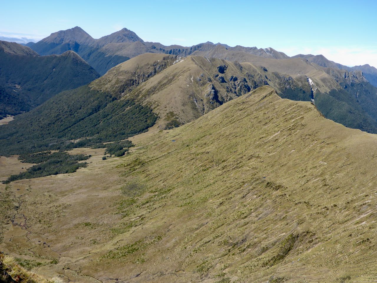
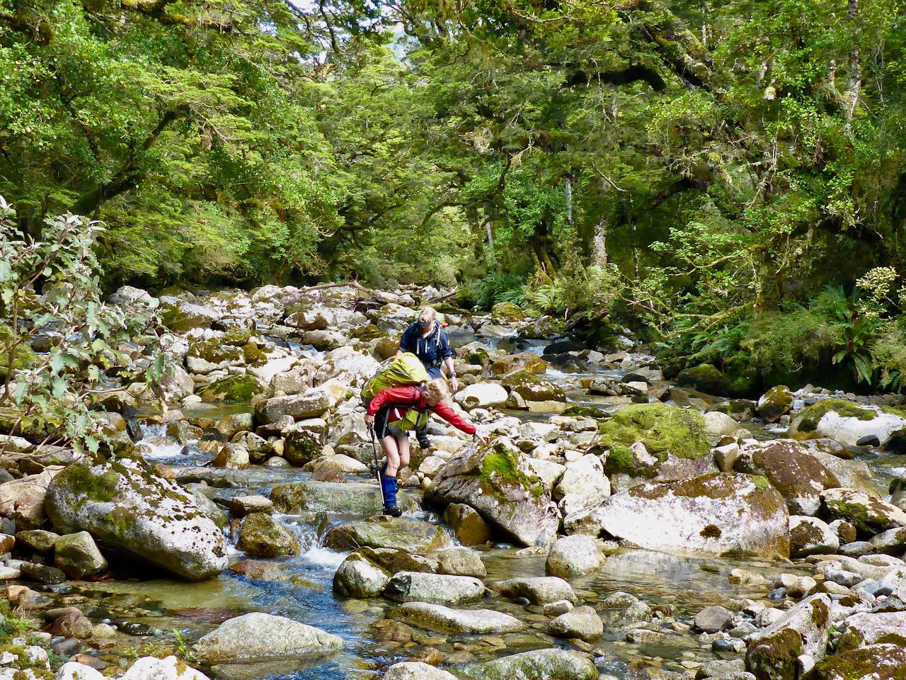
Ian said conditions were average and I was glad we were not kayaking down in these big seas. Once we entered Whale Passage, the seas calmed as Ian steered up North Arm to our drop off at the bottom of Surveyor’s Track. I had my first look at the mountains curtained with olive green forest under a grey sky showing some breaks of blue. Ian rowed us ashore and once we negotiated the slippery foreshore rocks, we had lunch in a small clearing before starting up the partially overgrown track. The track is 4-5 kilometres long and climbs up to the 400m level and is easy to follow. Mining for tin began in the 1880s and continued intermittently until the 1930s. There were some huts on the track but these have long gone. The track meanders through manuka bush and took us to the open tops at 500m altitude. Then it was an easy walk northwards. There were patches of scrub but mostly it was straightforward travel


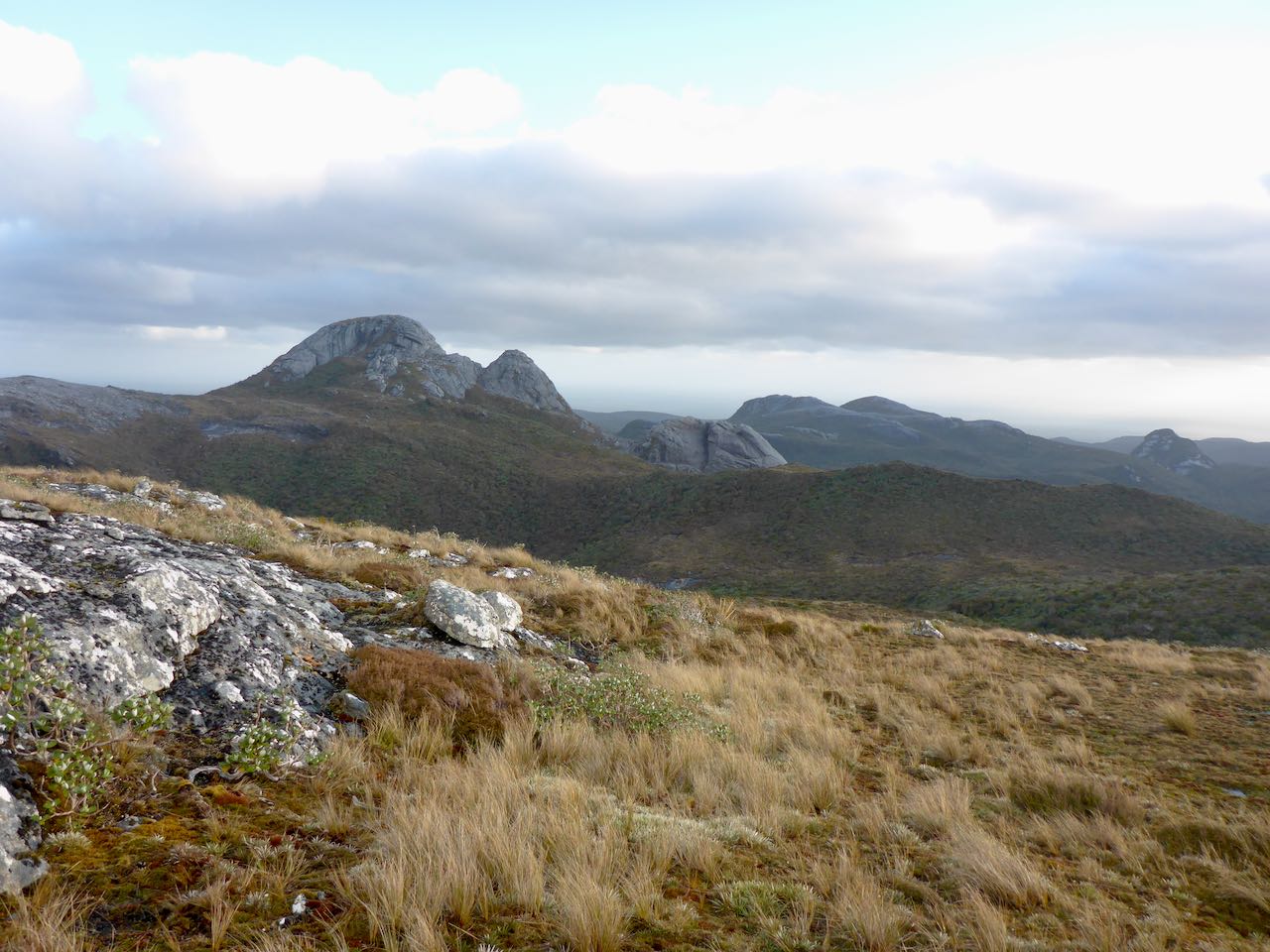
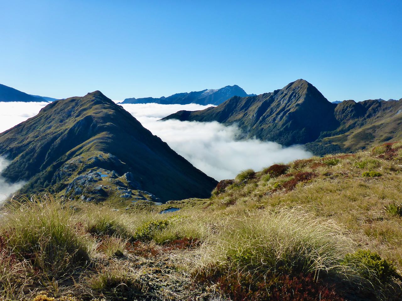
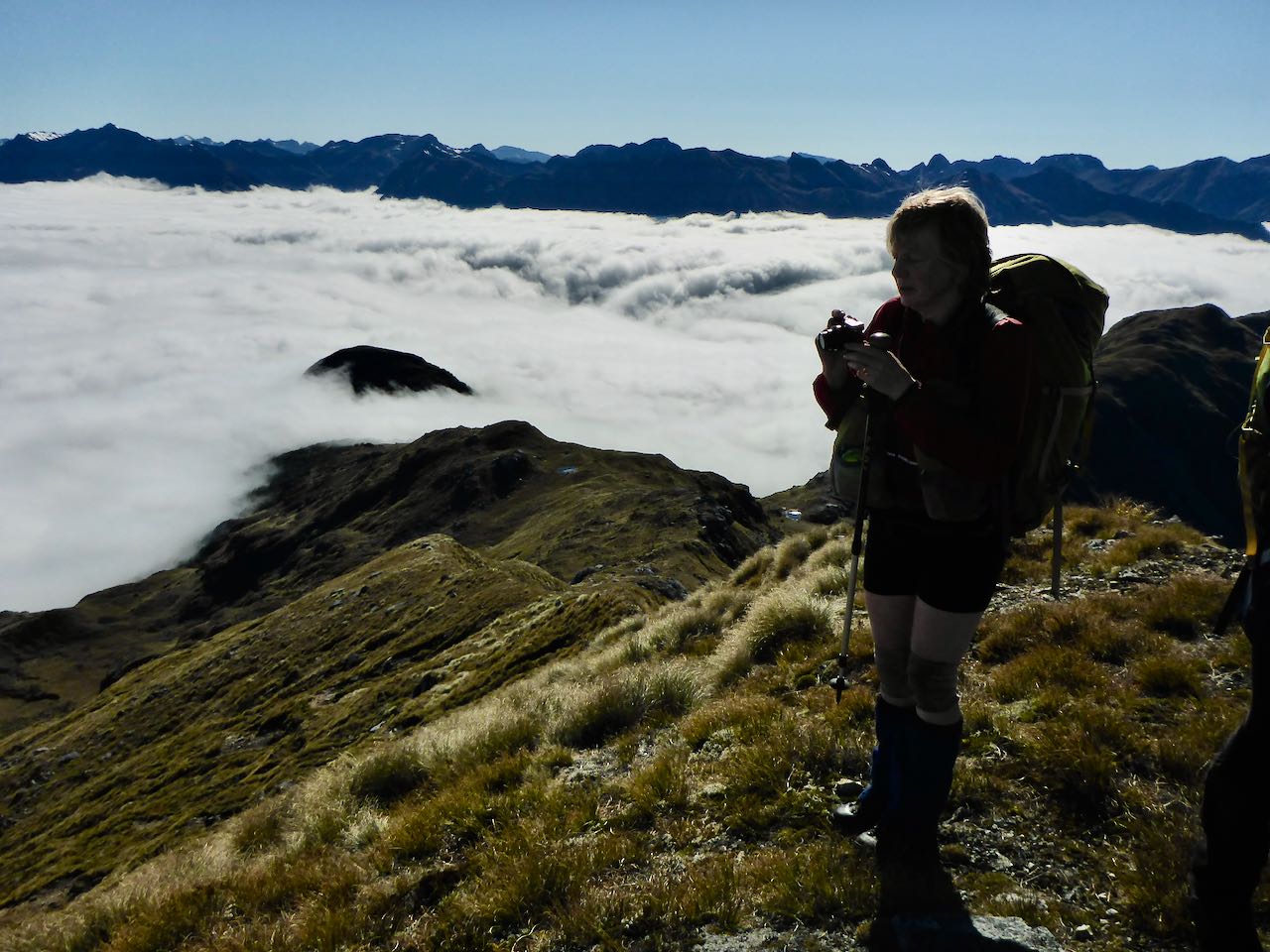
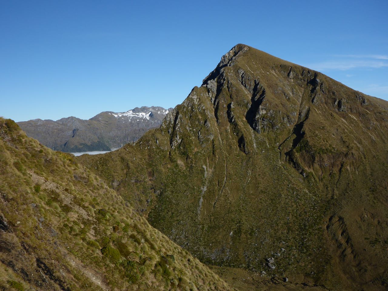
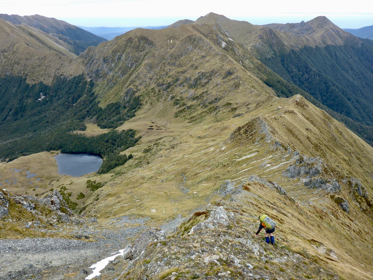
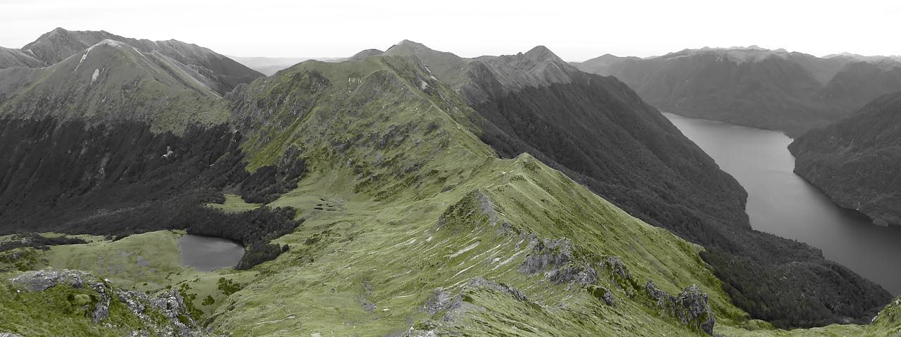
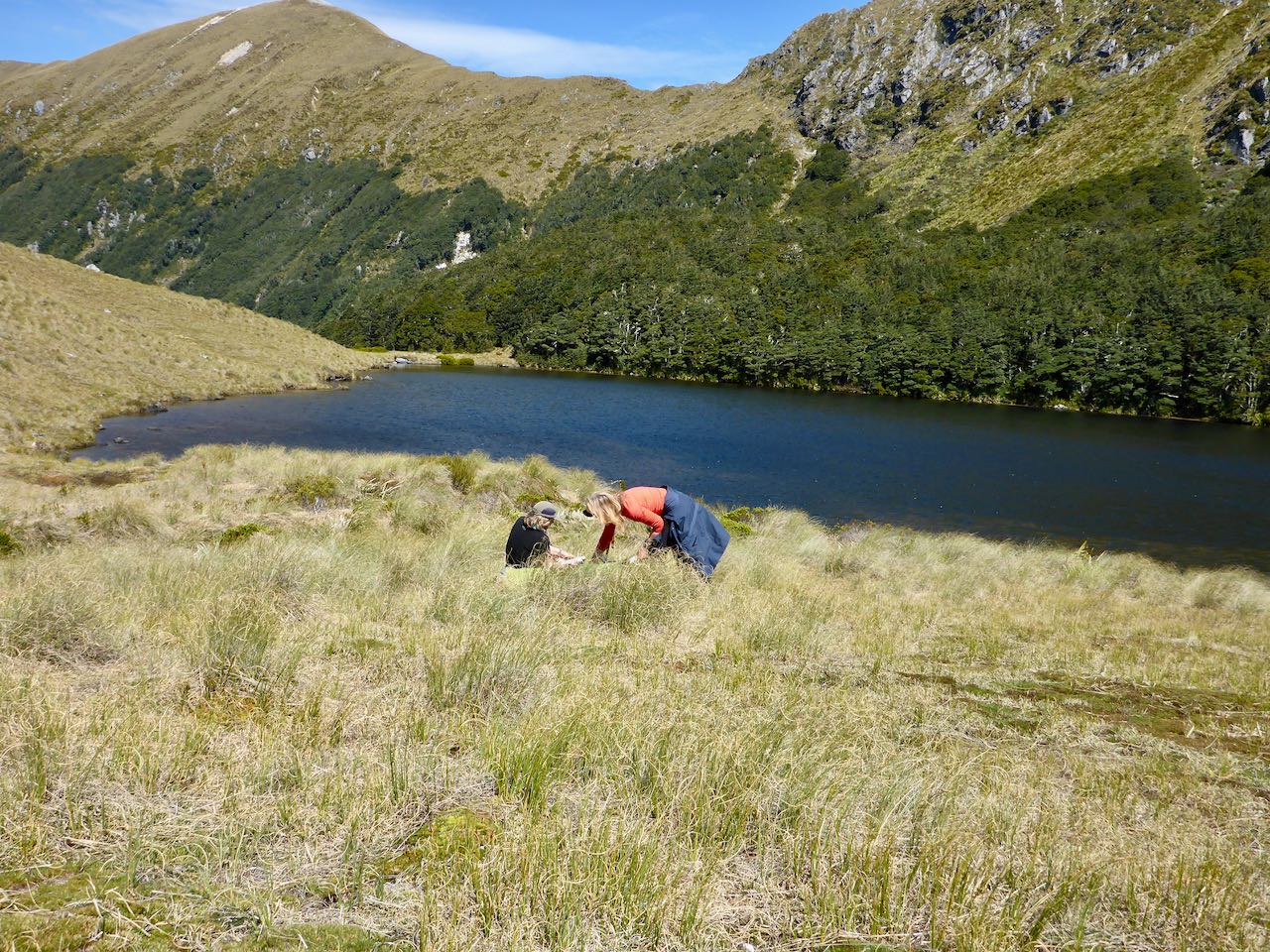
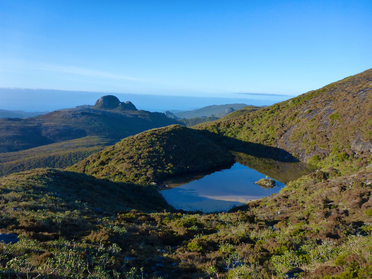
There were some great views of Gog, a steep rock peak to the south and many granite tors further along the range. Shafts of sun lit the ranges to the north. Later, we had some drifting cloud and drizzle but it was mostly clear. We could see both sides of Rakiura. The tops were boggy with few suitable campsites and very exposed to the prevailing westerly winds. We reached Granite Knob and turned it on the west side. A muddy track through the scrub on the north side took us down to a wide saddle.  Ahead we could see Mt Allen and we planned to make for the tarn at 550m on the east side where there were some campsites. Gavin was powering ahead, sidling across the eastern slopes. There was a vague track here that led in the direction of the scrub. I wanted to stop and check the route but then Gavin disappeared into the scrub so we all followed. What ensued was a bitter struggle through impervious, gothic, cheerless subalpine scrub. Gavin, David and Belinda had disappeared and Sally and I had no idea where to go – up or down? The bush was covered in black slime and snatched at our clothes and snagged our packs. We seemed to be getting nowhere. When I checked my altimeter, I was appalled to find we were at 480m, well below the tarn. By now it was later in the day, 9.00 pm. Panic was welling up at the thought of having to bivouac in this stygian hell. Sally took over and forced a way upwards until we broke free near the coveted tarn. Gavin and David were already pitching their tent on some very wet bog beside the south end of the tarn so Belinda and I carried on around to the northern end where there was a white level sandy beach, perfect for our tent.


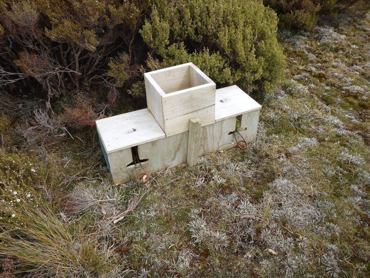
 It was a windy evening but during the night it died and we awoke to a windstill clear day. We got underway early, climbing back onto the ridge to the north of us. Further along, was a drop to a saddle at 500m where we came across some bait stations. We saw evidence of feral cats and DOC are trying to eliminate them as they prey on Southern NZ Dotterel, an endangered species. We saw some of these fragile birds walking quickly on the open tops, quite unafraid of us.


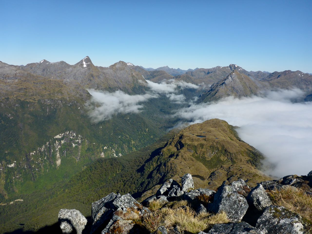
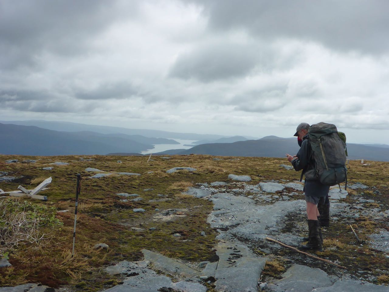
Beyond Blaikies Hill, there was another big drop to a saddle at 500m before the final climb to Table Hill. We came across poles marking the route and more bait stations, then traps. Off to the west, we could see the white sands of Doughboy Bay and dead ahead was Mt Rakeahua. Table Hill is the northern end of the Tin Range but about 4-5 km of bush separates it from the Rakeahua River.


The poled route now went to the west over another hill before dropping down to an open tussock area to the north. After crossing this we followed the track into the scrub. DOC has allowed this to revert to nature so it became more difficult to follow. After a steep descent, we came to a wet clearing, following a small stream. This went on for some time. We took a wrong turn at a T junction of streams but quickly realized our error. Further on we had another steep drop and then into a surreal podocarp forest – a wonderland of graceful trees in the soft evening light. We struck the Southern Circuit Track, then over the bridge and along a very muddy, wet track to Rakeahua Hut which was empty and very welcome. It has been a long day and we had beat the weather.


Monday dawned fine and the plan was to head over to Doughboy Bay. This is a 17 km walk and a climb of 400m. David, Gavin and Sally started over first and Belinda and I followed at a slower pace. At first quite wet and muddy, it improved when the track sidled up the hillside among taller trees. The section climbing up to the tableland was very pleasant. However, above the forest, the track was back into mud holes. Here we encountered a big Kiwi foraging close to the track – Our national iconic bird – a wonderful sight. But it was gone all too soon. A cold wind blew from the SW and even though it was sunny, we felt chilled. Eventually, Doughboy hove into view and after a steep descent, we were back into the arcadian forest. Bright red rata flowers scintillated in the canopy of green. Then we were out on a dazzling, white beach with great blue rollers thundering in like a benediction. It has taken us 8 hours and I felt strangely tired. The new hut is at the northern end of the beach in the trees behind the dunes. The others had already camped beside it under the trees in an idyllic area.


We decided to spend another day at Doughboy. The weather was still fine and it was great to just relax and take in the positive energy of our surroundings – wind, sea, sky and bush. We went for walks on the beach, had a wash, dried some clothes and read. Near the hut was the famous cave that we had camped in when we were here last many years ago with our two young daughters.


On Wednesday, we left for Masons Bay, 14.5 km away. A good track left the northern end of the beach and climbed to 400m on Adams Hill. On top, it was very wet and muddy before descending into a more pleasant forest. We stooped for lunch along this section and later reached the white sands of Masons Bay where a furious gale was blowing. We all set our own pace and Sally was off. It was cold and blustery as we steadfastly marched along this endless beach. It was sad to see so much plastic rubbish lying around. It was nice to reach Mason Bay hut and the only occupant was a friendly Dutch girl.


Thursday saw us tramp over to Freshwater Hut which was empty. Later a father and son arrived. The Friday saw us carry over to North Arm where we camped. This is now part of the Rakiura Great Walk and should be booked for the Hut and campground but this is impractical if you are coming from Freshwater after doing the Southern or Northern Circuits. That night we had our first real rain of the trip. The next day we carried on to Oban and stayed at the Stewart Island backpackers. That evening we had dinner with Bill Watt, a kayaking guide there and discussed plans to run a skills course later in the summer. On Saturday, we boarded the Aurora again to take us across to Bluff. 


Acknowledgment: First of all to Richard Struthers for allowing us to join his charter to Pegasus. Thanks to Ian Wilson of Aurora Charters who skillfully took us there and back. Thanks to my team – Gavin, Sally, David and Belinda. It was a pleasure meeting Bill Watt and sharing a meal with him.

Wednesday, November 18, 2020

A Traverse of the Princess Range in Southern Fiordland, 9-14 November 2020


 One evening as I was working on my computer, the phone rang. It was Paula Macfarlane and she invited me to join her, and her friend Jenny from Wellington, on a traverse of the Princess Range. It was an interesting proposal so I studied the maps, and wondered why I’d never thought of it myself. She proposed to do it in early December when she finished work. So there it rested. A while later, my friend Alastair organized a work party to recut the track from Teal Bay to Poteriteri Hut. This coincided with a long spell of fine weather, and I thought here was an opportunity to do the traverse. Sally and Belinda were keen but Paula had work commitments so could not join us.

We rendezvoused with Joyce and Johan at their base at the Clifden Bridge. It was a showery morning but promised to clear as we arrived on the shores of Lake Hauroko. Alastair had a party of 5 volunteers, and there was room for us on the Namu down to Teal Bay, first to drop off his crew, and then take us up the lake to Hay River.

By the time we got there mid-morning, the sun was out, and the sky clearing. With a wave, Joyce was off as we sorted out our packs, and set off into the valley. The going was slow with rough terrain and lots of windfalls. We went for about 1.5 kilometres to the second slip where we deemed it wise to start our ascent to the bush line on End Peak. It was fairly scrubby until we met a bluff at around 400m. We turned this on the right and found a steep open forest and deer trails to the bush line. Over to our left was a rocky dome 984m high that we avoided. We reached a tussock clearing at 1000m in the evening and set up camp. We found water in a nearby soak.


The next morning dawned clear though a bit cool. A cloud inversion filled all the surrounding valleys. It was a short stroll through the surrounding bush onto the open slopes. I felt invigorated and ready for action as we ascended the golden tussock slopes trending towards End Peak. The sun slowly burned off the cloud inversion below us. Just before peak 1162m, we found 2 old metal drums carelessly tossed into a tarn, and nearby 3 plastic containers of aviation fuel – a helicopter fuel depot. It was sad to see this blight on such a pristine landscape. In 2 hours, we reached the summit of End Peak. The views were superlative in all directions . . . an empyreal panorama of mountain ranges, lakes, and mysterious valleys.  To the south was a 260m drop along a narrow ridge to a wide tussock saddle. We started the descent, and in places, the ridge was so steep, we sidled on its west face.


From the saddle, a 150m ascent led to the next peak and then many more ups and downs over a series of tussocky peaks. The plan was to get to a low saddle at 925m about halfway down the range for our next camp but we struck a big obstacle at peak 1267m. Here the south ridge ended in fearsome, vertical drops. I left my pack and did a recce but it looked hopeless. Over to our left, a tussock slope fell away to the east so we took that route. It healed over lower down, and I could see the valley floor a long way below. On we went until I could see into a steep gully which offered a way down. There were some very exposed moves down a cliff face into a stream bed below. Once down it was a walk to the valley floor. We’d lost 250m from the summit. The sun was shining still, and it was warm so we decided to camp early.


The climb out the next morning was up steeping tussock slopes onto peak 1193m. The sky was clear, and we were in high spirits. There was a striking white scree slope on the peak to the west of us. Ahead stretched a whole series of tussocky peaks which we climbed. Off to the SW was Caroline Peak with some lingering patches of snow, and to the left of it was Lake Hauroko. To the west was Lake Kakapo which I last visited a few years back with Gavin and Belinda when we traversed the Upper Cameron Mountains. Lake Poteriteri was still covered with a cloud inversion. Once we reached peak 1253m, we could see the low saddle straddling the range with the bush quite close on either side. Several hundred metres below us was a wide valley floor covered in tussock with meandering streams and some tarns but we chose to stay high along the ridge, and this led to the saddle. There were old deer trails along the crest and very steep drop-offs to our right.  The last section led steeply down to the saddle where we stopped for lunch at a tarn.


The day was warm, the sky an azure blue, some distant cloud on the southern horizon, the nearby olive-green bush sloping away to the Unknown Burn girdling Caroline Peak now receding behind us. It had taken us 6 hours from our previous campsite so my original plan seemed overly ambitious. The girls went off to get some water from nearby pools. I thought this would not be a bad place to sit out an apocalyptic meltdown of society.

The climb out of 270m was up a tussock face, and easy enough if you could forget the mind-numbing effort in the hot sun. I was going strong with my featherweight, 18 kg pack, minus my usual packraft. Sally and Belinda resolutely followed me up to the ridge which continued south, curving around a wide basin filled with numerous tarns. There were some rocky peaks along this section that we climbed, and beyond the tussock ridge rose over some bumps to peak 1234. I knew that beyond this peak there were no suitable campsites for several kilometres as the ridge was steep and narrow. However, just before the peak, there were 3 small lakes close to the eastern side of the ridge, and we decided to camp at the further one.


A hundred metre descent took us to the far lake and a lovely level site. Here we set up camp in the early evening with the sun still high in the sky, and the mountains resplendent in the softer light. A kea paid us a courtesy visit and was surprisingly well behaved. Sally had deep conservation with it from her tent while it stood mutely outside, listening.It was a warm night with a gentle breeze which kept the tents dry the next morning. 


It was cool and overcast as we started our 130m climb back to the broad ridge above us. Ahead the ridge curved around to the left, over peak 1282. I put on my parka as it was chilly, breezy, and forged onwards. On the far side was a steep descent, and I could see where the deer had been. I zig-zagged down this to a flatter area while Belinda and Sally followed. Ahead the ridge descended to a low point at 1091m. To our right, a stream fell away down to Lake Poteriteri far below us while on the other side a creek went down a valley to join the Caroline Burn. 


There were several rocky steps before the rise to peak 1226m and beyond this peak 1327m. Here the main range split with one arm heading east to the Alice Peaks while the other continued south. We reached a saddle at 1255m. The rise to peak 1314m looks unpleasant with steep, shattered rock so we thought the best plan was to sidle along its western flank. This proved difficult as it was very steep and exposed in places. Once we passed this section and regained the ridge, there were some rocky outcrops to cross or circumvent. The final climb to the saddle at 1080m was tiring through knee-deep scrub and tussock. A 200m climb took us onto a trio of peaks that curved around to the left. It was overcast under a sullen sky, threatening rain. I put on my waterproofs as I huddled in the lee of the ridge waiting for Belinda and Sally.  


Below us was the Rata Burn Valley with 2 large lakes in the headwaters. It looked very inviting indeed. We descended to a low pass at 1064m and regrouped. Ahead the ridge turned east to the Beatrice Peak, and there were several big ascents and descents over the intervening peaks to Helena Peak, our original destination. Then Sally and Belinda suggested that we descend into the Rata Burn. Why not, I thought!

On cue, the sky cleared, and the day warmed up as we descended into the headwaters of the Rata Burn. We stopped for lunch in the sun, sitting on a tussocky terrace. The descent to the lakes was straightforward. Belinda’s feet were causing her grief so we stopped while Sally put some dressings on them. The surrounding mosses were colourful in the scintillating, limpid light, and I noted some sundews which are a carnivorous plant. Extensive tussock flats took us to the bush line where I found the start of a hunter’s track and some rubbish that they had left. Deer trails led down the valley through the sublime forest to a flattish area at 560m where we found enough space to camp.


The next day we continued down this long valley. The going was easy at first but at about 300m the valley tightened, and cliffs appeared. Our pace slowed, and we were forced up into the bush away from the river. Travel became much more difficult until we found ourselves on a cliff face on the TL above a gorge. Further progress on this line was impractical so after studying the GPS map, we decided to head uphill out of the gorge to the 400m level, and sidle in an NW direction away from the gorge. This worked out alright though we had to cross 2 vertical gullies. Once past the second one, the forest was quite open as we stopped for lunch in the warm sunshine. It was a transcendental experience admiring aboriginal nature under a cerulean sky. Belinda remarked with thoughtful perspicacity how lucky we were to be in such a sublime country while the world was falling apart.


We carried on away from the gorge until we could see Lake Hauroko, and then picked up a spur that took us down to the level plain surrounding the lake. Dense crown ferns, and swampy areas covered in coprosma made for slow going. Using our GPS map, we arrived at the ‘Shingle Flat’ on the Rata Burn in the evening. We were all whacked.  The sun was still high in the sky as we pitched our tents on the pleasant flat there. We would miss our pickup at Teal Bay at 4 pm but I did not care.


The following day we left early, walking down the river bed, and crossing the walk-wire over the Wairaurahiri River. The wire was a bit slack and wobbled alarmingly, especially as we negotiated the possum gate mid-river.  We arrived at Teal Bay hut at 10.15 am. 15 minutes later Johan arrived in his jet boat with a party of tourists and told us Joyce had gone up the lake looking for us. In the afternoon, Joyce arrived in the Namu for an exciting ride back to Hauroko Landing in the increasing NW wind.


Acknowledgments: To Belinda and Sally for your steadfastness and perseverance. To Joyce and Johan for the boat ride on Hauroko, and Alastair and his team for recutting the Poteriteri Track.