


One evening as I was working on my computer, the phone rang. It was Paula Macfarlane and she invited me to join her, and her friend Jenny from Wellington, on a traverse of the Princess Range. It was an interesting proposal so I studied the maps, and wondered why I’d never thought of it myself. She proposed to do it in early December when she finished work. So there it rested. A while later, my friend Alastair organized a work party to recut the track from Teal Bay to Poteriteri Hut. This coincided with a long spell of fine weather, and I thought here was an opportunity to do the traverse. Sally and Belinda were keen but Paula had work commitments so could not join us.
We rendezvoused with Joyce and Johan at their base at the Clifden Bridge. It was a showery morning but promised to clear as we arrived on the shores of Lake Hauroko. Alastair had a party of 5 volunteers, and there was room for us on the Namu down to Teal Bay, first to drop off his crew, and then take us up the lake to Hay River.
By the time we got there mid-morning, the sun was out, and the sky clearing. With a wave, Joyce was off as we sorted out our packs, and set off into the valley. The going was slow with rough terrain and lots of windfalls. We went for about 1.5 kilometres to the second slip where we deemed it wise to start our ascent to the bush line on End Peak. It was fairly scrubby until we met a bluff at around 400m. We turned this on the right and found a steep open forest and deer trails to the bush line. Over to our left was a rocky dome 984m high that we avoided. We reached a tussock clearing at 1000m in the evening and set up camp. We found water in a nearby soak.

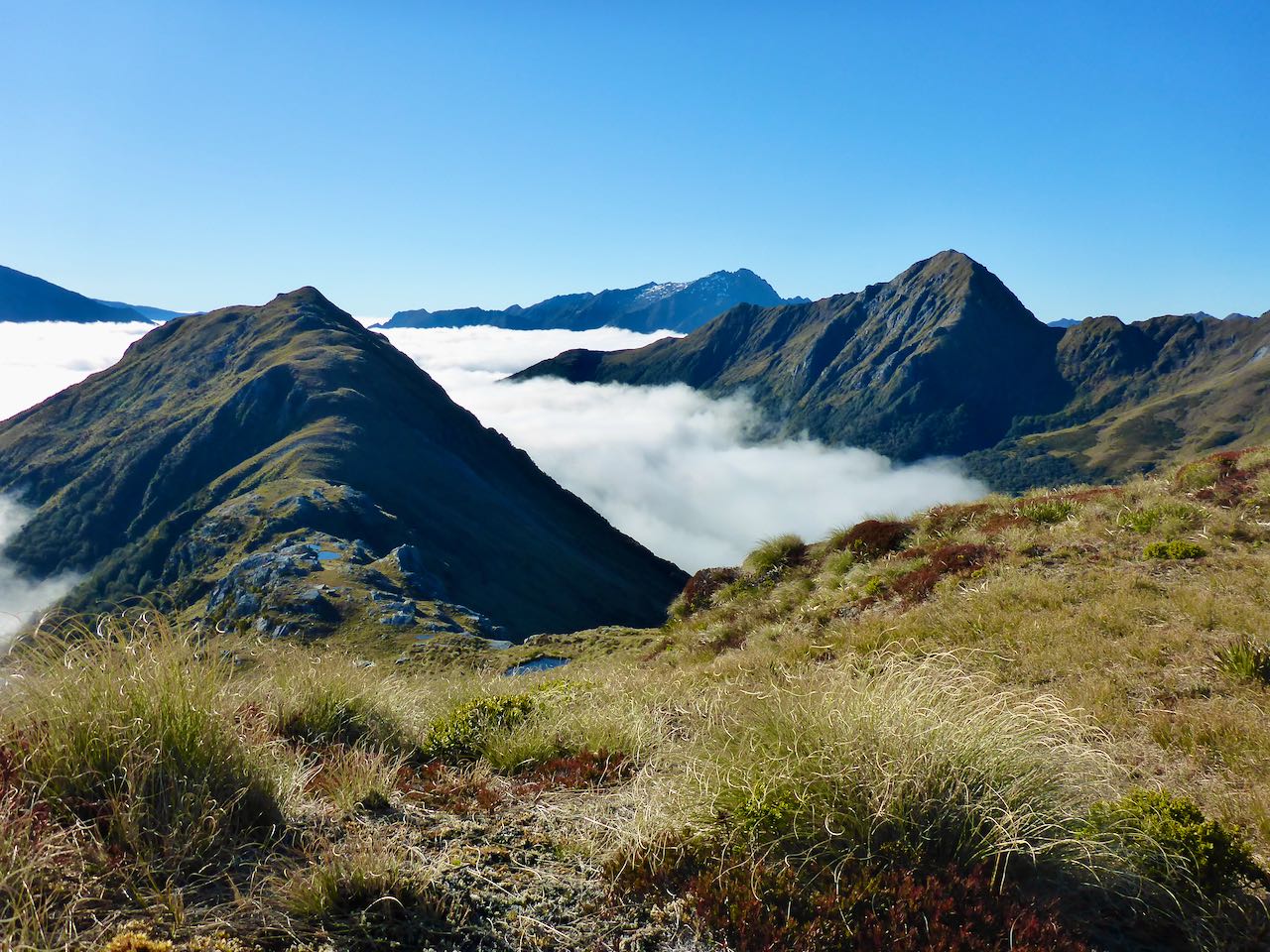
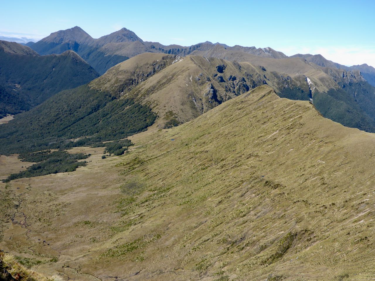
The next morning dawned clear though a bit cool. A cloud inversion filled all the surrounding valleys. It was a short stroll through the surrounding bush onto the open slopes. I felt invigorated and ready for action as we ascended the golden tussock slopes trending towards End Peak. The sun slowly burned off the cloud inversion below us. Just before peak 1162m, we found 2 old metal drums carelessly tossed into a tarn, and nearby 3 plastic containers of aviation fuel – a helicopter fuel depot. It was sad to see this blight on such a pristine landscape. In 2 hours, we reached the summit of End Peak. The views were superlative in all directions . . . an empyreal panorama of mountain ranges, lakes, and mysterious valleys. To the south was a 260m drop along a narrow ridge to a wide tussock saddle. We started the descent, and in places, the ridge was so steep, we sidled on its west face.


From the saddle, a 150m ascent led to the next peak and then many more ups and downs over a series of tussocky peaks. The plan was to get to a low saddle at 925m about halfway down the range for our next camp but we struck a big obstacle at peak 1267m. Here the south ridge ended in fearsome, vertical drops. I left my pack and did a recce but it looked hopeless. Over to our left, a tussock slope fell away to the east so we took that route. It healed over lower down, and I could see the valley floor a long way below. On we went until I could see into a steep gully which offered a way down. There were some very exposed moves down a cliff face into a stream bed below. Once down it was a walk to the valley floor. We’d lost 250m from the summit. The sun was shining still, and it was warm so we decided to camp early.


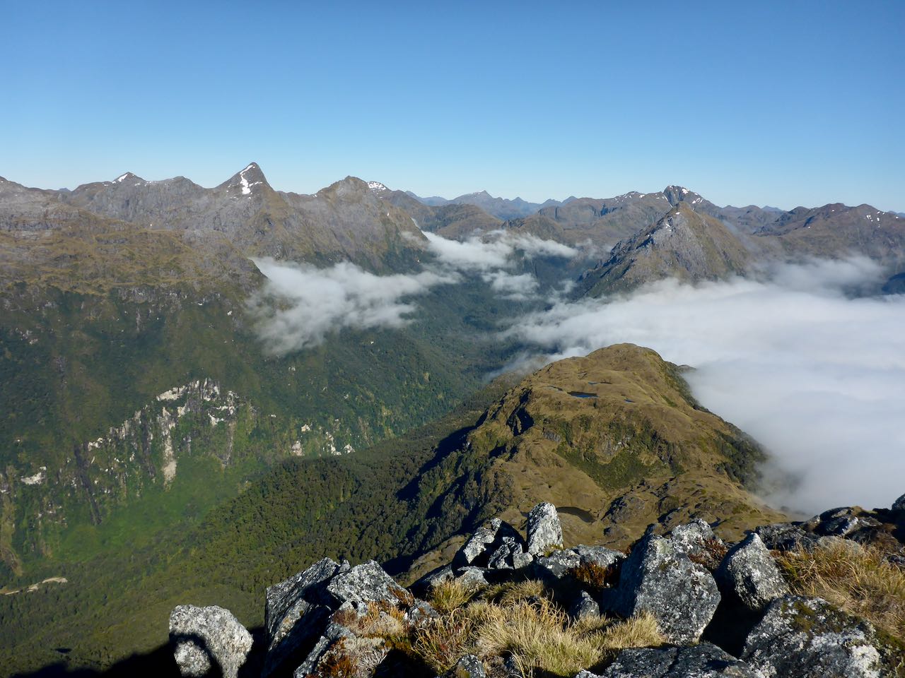
The climb out the next morning was up steeping tussock slopes onto peak 1193m. The sky was clear, and we were in high spirits. There was a striking white scree slope on the peak to the west of us. Ahead stretched a whole series of tussocky peaks which we climbed. Off to the SW was Caroline Peak with some lingering patches of snow, and to the left of it was Lake Hauroko. To the west was Lake Kakapo which I last visited a few years back with Gavin and Belinda when we traversed the Upper Cameron Mountains. Lake Poteriteri was still covered with a cloud inversion. Once we reached peak 1253m, we could see the low saddle straddling the range with the bush quite close on either side. Several hundred metres below us was a wide valley floor covered in tussock with meandering streams and some tarns but we chose to stay high along the ridge, and this led to the saddle. There were old deer trails along the crest and very steep drop-offs to our right. The last section led steeply down to the saddle where we stopped for lunch at a tarn.


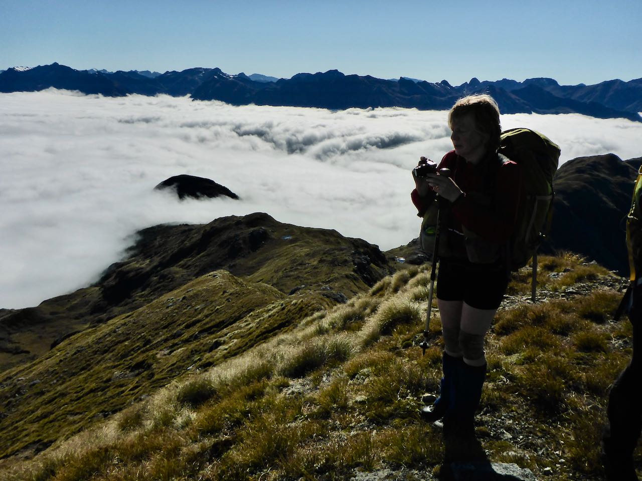
The day was warm, the sky an azure blue, some distant cloud on the southern horizon, the nearby olive-green bush sloping away to the Unknown Burn girdling Caroline Peak now receding behind us. It had taken us 6 hours from our previous campsite so my original plan seemed overly ambitious. The girls went off to get some water from nearby pools. I thought this would not be a bad place to sit out an apocalyptic meltdown of society.
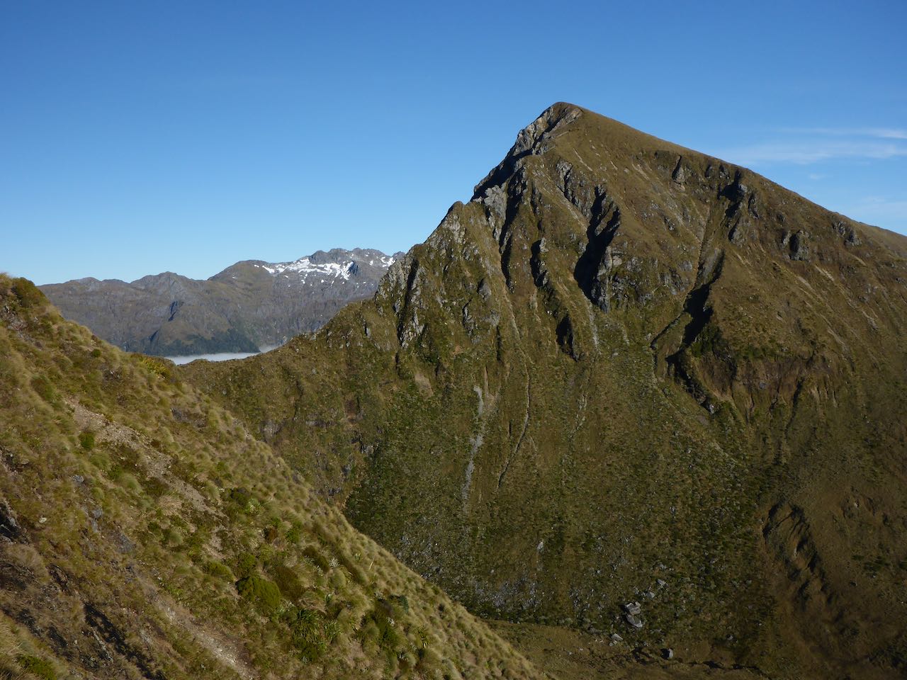
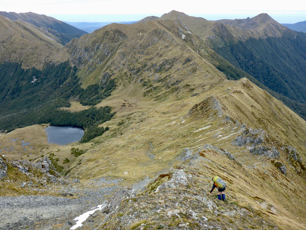
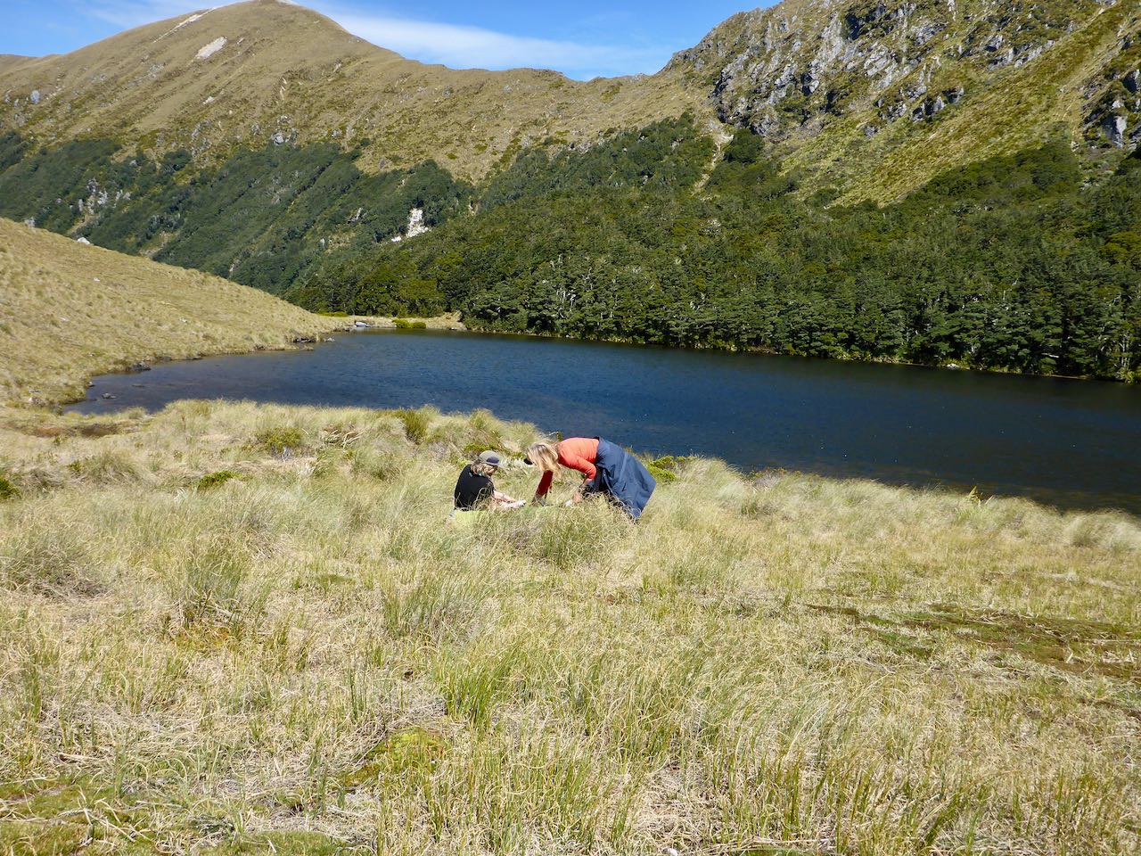
The climb out of 270m was up a tussock face, and easy enough if you could forget the mind-numbing effort in the hot sun. I was going strong with my featherweight, 18 kg pack, minus my usual packraft. Sally and Belinda resolutely followed me up to the ridge which continued south, curving around a wide basin filled with numerous tarns. There were some rocky peaks along this section that we climbed, and beyond the tussock ridge rose over some bumps to peak 1234. I knew that beyond this peak there were no suitable campsites for several kilometres as the ridge was steep and narrow. However, just before the peak, there were 3 small lakes close to the eastern side of the ridge, and we decided to camp at the further one.


A hundred metre descent took us to the far lake and a lovely level site. Here we set up camp in the early evening with the sun still high in the sky, and the mountains resplendent in the softer light. A kea paid us a courtesy visit and was surprisingly well behaved. Sally had deep conservation with it from her tent while it stood mutely outside, listening.It was a warm night with a gentle breeze which kept the tents dry the next morning.

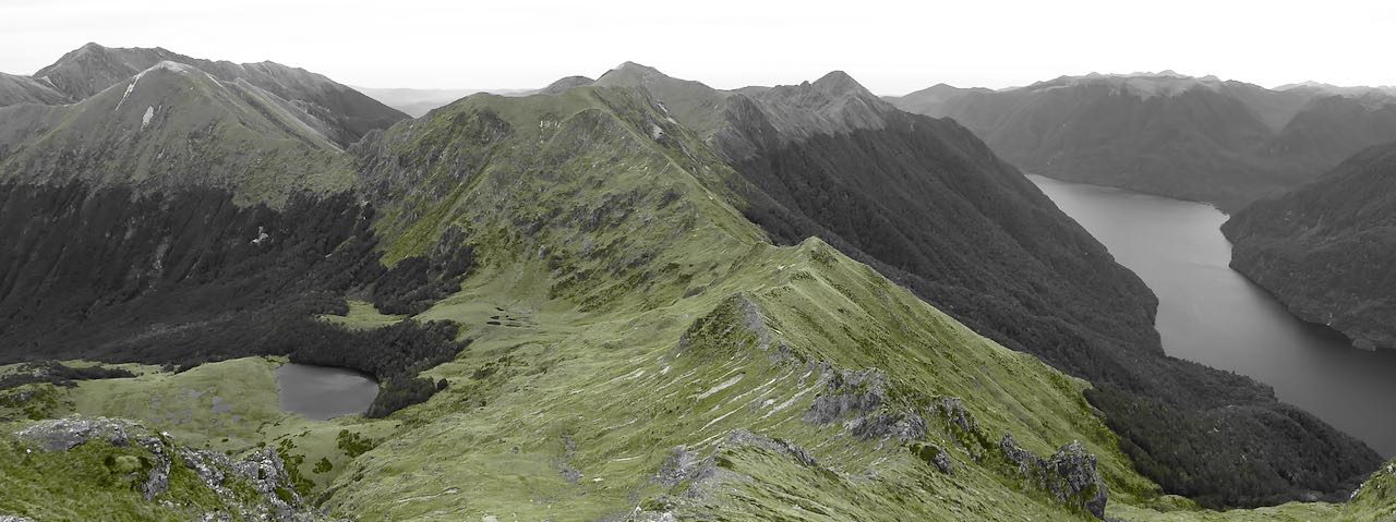
It was cool and overcast as we started our 130m climb back to the broad ridge above us. Ahead the ridge curved around to the left, over peak 1282. I put on my parka as it was chilly, breezy, and forged onwards. On the far side was a steep descent, and I could see where the deer had been. I zig-zagged down this to a flatter area while Belinda and Sally followed. Ahead the ridge descended to a low point at 1091m. To our right, a stream fell away down to Lake Poteriteri far below us while on the other side a creek went down a valley to join the Caroline Burn.


There were several rocky steps before the rise to peak 1226m and beyond this peak 1327m. Here the main range split with one arm heading east to the Alice Peaks while the other continued south. We reached a saddle at 1255m. The rise to peak 1314m looks unpleasant with steep, shattered rock so we thought the best plan was to sidle along its western flank. This proved difficult as it was very steep and exposed in places. Once we passed this section and regained the ridge, there were some rocky outcrops to cross or circumvent. The final climb to the saddle at 1080m was tiring through knee-deep scrub and tussock. A 200m climb took us onto a trio of peaks that curved around to the left. It was overcast under a sullen sky, threatening rain. I put on my waterproofs as I huddled in the lee of the ridge waiting for Belinda and Sally.


Below us was the Rata Burn Valley with 2 large lakes in the headwaters. It looked very inviting indeed. We descended to a low pass at 1064m and regrouped. Ahead the ridge turned east to the Beatrice Peak, and there were several big ascents and descents over the intervening peaks to Helena Peak, our original destination. Then Sally and Belinda suggested that we descend into the Rata Burn. Why not, I thought!
On cue, the sky cleared, and the day warmed up as we descended into the headwaters of the Rata Burn. We stopped for lunch in the sun, sitting on a tussocky terrace. The descent to the lakes was straightforward. Belinda’s feet were causing her grief so we stopped while Sally put some dressings on them. The surrounding mosses were colourful in the scintillating, limpid light, and I noted some sundews which are a carnivorous plant. Extensive tussock flats took us to the bush line where I found the start of a hunter’s track and some rubbish that they had left. Deer trails led down the valley through the sublime forest to a flattish area at 560m where we found enough space to camp.


The next day we continued down this long valley. The going was easy at first but at about 300m the valley tightened, and cliffs appeared. Our pace slowed, and we were forced up into the bush away from the river. Travel became much more difficult until we found ourselves on a cliff face on the TL above a gorge. Further progress on this line was impractical so after studying the GPS map, we decided to head uphill out of the gorge to the 400m level, and sidle in an NW direction away from the gorge. This worked out alright though we had to cross 2 vertical gullies. Once past the second one, the forest was quite open as we stopped for lunch in the warm sunshine. It was a transcendental experience admiring aboriginal nature under a cerulean sky. Belinda remarked with thoughtful perspicacity how lucky we were to be in such a sublime country while the world was falling apart.


We carried on away from the gorge until we could see Lake Hauroko, and then picked up a spur that took us down to the level plain surrounding the lake. Dense crown ferns, and swampy areas covered in coprosma made for slow going. Using our GPS map, we arrived at the ‘Shingle Flat’ on the Rata Burn in the evening. We were all whacked. The sun was still high in the sky as we pitched our tents on the pleasant flat there. We would miss our pickup at Teal Bay at 4 pm but I did not care.


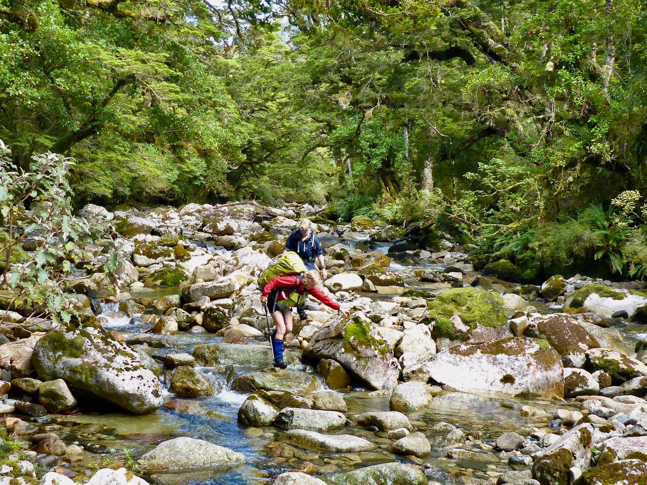
The following day we left early, walking down the river bed, and crossing the walk-wire over the Wairaurahiri River. The wire was a bit slack and wobbled alarmingly, especially as we negotiated the possum gate mid-river. We arrived at Teal Bay hut at 10.15 am. 15 minutes later Johan arrived in his jet boat with a party of tourists and told us Joyce had gone up the lake looking for us. In the afternoon, Joyce arrived in the Namu for an exciting ride back to Hauroko Landing in the increasing NW wind.


Acknowledgments: To Belinda and Sally for your steadfastness and perseverance. To Joyce and Johan for the boat ride on Hauroko, and Alastair and his team for recutting the Poteriteri Track.