It’s day 7 here on the Arcade Flats as the rain pours
down. We’re camped in our tents under some beech trees looking out at a dismal
scene and the news is not good – another 3 days of this is forecast. And what
about our previous good weather forecast – it should have been fine for us to
cross over to Collins but . . . It all turned to custard so quickly and before
I knew it, I was soaked climbing up the ineluctable, scrubby forest in the
Arcade wondering where our previous excellent deer track had gone to. It's
cooler now after the heatwave we experienced before and I realized I had been
foolish not to take more thermal clothing and extra food. We're on half rations
and in my case on quarter rations. Gavin has lent me a spare thermal top for
which I'm grateful. Our food cache put in 16 months before at the bottom of McTavish
Creek is frustratingly across the other side of the northern Olivine Range.
I’d been thinking of this trip for a long time. In September
2021, Sally, Belinda, Gavin and I walked up the Arawhata and placed a food
cache at the bottom of McTavish Creek. Then in a sudden, cruel twist of fate,
Belinda and I found ourselves in Western Australia for the summer and autumn.
I’d been thinking of revisiting my friends, Catherine and Robert at Gorge River
and then going up Gorge River to the Duncan and onto the Gorge Plateau. From there we would traverse the Red Hills to
Twin Lakes and down into the Cascade trench to Arcade Creek which we visited in
January 2020, cross to Collins and reach our food cache in the Arawhata.
It was a warm, sunny day on the banks of the Cascade
River as we blew up our packrafts. The water was startlingly clear as we glided
along the many twists and turns to the Ox Bows. Halfway through them, we found
the old farm track that took us over to Nolan’s Hut. Then it was onto the disused
and overgrown 4WD track to Barn Bay which we reached in the evening. We walked
down the Hope River and had a wee bit of difficulty in navigating the river as
the tide was in. I’d arranged to rent Robyn’s house on the airstrip so we had
luxury accommodation for our first night.
.jpeg)
.jpeg)
.jpeg)
The weather was still brilliantly fine the next day as
we forded the tidal bar of the Hope River and walked south along the boulder
beaches. After several hours we came to Sandrock Bluff and had no difficulty in
finding the track over it which had recently been marked by Robert with danger
tape. Beyond it, the going was easier with sandy beaches a lot of the way.
After 8 hours, we arrived at Gorge River and paddled across. We established
ourselves in the DOC hut and not long afterwards, a Dunedin couple, Sharon and
Joe Bretheron arrived. They had been a few hours behind us and were great
company. Catherine came over and asked us all in for a cuppa so we spent a few
hours chatting with her and Robert and comparing notes. In the evening we
retired back to our hut and had dinner and an early bed.

.jpeg)


We stirred early as we expected a big day ahead of us.
There are 2 pools at the mouth of the Gorge River which we paddled. There was a
strong SW wind blowing which we were glad to leave behind us. The TL offered
better going for a long way and then the TR to the mouth of Jerry Creek. About
a kilometre further on, we came to the first of a series of small gorges. We
traversed above the first one and made the mistake of dropping back to the river
only to find the next gorge awkward and time-consuming. More gorges gave us
trouble until we decided to climb up to a terrace about 120m above the creek
which offered much better going. After several kilometres, we reached the much
easier flats. On the TR was a sign "Garand Flat" and the next one
"Mistresses Flat" likely old hunter's camps and surprisingly clean
and no rubbish discarded. We camped further on under some beech trees in an
idyllic setting with the Red Hills filling the head of the valley.


Day 4 saw us travelling up more flats and on easy deer
trails in the bush, a complete contrast to the day before. The flats just below
the Duncan were especially nice and I thought it would be a great place to take
my grandkids in nice weather. We went a short way up the Duncan and cut up onto
hills 463, 660 and 717. We did find some good deer trails but none on top of
hill 660 which was slow and scrubby. There were few camping spots and no water
so we carried on over hill 717 to just short of the summit of hill 906. Here we
struck some awful terrain of large boulders covered in moss. It was
painstakingly slow. We eventually reached a dried-up tarn just short of the
first flats on the Gorge Plateau and camped in a nice flat dry area. A bright
spot during the day was seeing a Rifleman feeding on a mossy tree trunk.

On day 5, we were hitting my favourite Red Hills. I
had been here twice previously with Gavin but this was Tony’s first. We were
able to find open leads across the flats right up onto the Red Hills. We
reached ‘Nasgul Lake’, the scene of an epic struggle between a ferocious band
of winged Nasguls and us, several years previously. There was still evidence of
this battle – an ominous pile of stones, where we once camped. I remember vividly
the night they came for us – outflanking us on every side, moving stealthily in
till a swift blow by Gavin with his walking pole resulted in a loud protest.
But I proudly delivered the ‘coup de grâce’ – a mortar round into the scrub
where they were squawking resulting in an explosion of wings and noisy protests
as they flew in tight circles just above our tent. Today though there was no
sign of them.
From here we turned right and gained the main ridge
and followed this to Peak 1242. There were great views all around Big Bay and of the flats at the head of Low
Creek and beyond Junction Hill. Instead of continuing along the ridge to the
south, we sidled underneath on the east side and climbed over the shoulder of
Peak 1287 and descended directly to Twin Lakes. What a glorious place, sunny
and calm and surrounded by red hills with two large lakes. We got there at 3.00
pm and set up camp on some sere grass near the lake shore. We all went for a
wash. In the evening, I noticed a change in the weather as some cloud was
blowing in from the west and suspected a weather change in the offing which
later proved correct. Across the Cascade trench was the Northern Olivine Range,
our last hurdle to the Arawhata.


.jpeg)
.jpeg)

Day 6 saw us walk around the
lake and climb over the shoulder of Peak 1315, dropping towards Arcade Creek.
The terrain is red ultramafic rocks with sparse vegetation some of which was
Dwarf Rata. We skirted some vertical cliffs and picked up a very steep gully of
large red rocks leading down to the Cascade. It required the utmost
concentration as a slip would have serious consequences. Once down, we entered
a scrubby forest and pushing through this we came to the confluence of the
Cascade and Arcade rivers. Fording these was not easy but after several attempts,
we made it across. Tony led the way and picked the best spots. Then Gavin
scouted out a deer trail leading up into Arcade and for a while, this went well
as we climbed swiftly upwards. At around 550m the trail disappeared in windfall
and despite all our efforts, we could not pick it up again. Pushing onwards was
now much more difficult through dense forest, crown ferns, and steep gullies.

.jpeg)
.jpeg)

The day had clouded over and
then it started to drizzle. I thought this was just a passing shower as no rain
was expected in our forecast but no, it just got heavier. By the time I
realized this, I was soaked as the bush was dripping wet. And where was the
great deer trail of our previous visit? It now became a real struggle pushing
through wet, dripping forest, finding the odd deer trail that would suddenly
vanish. Tony and Gavin led the way as I was too whacked by the effort,
unsuccessfully willing this purgatory to end. Up and down steep the bush spurs,
across steep creeks, crawling under fallen trees – an endless succession of relentless
obstacles . . . cold, wet and tired.
The flats were a welcome
sight and the tall tussock grass soaked our shorts. There was our old campsite
under the beech trees – forlorn and dismal but still the best one in the valley
so far. It was a relief to drop our packs and get the tents up. We were all
tired and eager to get out of the rain. That night, we got the forecast on our
InReach and the bombshell – several more days of this – we’d have to ration our
food – tough times ahead. I silently cursed myself for not bringing more
emergency food and clothing – I’d become too complacent because of all the fine
weather we had all summer – I was going to pay a high price for my omission.

Day 7 started badly. Gavin
was keen to push on to the tarn at 1280m just below the pass over the mountains
but after discussion, we decided it would be safer to hang out here on the
flats. Our situation was difficult but not desperate – we’d have to be very
careful of our dwindling food supplies. It rained all day. A sombre mood
pervaded the team but at least the 4 Whio in the creek below us were happy.
Gavin lent me a spare thermal top as a lot of my clothes were wet. I slept well
that night.
On day 8, it was still
raining. The ‘Dark Cloud’ forecast predicted rain for another 4 days. It’s a
long way up to the tarn below the pass but I’m not keen to attempt this until
the weather is more settled. The team is rearing to go but it’s not the right
decision until the weather clears.
Day 9 and it's still raining
and our hopes of leaving are dashed. The nearby creek is up and will prove
another obstacle. I look morosely at my dwindling rations and wonder if I'll
have enough energy to tackle the climb over the Northern Olivines – dark
thoughts about our prospects. I study the map intently – is there another
shorter route and . . . yes, I can see one but in a brief clearance, I study
the distant terrain and I'm not so sure as bands of cliffs line the route. I
lie in the tent listening to heavy drops of rain rattle drumming on the tent
roof and the roar of the creek down below us. Things are not good but could be
much worse. For lunch, I have a meal of 4 crackers and 1 slice of processed
cheese. In the afternoon, we have a brief clearance and sun for a few minutes.
I name our campsite "Camp Misery".
By 1600 hours, the rain is
hammering down in torrential showers. Maybe we’ll get good weather in another 2
days. If we don’t cross by day 12, I doubt we will as we’ll be too weak from
lack of food. It feels like a Shackelton Expedition – he was one of my kinsmen
– one of my heroes. I keep these thoughts to myself as morale is low in the
camp. Then I cast my mind back to more great survival stories like the one of
James Scott, who was lost for 43 days in the Langtang Himalayas in 1992. The
tale is recounted in the book "Lost in the Himalayas". And there is
the extraordinary story of my friend Matt Briggs who survived a week in the
mountains near the Horace Walker Hut after a fall off Gladiator Peak sustaining
lacerations and fractures. He saved himself when the cavalry failed to arrive.
http://www.stuff.co.nz/national/2305592/Epic-trek-for-survival
And there is my own survival
story on the Northern Patagonian Icecap years ago in a terrific storm. Maybe
our situation is not all that bad!
The days tick on and I lie
in my sleeping bag in a sort of suspended animation . . . thinking. Maybe I’m
too old for this kind of s@#*. I put the time to good use planning various
family tasks and redesigning my conservation projects and doing trips with my
grandkids who I’ll be seeing soon in Western Australia. I write a few draft
letters to various organisations about altering the conservation projects.
On day 10, it finally looks
like it's clearing and we pack up and leave early in the afternoon. On our
previous trip, we had a tousle with the scrub in the upper valley. This time we
find an easier route but the climb up the spur to the tarn was very difficult
through nasty dense forest. It took us 5 hours to make the tarn. A cold wind
greeted us. At our campsite, there was the ominous pile of stones used as
ammunition on our previous visit to ward off more rapacious Nasguls. We wasted
no time in getting the tent pitched and having a meagre dinner.
By 11 saw us climb up to the
pass leading over to Collins. A strong, cold wind battered our ascent but later
improved once over into the sunlit valley beyond. The descent was
straightforward down to the tussock meadows below. We made for hill 1230
overlooking a cataract and gorge. On the other side of the hill, we started our
descent. Steep slopes led to vertical bluffs and we spent some time
reconnoitring them. Our first try failed and then we spotted an easier line closer
to the cataract which went easily down to the next level. We carried on down
the TL to the subalpine scrub which proved a major obstacle. It was a
combination of Olearia, Fushia, Coprosma and Dracophyllum – dense and
ineluctable – devoid of deer trails and very difficult to negotiate. Our speed
dropped to 3 hours a kilometre. Eventually, we reached the beech forest but
this too was slow going with a dense understory of scrubby plants and steep
terrain. We sidled leftwards to a tributary stream of Collins Creek but it was
all hard going. At 6.30 pm, we found an open area in the forest and decided to
camp. Our food and water supplies were now nearly exhausted but morale was now
high as the food cache was much closer.


.jpeg)

On day 12, we set off on a
good deer trail leading to the tributary 400m away. It was no surprise when we
promptly lost it. I had hoped once we got onto the spur on the far side that it
would be easier but not so. Crown ferns made it difficult and our route
intersected with lots so gullies dropping towards the tributary now on our
right. After 5.5 hours of difficult travel, we burst out of the stygian forest
onto the Arawhata flats. Great joy erupted in the company and we seemed to have
a new lease of life as we headed down the flats to McTavish Creek. There we
retrieved r food caches, set up camp and . . . ate. The sun was blazing down
and it was rather arcadian.
.jpeg)
.jpeg)


There was a heavy dew
overnight leaving the tent outer very wet. We packed up and walked over to the
Arawhata River on the other side of the valley and launched. It was joyous
riding along the current down this mighty river. After a while Gavin noticed
his raft getting soft. His previous repair of a leak near the mouthpiece had
come adrift so every 1-2 km we had to stop so he could reinflate the raft. In
the afternoon, we came to the DOC campsite opposite Callery Flat and stopped.
That evening Tony and Gavin repaired the leak with Aquaseal FD and left it to
set overnight. This proved successful so we made good time down to Neils Beach on
day 14. We had left one vehicle parked at the Hughes house there so after
retrieving Gavin’s van at Martyrs, we were homeward bound.


.jpeg)
Acknowledgements: Thanks to
my great friends Gavin and Tony. Without your enthusiasm and strength, we would
not have succeeded. Thanks to Catherine and Robert at Gorge River, legends and
inspirational friends. Thanks to Robyn Hoglund for letting us rent her house at
Barn Bay. Thanks to Sharon and Joe Bretheron for your company at Gorge
River.
Photos by Stanley and Tony.
Stanley Mulvany
04/03/2023

.jpeg)


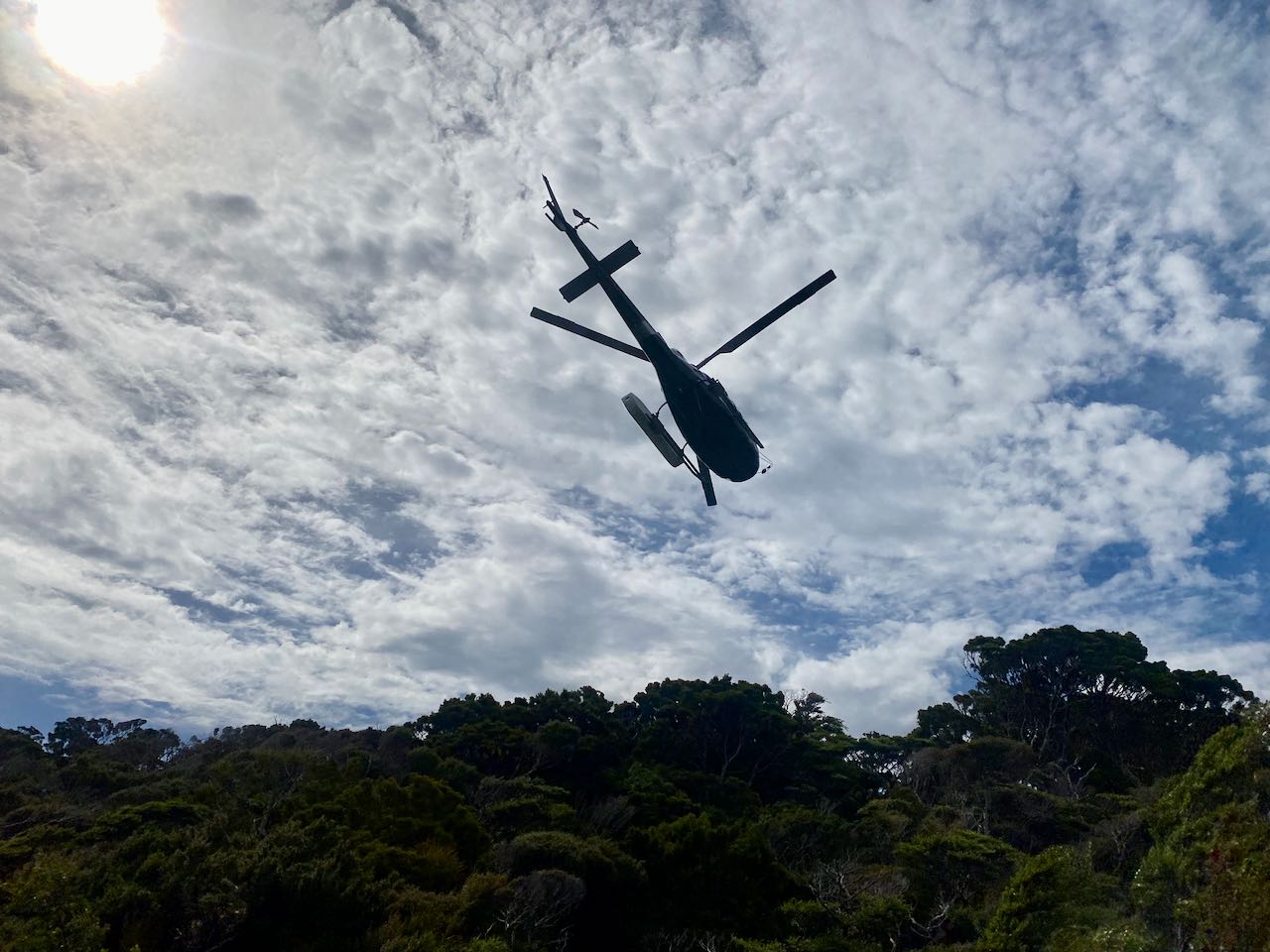 Our drop off at North 5-Fingers Hut
 Looking east from 5-Fingers

.jpeg)

.jpeg)
.jpeg)
.jpeg)


.jpeg)
.jpeg)
.jpeg)
.jpeg)

.jpeg)


.jpeg)
.jpeg)


.jpeg)
.jpeg)


.jpeg)

.jpeg)
.jpeg)


.jpeg)