


-->
I reached Mt Cook from Mesopotamia on 4th
December with Reece McKenzie. It was the hardest section of my traverse of the
Southern Alps that I’d completed to date but I had a suspicion worse was to
come and indeed that was the case. On 2 occasions in January, we had to
postpone the next section due to bad weather forecasts. I was very fortunate to have Penny Webster
and Bruce Farmer as my companions. Penny of course is one of NZ great climbers and a renowned multisport athlete. Bruce too is a formidable climber,
a veteran of 2 Everest expeditions and first ascent of Molamenking in Tibet and
Cerro Stokes in Patagonia. Not only are both great mountain climbers but also
more importantly are enthusiastic, kind and considerate and wonderful
companions on a difficult enterprise.


Logistics were a bit of a headache and we
decided that I would drive up to Glenorchy, stay with Bruce and on 6th
February, we’d drive over to Haast, drop off a vehicle and then carry on to Mt
Cook in the other car. Penny would arrive in the afternoon at Unwin and then
we’d set off up the Sealy Range.
It was a pleasant drive up to Glenorchy
where I found Bruce and Rosemarie in their lovely house. This was my first
meeting with them and I was immediately treated like royalty. After a nice
dinner and pack, we bedded down early. We were up by 5:00am and away shortly
afterwards. 3 hours later we had arrived at Pleasant Flat where we drove in on
the 4WD track towards the old Landsborough homestead. After a kilometre, we
left my car, transferred my gear over to Bruce’s, and set off for Mt Cook. It
was another 3 hours to Unwin Hut at Mt Cook where we arrived at lunchtime.
Penny arrived mid-afternoon. After a sort out we drove over to White Horse hill
where we left Bruce’s car and set off up the hill.


-->
We had a pleasant camp on the Sealy Range
but during the night it started to sleet and it was rather white and miserable
next morning. We packed up early and set off on a GPS bearing for Barron Saddle
Hut. We were relieved to have Penny navigating as she had ski toured here
before and was familiar with most of the route. We took the high level route
crossing the Annette Plateau, the Metelille Glacier, the Sladden Glacier and
the ledge around the NW Ridge of Mt Darby. Most of this was in the murk, which
only cleared once across Sladden Saddle. Once past Darby we climbed up a
snowfield and then across some rocky hillocks for a view of the toilet of the
Barron Saddle hut. That was a welcome sight even if it was just a toilet! Penny
raced ahead to get the forecast at 7.00pm.


-->
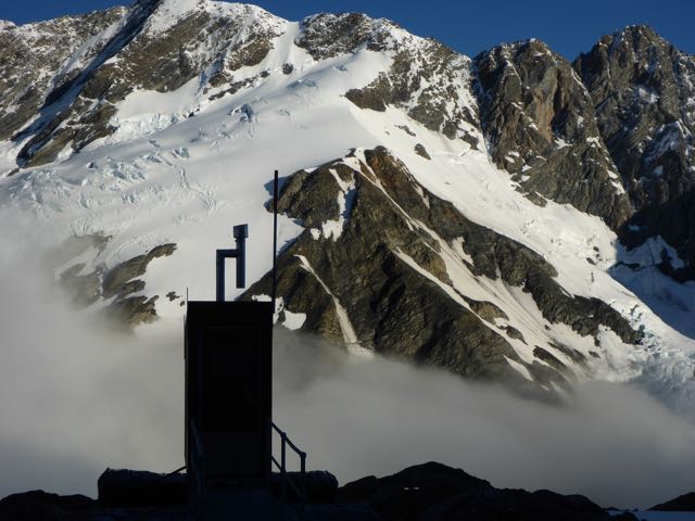
Barron Saddle Hut is a giant barrel
situated just below Barron Saddle. It replaced the 3 Johns Hut that was blown
away in a storm in 1977 killing 4 members of the Wanganui Tramping club. No one
else was there when we arrived, just as the weather forecast was coming
through. This promised good weather for the next day, so we were very relieved.
The ranger station at Mt Cook was surprised that we were there and more so when
we told them we were crossing over to the Landsborough. I gave them a trip time
of 7 days and a panic date on day 9. Penny produced a gourmet dinner for us.

Next morning there was cloud in the valleys
and it was clear overhead, promising a fine day. We got underway climbing up to
the saddle where we could see the torn stays of the 3 Johns hut. I shuddered
when I saw the very steep drop off into the Dobson valley. We climbed along the
ridge up to a prominent snow dome and then sidled left onto steep snow slopes.
Further along we headed straight up a snow face that became increasingly
steeper and icy. We took out the rope and Penny lead off on a belay, and then
Bruce and I followed. I took over the lead for the next pitch and then it was a
short pitch to the ridge. The view was spectacular, back towards Mt Cook and to
the right, the Sealy range and then the Dobson valley. To the left were the
Mueller Glacier and the mountains on the left side of that. To the west of
Scissors, slabs dropped away into the Spence Valley. It was difficult to tell
how steep the slabs were and we could see a line of weakness cutting diagonally
right.


-->
Penny went off on a recce and said it was
fine. We used the rope as a handrail on a vertical step. I put in a cam as an
anchor and then decided I did not like the look of it so put in a second cam. When
one of us was down climbing, a slip loaded the rope and the primary anchor
popped out but the backup held, causing some palpitations. Penny came last and she lowered her pack and
then carefully descended. We continued along the line of ledges heading right.
Between them there were some cracks, we slid down, the friction of our packs
slowing our descent. On one section I rigged the rope up as a handrail and this
was just as well as the slab was very steep and as smooth as glass. Finally we
came to near the end of the slabs and here we did one awkward sideways abseil
to the ice.
By now it was afternoon and cloud was
pouring over the divide and rain was in the offing. We set off down the stone
pock-marked ice till it ran into moraine and then down this alternating with
leads of ice to a shelf on the mountainside with glacier to the left and rock
ribs on the right. We guessed correctly the best route was down the remnant
Spence Glacier on the left. This was an easy, straightforward descent and soon
we were cruising done to Spence Lake. Walking around this we climbed up to a
terrace and walked down the ablation valley and ancient lateral moraine to above
Rubicon Lake. Here we dropped down to lake level and following the outflow
river, we took a compass bearing on the Rubicon Bivvy rock, which led us
directly to it. By now it was drizzling and it was a relief to find the bivvy.
It was a huge rock with rock walls that had been built around it. The floor was
grassy so it obviously got wet at times. However it was heaven to us and we got
ourselves set up, had dinner and a pleasant night in it.


--> The following day was dreary with drizzle and heavy overcast clouds pressing down on the mountains. We packed up and set off hoping to reach Zora Canyon where we planned to camp. I had on my parka and overpants but Bruce said he would get too hot in this and opted for just shorts and shirt. In no time he was soaked but he did not seem to mind and happily carried on. My memory of this day is a blur of crashing through scrub, clambering around huge rocks, wading across streams, an interminable succession of twists and turns of the upper Landsborough Valley. A milestone was seeing the bush appear near Baffle Ravine opposite Whitcombe Creek. We struck trouble just before Arthur Creek in the form of a huge bluff that we knew we had to climb. But where was the route? Penny forged ahead and up and up we went for a long way, across slips, up cliffs and into more bush till I was wondering if this was correct. But I should never have doubted Penny, as she is a master navigator and guided us safely through and down to an open creek bed past Arthur Creek where we found a delightful mossy bench on which to pitch our tent. Soon Bruce and Penny had a fire going and dinner on. The rain had cleared and we had a pleasant evening there.


--> -->
The 10th dawned fine and we set
off dropping down to Humphries Creek. There was more of the scrambling across
huge boulders till we reached Zora Canyon where the valley widened and the
travel became easier. Up till here we’d been only loosing height painfully
slowly due to the difficult terrain but from here on, we picked up some speed.
A large flat appeared and yes, I thought this must be Kea Flat but alas our GPS
said otherwise. Further on we came to a bush terrace and on top was the start
of Kea Flat. We’d had enough punishment for the day so decided to camp next to
a lone beech tree on the flat. Bruce soon had a fire on as I pitched our tent.
I’d been to Kea Flat once before in the
late 1970s with Jock and Pat. We’d come over the Solution Range from the Lower
Otoko Pass and had a food cache here on this flat. Our plan was to reach Mt
Cook over Scissors but looking at the terrain now I doubt we’d have succeeded,
considering our inexperience then. The weather broke when we were here before
and we had retreated over Broderick Pass to the Huxley and Hopkins. My
recollection of travelling on down to Creswicke Flat was of easy travel but
this was not borne out this time.


-->
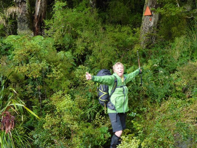
The 11th was a grey morning with
showers on the tops. We cruised down Kea Flat and then found trappers tracks in
the bush marked with pink triangles. These were a big help. The forest was
fairly open and moss grew on the trees. One in particular has a woody mushroom like
growths on the trunk. Penny gave it a big huge which was sweet. Our track then
headed up hill and ended on a near vertical slip. Penny forged ahead across
this as I carefully followed. Looking down it was maybe 100m straight into the
flooded Landsborough, definitely no place to slip. Just at that moment Penny
shouted, “Don’t look Stanley” just as I swivelled my gaze across towards her perched
behind a tree, sans brassière. She was in the act of changing her sodden top. I
reassured I had other things in my mind . . . like my tenuous grip on the mountain!
Meanwhile Bruce was trying to maintain some adhesion to this near vertical
slope behind me.


-->
But this was only the beginning of our
difficulties following this errant track. Shortly after this, it dived down to
river level into as bind corner. We were completely flummoxed as to where it went.
A rock wall prevented boulder hopping at river level and above us we were
ringed with cliffs. Back and forth we ran searching high a low till I noticed
something written on a track marker by the river. This is what was written, “I
agree! F@*k this!! (back to the creek and up)”. Yes, now it became clear . .
.this was a dead end and we were not the first to discover this. So back along
the creek we went, till we picked up a faint trail heading upwards. This
eventually dropped back to river level and Creswicke Flat. Then we were trudging
across the flats through sodden knee-high grass to the new Creswicke Flat Hut.


Creswicke Flat Hut was built last year from
the $124,000.00 bequest of the late Barry Smith, a hunter who loved this place.
It replaced the old dilapidated Creswicke flat hut that I stayed in, so many
years ago. It’s got 4 bunks, a great little pot bellied stove and a wide veranda
out front. Amazingly Penny knew Barry and in fact he took her on her first
tramp. He was a teacher in Christchurch. It sounds like he was a super person
and keen to help young people into the outdoors. We settled in and got the fire
going and started drying out clothes. Although it was early afternoon I was
keen to stay the night and enjoy a comfortable place to stay. It did not take
the others long to see the logic of this. We were most impressed by this very
well made and welcome hut with a fabulous view across the flats to Solution
range, covered in a cloud layer. I’d scratched my eye earlier in the day when a
branch flicked into my eye from the side so Bruce put in an eye pad but this
was too uncomfortable after a while so we took it off.

We were away early next day. My eye was
feeling better which was a relief. It was overcast and drizzling and the river
was in flood as we plodded along river flats and through the bush on the
trapper tracks. There was none of the drama of the previous day’s slips and
blind alleys. There was a steep climb on a track over Harper Bluff and then an
easy descent to Harper Flat. I’d been here some weeks previous on a tunnel
tracking job for a few days so was familiar with the area. We set up camp in my
old camping spot at the bush edge near the old airstrip. Again this proved a
delectable spot. Penny found her new jacket was leaking and made a waterproof
layer under it with a rubbish bag. I was chilled from damp clothes and hastily
got on some dry gear to warm up. I think this was the start of a respiratory
infection, I subsequently developed.


It was now day 8, as we set off down the
flats. Sadly lots of ragwort and blackberry were growing here. We were looking
for more track markers but none were evident. Once the flat ran out it was
boulder hopping beside the river, till this was no longer practical and then,
into the bush. It was damp and not the most pleasant. We came to an eroded
cliff and Penny climbed down and then me. As Bruce took off his pack, we found
the 2 ice axes had been pulled off somewhere back in the scrub, so he went off
searching for half an hour and thankfully found them. Then it was down more
flats to Strutt Bluff. The 2013 edition of Moir’s Guide describes a “good
marked track” over the bluff but this is no longer the case. We found old
footprints in the sand leading to the right just before the river cut in and in
the bush some orange markers heading left. Higher up there was some flagging
tape but then nothing in the steep bush. We climbed up 80m and there was what
appeared to be an old track but it lead nowhere and horizontally to our right a
vertical vegetated cliff barred further progress. We then descended back down
to the river flats for a rethink. On our second sortie we regained the ledge
and then decided to climb straight up to point 384m which although steep was
straightforward. At the top a rock ledge slanted diagonally to the right. I
think this was the original route noted in old editions of Moir’s. We could see
the lower Landsborough Flats and we made our way down to them. What should have
taken us less then an hour had consumed at least 5 hours.


-->
I thought we’d make the old homestead and
camp there so once on the old 4WD track we sped along. But something was wrong,
as there was no sign of the house. I’d been here only several years previous
and I remembered the track going right by the house and impossible to miss.
Penny did a great job navigating using her GPS as the track disappeared on the
gravel outwashes. It was now dusk and in the fading light we spotted a light up
ahead. “Yes, it must be the homestead and someone is camping there” I thought.
We entered some bush on the track skipping around pools of water in the dark
when suddenly bright lights spotlighted us like possums caught in the open.
Then a Toyota Landcruiser stopped and the driver, a young guy asked if we were
alright. They were the advance party of a team getting ready to do a bird count
on the tops next day. They asked if we wanted to use their satellite phone and
I took them up on the offer . . .calling Belinda and asking her to call the
rangers at Mt Cook next day to forestall a likely S&R mission, as we would
be 2 days overdue. They gave us some chocolate biscuits and wanted to know who
we were. They also told us DOC had bulldozed down the old homestead the year
before hence the reason I could not find it. Then they were gone and we set up
camp in the drizzle on the next flat.


On the final day it was only a 2.5 hours
walk out to my car, thankfully untouched. We then drove back to Mt Cook to
collect the other cars. That night had a very pleasant dinner at the
Mountaineers café with Jane Morris, a good friend of Penny. I was feeling quite
ill so I drove back to Invercargill next day and went to bed.
Acknowledgment:
Mt Cook to Pleasant Flat 6-14th February 2017. This has been the
hardest section of my trip down the Alps to date and I’m so grateful to Penny
and Bruce for their company, enthusiasm and good humour.
Stanley Mulvany
Invercargill
1 comment:
I think bed would have been mandatory after that little effort. Nice read thanks.
Post a Comment