This journey has been on my shelf for a long time and after
our recent Wilkin –Waiatoto Expedition, we were keen to explore further south.
The logistics are a hassle to sort out and we decided the best plan was for
Belinda and l to leave a car at Gunn's Camp in the Lower Hollyford and drive
our other car to Arrowtown to Gavin’s place. Then the next day, Carol would
drop us off at the Martyr Homestead in Southwestland. This all went according
to plan and on 14th February, we said farewell to Carol at the
locked gate at the road end, south of Jacksons Bay and started down the gravel
track. There were just the three of us, Gavin who has been with me on 3 other
tramping – packrafting trip in the last 6 months and Belinda. We each carried a
week’s food, camping gear and our packrafts that as usual made for rather heavy
packs.
The day was clear with some cloud on the tops as we walked
past the homestead. I had intended to call there but no one was about. It is
advisable to get permission in advance, as this is private property. We carried on to the Cascade River. Here, we
decided to cross as there was a good ford and flats on the true left. After a
kilometre, we were forced into the bush and this was a bit slow until we came
out onto flats further on. The day had brightened up and it was pleasant enough
strolling along the 4-WD track. This entered the bush for several kilometres
and then emerged onto cleared flats where there were some fine stately
Kahikateas, NZ tallest trees. A mob of cattle watched us pass and we arrived at
a bucolic hut with some derelict cars parked nearby. Here the track did a sharp
turn to the left and re-entered the bush. A short while later we came to Dee
Creek, which was dry. Further on we came to Limestone creek which we walked
down this to pick up the track again on the TL.


Then, it was a long plod to Barn Bay. I saw 6 deer on the
track that clearly has not been used for some time as there was windfall across
it in several places. Scrambling across this we stumbled into a wasp nest and
Belinda and Gavin got stung several times. On reaching the Hope River, the
route disappeared and we kept mostly to the TR in bush down to the airstrip
which is right on the coast. There was a house there and a young affable
Hungarian was in residence. We decided to camp on the airstrip and cook on the
porch.

Next morning dawned fine and clear. Gavin was as usual very
organised and ready to depart in no time. Leaving the airstrip, we waded across
the Hope River onto the sandy beach opposite. The day was warming up with a
blue sky and a heavy surf rolling in off the Tasman and crashing with abandoned
restraint onto the boulder beaches. It was about 5 kilometres to Sandrock
Bluff, mostly on boulder beaches. This was a slow walk with our heavy packs.
Years ago, a mining company sent a bulldozer south along this coastline and at
Sandrock Bluff, it made a rough zig-zag track over it. We found this and it led
upwards for about 100m before dropping into Bluff Creek, which we followed down
to the coast again. Here we stopped for a pleasant lunch.


South of here, the beaches were mostly sand and small stones
that made for easier travel but the big surf kept us further up the beach. We
passed bleak Browne Island off shore and then closed on the rocky headland of
Bonar Knob. Rounding this there was a tremendous view southwards with some
prominent headlands far away but it was hard to know where Gorge River lay
hidden. The bush came down close to the beach and was sculptured into waves by
the incessant wind. From the flax bordering the beach, we could often hear the
alarm cries of Tawaki or the Fiordland Crested Penguin. On one occasion we saw
a few peering out at us. Apparently, they moult at this time of the year.
Then, we saw a distinct valley open up ahead of us – Gorge
River at last. It issues through a steep defile and has a deep pool before it
discharges into the sea. On the far see, we could see the roof of the Long's
house and their wind vane and the sounds of an angle grinder drifted over the
water to us. I suggested we inflate one of our packrafts and Gavin ferry the
rest of us across. Surmounting the bank on the far side, we stepped onto the
tiny airstrip and on our left were the Longs house and the DOC hut next door.
Ah, the delight to heave off our monster packs and boots and get into my crocs.
Once we settled in and had a hot drink, we felt like new people.


Just then a plane did a low fly past the airstrip and when
we dashed out, we bumped into Catherine Long, who was surprised to see us. Once
I mentioned Tara, she guessed we were her parents. She invited us in for a
cuppa later. The DOC hut was small but spotlessly clean and bright – a welcome
haven indeed. In the evening we called into the Longs and had a pleasant
discourse with Robert and Catherine. They are known as “New Zealand’s remotest
family”, good friends of our Tara. They are the archetypical, quintessential
Kiwis before the rest of us lost it to our consumerism-based society. Later, I
reflected on how many Kiwis live in voluptuous magnificence into huge, lavish
houses in places like Queenstown and who whinge about paying tax and don’t know
the meaning of social inequality. I realise that the Longs are indeed fortunate
to be away from that hubris, to have found their place in nature. We as a
nation could learn a lot from their outlook, to appreciate nature and live in
harmony with it.

Next morning, we bid our farewell to the Longs and started
off southwards under a grey sky and blustery onshore wind. The rain was not far
off. The plan was to make for the Hacket River and camp there. The coast was of
greasy boulders and it made for slow going. In places, loose cliffs bordered
the beach and there was only a narrow passage between these and the pounding
surf. Longridge point came and went as the weather slowly deteriorated.
Somewhere before the Hacket, it literally sheeted down as we crouched under
some cabbage trees that offered scant protection from the deluge. It was
somewhat Gothic, inimical and lugubrious! The mist had descended in an
ineluctable miasma as we plugged along this sodden coast. Then, we arrived at
the Hacket, which was a rapidly rising torrent of brown water rushing into the
surf in a deep channel through a sandbar. We decided to chance a combined
crossing at its narrowest point. Linking arms we plunged in only to have Gavin
lose his balance on a big rock that we could not see. Unfortunately, his new
camera got immersed and ruined.


Once we recovered from this, we wandered up the creek for
about 100 metres and found a clearing in the bush that had been previously used
by hunters or fishermen. The rain had eased off to drizzle as we pitched our
tents. In the evening the weather cleared and we even had some sun as I put up
a clothesline. I went off for a bath in the river nearby much to the delight of
the sandflies.
From the Hacket, it is only a few kilometres to Awarua Point
but was slow going on big boulders - the worst to date under a grey weeping
sky. It is a low promontory inhabited by some shags drying off on some offshore
rocks. On the far side is the deep indentation of Big Bay and it is about 7
kilometres into it - all slow going until one hit a 4-WD track near the far
end. A big sea was running in and massive waves were exploding in unfettered
fury. At the end was a wide sandy beach bordered by Awarua River on the right.
A track led around this into the bush where we came across some old cribs and
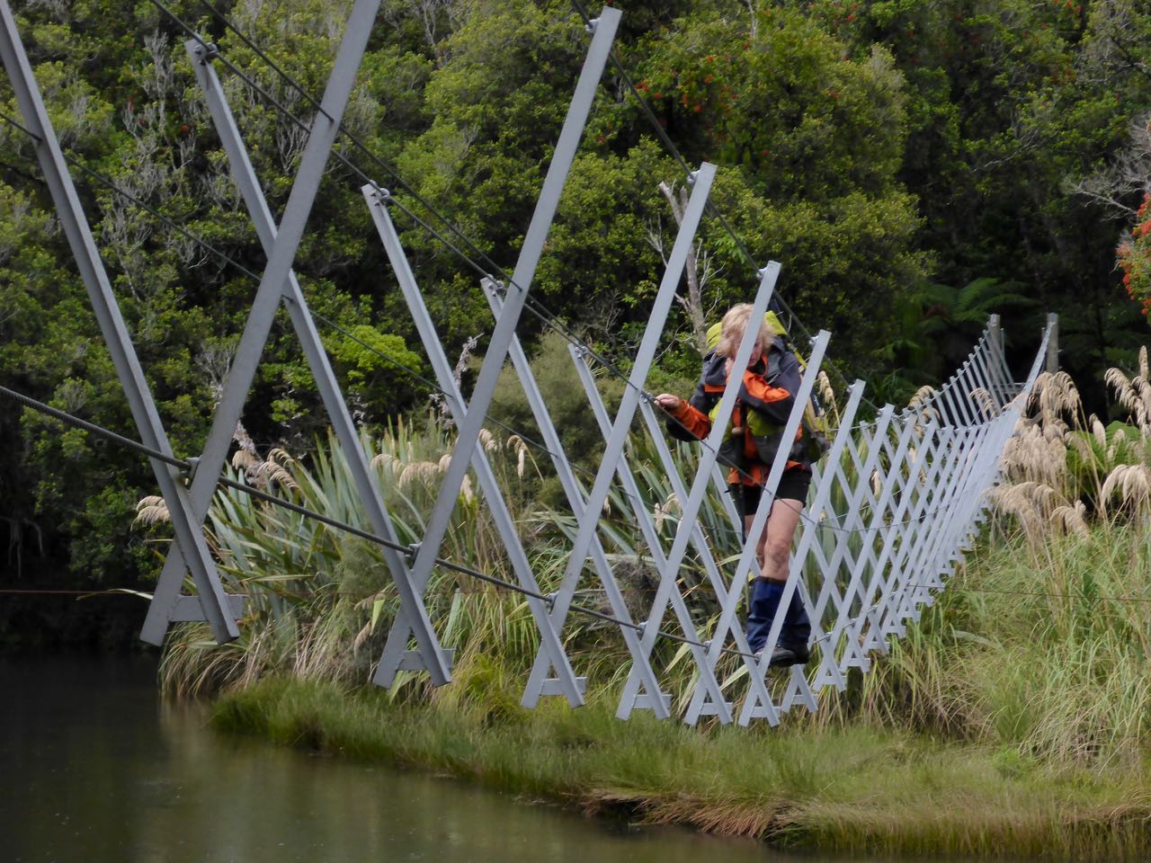
this carried on for just over a kilometre to a walk wire across the river to
the DOC Big Bay Hut. Thankfully, this was empty.


The first task on the agenda was, of course, a hot drink. In
no time, Gavin had heated up his customary noodles while I got myself organised
in a desultory manner. The rain came on in more earnest now so we were glad to
be in a shelter. Someone in the hut book reported seeing " the biggest rat
I've ever seen". We could hear an ominous gnawing sound from somewhere
under the hut sink that continued all day. Belinda’s feet were very sore and
left big toe nail had a bleed underneath the nail and appeared to be infected.
The rest would do her good. I found a copy of Dr Dave Baldwin’s book “The Bushman’s Bible” that he had donated to
the hut and started reading it. Apart from the colourful language, it was an
excellent read.
The next morning it was still raining so we decided to stay
put. However, by lunchtime, it has eased off and some blue sky appeared, so we
set off for the Pyke Crossing. It was about a 4-hour walk across on a mainly
good track. At the Pyke was a nice campsite where we set up camp. We all went
off later to have a bath in the river.


It was cloudy next day as we inflated our packrafts for the
push down the Pyke. There were a few easy rapids and it was very
straightforward. The river grew in volume with each tributary and by the time
we entered lake Wilmot it was pretty big. In places there were trees in the
river and care was required in avoiding these “strainers” as we call them.
Gavin capsized on an eddy line but thankfully he was near the bank and was quickly
back in.
Belinda was keen to circumnavigate Lake Wilmot, so Gavin and
I pulled into a beach at the south end and waited for her to do this. It was
drizzling and dank clouds hung over the valley like a widow in mourning. I
spent the time muttering imprecations to a patient Gavin about Peter Thiel (Mr
Paypal) and his covert citizenship granted by our previous inept and corrupt
government. The wind was now getting up and we could see Belinda coming down
the lake in the following sea.


Once we re-entered the river, the waves disappeared and we
entered the enchanted forest once more. Gliding along we noticed some cut
branches on the TR of the river and then we were hailed by a lively, bearded
chap called Bruce Ray (aka Sammy Stoat). There was a large rock in the river so
we pulled in for a chat. Belinda had met him before at Okarito and Tara has
also met him on her travels. “Are you Bruce? Tara mentioned you to us” I asked
him. “Stan-n-n. I’ve heard about you. I’ve met her mother. Wait a minute
(swivelling around again to look at Belinda) – you’re her mother.” “Come on up
for a brew in my hut. It’s called Alcatraz cause it’s built on a rock”.
Unfortunately, we were worried about the deteriorating weather and after a few
minutes, we reluctantly had to carry on. It’s inspirational meeting people like
Bruce and the Longs who live a virtuous lifestyle and have found their place in
nature, unsung heroes, and archetypical kiwis!


About 5 kilometres further on we reached the Olivine River
confluence and we stopped at the hut for lunch. It was a hurried affair and we
were all a bit damp and in Gavin’s case, quite wet. On we went around many
bends till we eventually reached Lake Alabaster. Here there was a fine view
down this large lake and with the wind behind us, we made this a fast paddle.
Towards the far end, there was quite a fetch and the waves were building but it
was easy enough to cross over to the TL and the large Alabaster Hut.
Surprisingly this was empty.


Soon we had all our wet tents and gear hanging up to dry in
the cavernous porch. Later a young German woman arrived and was surprised to
see only the three of us considering all the wet gear drying outside. Her name
was Anya and she appeared to be in her 40’s and taking time out from a desk job
to sort out her priorities. It poured that night, rattledrumming on the tin
roof.
We got away next morning under another grey sky but at least
it was not raining. The Pyke was huge, brown and rushing down to meet the
Hollyford River. About half way along we came to Hidden Falls Hut where we
stopped for a spell. There was some young “Real Journeys” staff there that we
chatted to. One of them was Robbie who said he was a sea kayaking guide. “You
must know Tara” Belinda explained. “Tara, she taught me. You must be her parents”
he exulted. When I explained our car was at Gunn’s, Robbie offered me a lift –
so I was saved the 8km walk from the road end. Then, all that remained was the
3-hour drive back to Arrowtown.


Thanks to Belinda and Gavin for a super trip. Thanks to
Carol for driving us across from Arrowtown to Martyrs, to the Longs, Bruce and
Robbie for your hospitality and exemplary providence.
No comments:
Post a Comment