


This is my story of a traverse of the Southern Alps of New Zealand. It
is not a unique journey as it has been done many times. I
recently retired from clinical medicine and this was my ‘retirement plan’. Initially I planned
to complete a round of all the ‘Munros’ in Scotland of which there are 282 summits. These are the peaks over
3000 feet high. Over several years I’ve climbed
over 30 of them, with my great Scottish friend, Frank Johnstone, from Boat of Garten. However I was put off after reading several
books on the Munros and the terrible weather to be expected. Instead I decided
I would tackle the Southern Alps. I would have no fixed schedule, only go when
the weather was favourable and pick off various sections in no particular
order. To the purist this might seem haphazard but for me it made eminent sense
and much more fun than slogging it out in filthy weather as one continuous journey.
Just before Christmas I spent over 4 weeks in Nepal with Bryan Scott on an earthquake survey. I was fairly fit after walking over the Langtang Mountains during that trip. Then in the New Year, I joined some friends from the Southland Section of the
NZAC for a trip across the Bracken
Snowfields and the
Waitaha. Following this I joined Simon Marwick for a traverse of
Poseidon Creek over to Lake Liz and down the Transit River and Anita Bay...all good training for the traverse.
I started on 12th February. The previous night I stayed with Neil and
Shona at Albertown on my drive north. I arose early, had breakfast, left a
‘Thank You’ note, and drove on to Waddington, where my brother-in-law Geoffrey
lives. There I checked the weather forecast and saw it was only good for a few days, so on the spur of the moment I asked Geoffrey to drop me off at
the Bealey Bridge, the same day. He had a few jobs to do so it was late before
he dropped me off. It was the eve of the ‘Coast to Coast’ race and there was a
big encampment at Klondyke Corner. I set off at 7.30pm and moved along quickly.
I did not stop till 9.00pm as I had difficulty finding water and it was just
about dark before I camped. I slept well as I was quite tired.

I woke at dawn to a still and overcast day. The sandflies were active as
I had a quick breakfast and then I was off. Not far along was Anti-Crow Hut.
There was a German woman tramper there whom was bound for Carrington Hut. I was keen to keep going so did not stay to chat more. It took me
3 hours to reach Carrington Hut and by then it was sunny and hot, as the sun
had burned off the low cloud. It must be over 40 years since I was last here
and I was surprised to see such a large hut. It was empty. I dried out my tent and had an
early lunch before setting off yet again.
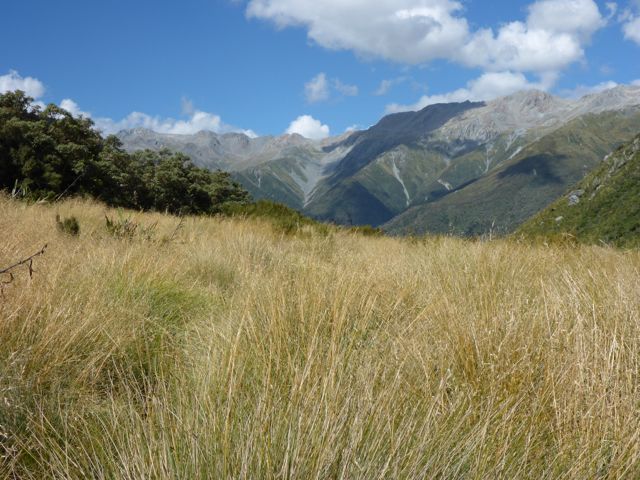
I crossed the White River and found an easy route up the boulder bed of the Taipoiti River to Harman Pass. I met a group of trampers lolling around at a creek just below the pass and one of the girls was wearing a very skimpy bikini. I had to tear my eyes away to avoid staring! Harman Pass was unremarkable and off to the left I could see Whitehorn Pass, which at 1753 meters had a permanent snowfield leading up to it. This was a slog across boulder fields then up glacial snow to the pass. The slopes on the left were collapsing and large boulders had fallen onto the snow. . . not a place to linger. There was a great view here of the Cronin Glacier on Mt Rosamond to the right of the pass and down to Cronin Creek. I had a second lunch.
There was a zigzag path down the scree just below the low point of the pass that went on and on. The route follows down benches on the true left for a long way before dropping into the creek. I was strolling along when I saw an unusual ‘rock’ that looked like a person staring down valley. This materialized into a young hunter called ‘Ash’ who was out spotting game. I dropped my pack and climbed up to him and asked if he was all right. He was startled by my sudden appearance. We chatted for a while, and then I carried on. At 1000m the route crosses to the true right and shortly after enters the bush with a few ups and down across side creeks to Park Morpeth Hut. I had been on the go for 12 hours and was relieved to reach the hut. It was empty. It was built in the 1931 by the CMC (Canterbury Mountaineering Club) as a memorial to 2 young climbers, James Park and John Morpeth who lost their lives, drowning in the Burnett River, a tributary of the Wilberforce River nearby. The hut though old was comfortable and had a mountain radio. There was a request of a donation of $5.00 for use of the shut, which I gratefully left.


I had a good sleep and awoke refreshed. The sky was clear and we were
still in the shade as I closed the door on the hut and set off up the
Wilberforce River towards Browning Pass. At the top of the river was the Clough
Memorial on a terrace, in remembrance of Allan Clough who drowned in the
Wilberforce River on 26/01/1956. Above was a steep slope with an old zigzag
track, built by miners year ago that ended in a cliff face, the proverbial road
to nowhere! I slowly gained height on the overgrown track, then climbed
straight up to a short cliff face that I ascended to the pass at 1411m. What a
grand sight, a lovely lake nestled in a shallow basin to the north. There was
an easy track around it and as the day was sunny and warm, I was looking forward
to a lazy swim once I got there. I was just about to stop for my swim when I
noticed a large group of trampers come over the rise from the far end of the
lake. This sort of killed my enthusiasm for a dip! They were a group of 17 from
Outward Bound and Kupewatch, on a day trip from Harman Hut further on in the
Arahura Valley. That was bad news for me as I had hoped to stay there. I
dropped down towards the river and stopped by a creek for a wash, then carried
on down to the river and into the subalpine scrub to the hut. It was packed
with gear with lots of tarps and a tent outside so after lunch I carried on.
There was a swing bridge and a good track took me down the Arahura and then up
to the low Styx Saddle and down at the Styx Valley to Grassy Hut, thankfully
empty. Here I read in the hut book that Robert Porte, an old climbing friend was
a day ahead of me. I arrived at 5pm, a 10.5 hour day. It was good to stop at
last. So far the good weather had lasted
but for how long?


On 15th February it was cloudy on the tops as I set off for the crossing
of Lathrop Saddle to the Crawford. A short walk down the TL of the Styx brought
me to the track to Browning Range Bivouac. It was a steep climb up through the
forest to a creek bed that led up to another track on the TL of it. The hut was
right on top of a knoll at 1100m and it took me the recommended 2-hours to
reach it. Just before it was a sign that read, “If you’re just about buggered,
you’re just about there”. This was most encouraging! The bivi was tiny with
only room for 2 and too small to stand upright in unless you were a hobbit or
leprechaun. After a brief stop I pushed on up to the bushline where a spur led
to Lathrop Saddle at 1572m. Some keas paid me a visit and were surprising well
behaved. The saddle was broad and cut right through the mountain range. There
are normally a few tarns in it but they were dry or nearly so. On the far side
I stopped for lunch. The route is down to the right on scree and then tussock
and is marked with poles. It took me 6 hours to make the crossing to the Top
Crawford Hut. I had this nice 4-bunk hut all to myself. I had a bath in the
river, washed some clothes, lit the tiny pot bellied stove and made lots of hot
drinks. I decided life was not too bad after this. I noticed Robert was still a
day ahead of me.


I had a restless night as I was worried about the weather and wondered
if I should have pushed on the day before. I was aware Farquharson Creek down
the valley was impassable after rain. It was cloudy but it felt like rain was
no far off. I had breakfast in the dark and left at first light. There was good
travel along the riverbed for a while and then I headed up a track into the
bush. The track was well cut and made for easy travel. Farquharson Creek was no
problem to cross and then it was down to Crawford Junction by 9.15am. It had
taken me 3 hours. The last time I’d been here was in December 2008 with Fischer
Thomas and David Waugh and we’d been marooned for 3 days in pouring rain. I was
keen not to have a repeat of this so carried on to the cableway, a bit up
Kokatahi Creek. This was a bit tricky to operate solo as the cage did not reach
the platform and I had to hold the wire and climb down to it, carefully load my
pack into it, then jump in and run into the middle of the creek. On the floor
was a metal lever and by applying this to the thick cable, I could winch the
cage to the other side. The track was now on the TL of the Kokatahi River and I
slowly gained height. Then it started to drizzle and it became a real slog.
When I was boulder hopping along, I found a basin sized hot pool beside the
river. There was a smell off sulphur in the air and typical hot pool algae in
that area. I reached the swing bridge to the old Top Kokatahi hut site and
crossed expecting to see a well-defined track on the other side, which my map
showed, but none was evident. There was a ‘flood route’ put in by the Permolat
group but it would have been an awful bush bash. Crossing back, I carried on
along the disked track/route, which forded the river several time to eventually
climb on the TR through subalpine scrub. Then Hallelujah, I could see the hut
up ahead, a lovely sweet home. Shortly after I got in the rain came on in earnest
and the mist descended but I did not care. I decided I’d stay here till the
weather improved and it was an opportunity to rest up in any case.
On 17th I awoke to teaming rain, which I had slept through thanks to my earplugs.
It was not really cold as is typical in northerly fronts. I noted the
barometric pressure on my Suunto watch had dropped a lot overnight. I had a
bath outside and a shave and felt much better. I was relieved to be here,
knowing the difficult river crossings were behind me and I had only Zit Saddle
to cross to the Toharoa. I had a lazy day, reading and eating. There was an
interesting entry in the hut book, which I enjoyed, that read
“Kia Ora, Another story from the “God is great series”. After slogging
our guts out up this beautiful valley from the Crawford Junction Villa, we
finally reached this beautiful hut. I was pretty knackered but on looking out
the south window I saw a beautiful sight on the lavatory track. I called my
mate over, as I was worried I was hallucinating but she confirmed that there
were 9 cans of beer on the track. We immediately scanned the hut book, checked
the lav, yelled out in all 4 directions but receiving no reply presumed it was
a miraculous manifestation. We took 2 cans for scientific analysis and 2 as brown
wine in lieu of red wine for our evening meal. Delicious. We have left 5 for
any other students of the hop who may pass this way. You will have to find them
but they are out of the sun. If you don’t think it’s a miracle, and can solve
the mystery or if you want a refund send the docket to “Jim Cossie, RD1 Runanga
7873”. May God bless all who reach this hut (on foot)”.
By 6pm the weather was clearing and the mountains appeared in the cloud
wrack, just an amazing transformation from earlier in the day. Some darker
clouds were smoking off a grey rock peak down valley. The subalpine bush was a
deep olive green and the mountain holly was covered in its white flowers, time
for ‘forest bathing’ soaking up the ambience of my surroundings! The only
negative was that the barometric pressure continued to fall so I guessed this
was just a temporary lull. Still I felt a deep contentment just being here and
enjoying the power of nature and its many moods.


Next day, it was still overcast with the odd hint of blue coming through
and the rain had stopped. Even though the barometric pressure was still quite
low, I decided to try to cross Zit Saddle. I left at 8.00am climbing up the streambed
near the hut where there was the odd marker pole. The tussock was saturated and
my shorts got soaked quickly but the exertion kept me warm. The route crossed
the ridgeline north of Zit Saddle at 1540m in mist. From here it was a steep
descent and I had some difficulty in locating the route markers. Once out of
the cloud, I could see the orange Adventure Bivi on a tussock clearing far
below me over to the right. Once off the steeper slopes, the route wound around
the scrub and then I was there. It was drizzling and cool. The Bivi was small,
very small with just 1 bunk with 3 mattresses piled on top. Goodness knows
where there was room to spread them out in such a tiny space. I ate some
chocolate and then carried on. On the other side of the clearing the route
dropped down steeply through forest and it was well maintained and warmer out
of the wind. I reached the valley floor and then crossed a swing bridge over a
gorge and on to Cedar Flats. On this last leg the rain just bucketed down and I
was pleased my old EarthSeaSky Zeal jacket kept the moisture at bay. At the hut
I finally caught up with Robert Porte. The last time trip we did together was
many year ago when we crossed the Arawhata Saddle to the Arawhata Valley, Mt
Athene, Mt Iona, Mystery Col, Snowball Glacier to the Whitbourne Valley and
beyond. That was an epic trip!


I spent the rest of the day at Cedar Flats hut, which is commodious, and
in a pleasant location with lovely stands of Cedar nearby. It was interesting
catching up with Robert. It rained all day as it did the next day. We decided
to stay put as the river was in flood and no doubt the side creeks too. I
shared some of my provisions with Robert who was running low on food. We
finally got under way on 20th as the river level had dropped and it was just
drizzling. It was an easy walk out to the road end but taking the high level
route lower down the river meant an extra hour. We met some young guys carrying
in their kayaks and stopped for a chat. Just past the car park at the Toharoa
we passed a Wilderness Shuttle van dropping off some trampers and I stopped it
on the way out and bought a ride to Hokitika to be dropped off at David and
Glenys place. Here, I was given a great welcome and lunch. David was keen to
join me on the leg from the Hokitika Gorge to Erewhon and skip the Toharoa to
Frew leg. I figured I could do that missing link later. David pointed out a
shorter link from the Toharoa to the Hokitika Gorge by going up from Cedar
Flats to Squall Peak and Jumble Peak and down Gerhardt’s Spur.

On 23rd February Belinda drove David and me to the Hokitika Gorge. It
was an overcast day as we plodded off up the river. Near Rapid Hut we crossed
on the cableway reaching the hut in 2 hours from the road end. After lunch we
set off fording Rapid Creek, which was fast flowing, and tricky, then boulder
hopped along to the Whitcombe River. Then it was up a track into the bush to
reach the swing bridge above Colliers Gorge, which we crossed. Shortly after
our trip, a young kayaker was drowned just here. From high on the bridge, the
river is just a mass of white water in a tight gorge. It was an easy walk to
Frew Hut. We arrived at 3.30pm in cloudy skies with some sun breaks. Soon after
we arrived 5 North Island trampers arrived from Frew Saddle. They were very
chatty and good company.


We got away at 8.00am next day and made good time to Prices Flat Hut.
The track was mostly good but my pack felt awfully heavy and I had a sore back.
We got there in 3.5 hours to find a young Frenchman there. He had come from
Erewhon and recounted a perilous crossing of the Rakaia River. It sounded like
he was lucky not to have drowned. We stopped for an hour then continued on to
the Wilkinson Hut. The track had many ups and downs and the tree roots were
very slippery. It took us 5.5 hours to reach the hut and we were both pretty
tired by the effort. There we met Eigill Walhberg, who is a DOC worker and out
for a stroll for a few days. The hut was small with 4 bunks and one needed to
be a contortionist to use the top one was. Eigill showed me a Blue Duck that
likely had been killed by a stoat that he found nearby.


On 25th we had a lazy start and it took us 2.5 hours to reach Neave Hut
in a clearing in the subalpine scrub further up the valley. We polished off a tin of baked spaghetti that
David had found in the previous hut. We spent the day here and I had a bath and
shave to while the time away. The Whitcombe Pass from Canterbury to the West
Coast was known to and crossed by Maori in pre-European times but Harper saddle
further north was an easier route, more frequently used. Europeans, John
Whitcombe and Jakob Lauper first crossed the Whitcombe Saddle in 1863. It is a
tale of epic hardship, arduous travel and starvation. On the West Coast,
Whitcombe drowned in the Taramakau River. There is a television documentary on
it “First Crossings” by Jamie Fitzgerald and Kevin Biggar that I’d seen
previously and first kindled my interest. I noted in the hut book an entry by
them when they flew in to make the film, several years back.


On 26th we woke to a cloudy day that promised fine weather with the odd
patch of blue showing through. Off we went and soon arrived at the ‘Gateway’, 2
large pinnacles of rock by the river The route was boulder hopping and short
patches of track in the sodden bush. The weather improved all the time till it
was sunny but a cool wind blew and grew stronger the higher we climbed. It took
us 4 hours to the pass. Then it was a gradual descent across tussock and riverbed
to the Lauper Creek and the Rakaia valley beyond. The wind grows stronger and
blew my hat into the Lauper River. David managed to retrieve it 100m lower
down. Unfortunately I lost it later on Gerhardt’s Spur! We went straight out
into the Rakaia Valley hoping to cross to Reisch Hut but the river was huge and
malevolent so we walked up the valley through a gale force wind to the Ramsey
Lake and crossed at the outlet where it was deep but slow moving. We linked up
and made our way slowly across. Waves washed down the lake and slopped up into David’s
armpit! I would not have had the courage to do it by myself. Once across I
stopped to take a photo and good grief my glasses flew off and disappeared in
the gale. David ran after them and retrieved them but unfortunately they were
badly scratched. We then carried on up to the Lyall River that David said would
be easy to ford but one look altered our plans. We then walked down river past Meins
Knob where there was a swing bridge and used this to cross to the TR. Then it
was down to Reischek Hut.


This is a lovely 6-bunk Hut built by the NZDA in 1963 and open to all.
It is in the lee of a bush spur and protected from the Northwesterlies. The
rain came on later. We spent a comfortable night here. The following day it was
still very windy with fast moving clouds on the Divide peaks so we decided to
stay put. We picked up the forecast on the mountain radio, which promised an
improvement later that day. I did true usual things like repairs, wash and
laundry. We dragged some mattresses onto the porch and lazed in the sun. Such
hardship! The wind dropped in the evening. It’s an awesome place in the Upper
Rakaia with the golden stony flats and scrub covered grey mountains and glacier
shrouded Lauper Peak.


The 28th dawned fine and the wind had dropped. We strode up the flats to
Miens Knob and climbed the track to the top of the hill. There were great views
of Mt Whitcombe, Ramsey and the Lyall Glaciers. Then it was an easy climb up
the ridge and sidle high up to the Butler Saddle at 1870m. On the far side was
a 500m descent on scree to the stream draining into the Lawrence. Then it was
down the Lawrence to the Lawrence Bivouac, a nice 2-person ‘hen house’ that we
reached at 3.15pm. It is situated on a large tussock clearing and very inviting
in the warm sun. We stopped here for a few hours and had a brew-up.
Interestingly in the hut book I saw an entry by an’ Emma Richardson’, address
‘No fixed abode’ who seemed to be in all the hut books that I’d stayed in. I recognized
a few other names like ‘Shaun Barnett’, ‘Geoff Spearpoint’, ‘Jon Taylor’ and ‘Robert
Porte’. It’s a small mountaineering world in NZ. After a rest we felt a lot
better and I suggested we push on to the Hermitage musters hut further down the
valley. David was keen, so off we went in the evening when it was cooler and
more pleasant. On arrival we found the hut locked so camped outside in David’s
tiny tent.


On 29th we left for Erewhon. It was an easy walk along the riverbed of
the Lawrence and Clyde with numerous easy fords. We reached it late morning. The manager let
David ring his brother in Ashburton who had offered to come and give us a ride
out. Then 2 Australians, who had drive in for a look, gave us a lift out and we
meet his brother near the tar seal. He drove us to Waddington where I had left
my car and Belinda joined us for the drive back to the West Coast to drop David
off in Hokitika.


Two days later on 2nd March, Belinda dropped me off at the entry to the
Toharoa Valley. I was about to close the loop! It took me 3 hours to walk back
to Cedar Flats. After a brief spell for lunch I set off up the unmaintained
track to Squall Peak. The start was not obvious and it took me 30 minutes to
locate it just past a creek on the TL just down from Cedar Flats. Then it was a
steep climb to bush line. Higher up in the tussock we entered cloud but I had
reset my altimeter so was confident I had reached Squall Peak when it
registered 1420m. On then to Jumble peak in cloud at 1610m. Beyond it I dropped
to a saddle at 1550m. Here the map suggested I drop off to the west down to
Gerhardt’s Spur. Then the fun started. Down I went in clag and rain on a
compass bearing seeking the elusive spur. I ran into cliffs on the right and moving,
left the land dropped away very steeply. It was very confusing so I climbed up
to the saddle again to re-orientate myself and had another go. This time I got
lower down to 1400m on easy ground but again ran into cliffs in every
direction. Thoughts of a bivi out
crossed my mind but I had no tent or bivi sac so it would be a last resort.
Then I noticed an old deer trail so I decide to follow it. Deer know a thing or
two from my past experience. Down, down
till it seemed to drop off a spur down a very steep bluff. Carefully descending
this a little ways, I could look below the cloud layer down to a creek way
below me, definitely not the way!
Carefully climbing up about 30m I moved to the right and bingo there was
my spur running horizontally along with a trail on the crest. I thanked God
profusely. The spur led to the most wonderful 2-man bivi in the whole world. In
comparison to every other hut I’d been to on this trip, this was infrequently
visited.


On 3rd March I started at 8.00am as B was picking me up at noon and I
figured 4 hours would be ample. The track along this huge spur was fairly
indistinct but I made good time to the 800m level. Here the ridge blends into a
face and the indistinct track disappeared completely. I spent ages trying to locate
it from the last permolat marker without success. Stupidly I did not take a
proper compass bearing and guessed where I was (incorrectly) and ploughed on
down towards distant farmland I could see through the trees. This was a bad
mistake! The terrain was steep and I blundered into a maze of deeply riven
gullies choked with windfall, ferns, waterfalls, supple jack and lawyer. I tried to sidle out but it was not possible
so kept on down. One bright spot was an open slip of about 100m that I
carefully down climbed. I ended up in a greasy, slippery creek and fell head
first down a small waterfall getting totally drenched in the process with my
leg jammed between 2 logs (sigh!). It was not much fun!! Finally I spotted a
major creek down below me and reached it. A short distance along it joined
another large creek on the left and entered farmland. I was saved!! Another hour on farm tracks and road took me
to the car park at the Hokitika Gorge, 3 hours late for my pickup by Belinda.

I was glad to have covered this section of
the Southern Alps, which is one of the harder sections. A few days later I did
some of the Araroa Trail south of Lewis Pass while Belinda was paddling Lake
Sumner. At Hope Halfway Hut I had the misfortune to run into a large school
party so turned back to the Hope Kiwi Lodge to spend a quiet night there. Then
we went to Kopara and Belinda paddled Lake Ahoura. I headed home to
Invercargill to catch up on business and planned to continue the
journey a little later.