
On 11th July we flew from Copenhagen to Kangerlussuaq and next day on to Nuuk, Narsarsuaq and Nanortalik.


In Nanortalik we were met by my friend Niels Jepsen and stayed in his cottage by the sea. Next day we got a boat transfer to Tasiusaq, a village half way up Tasermiut Fjord. From there we made our way to Qeqertea island on Tasersuaq Lake where we camped.


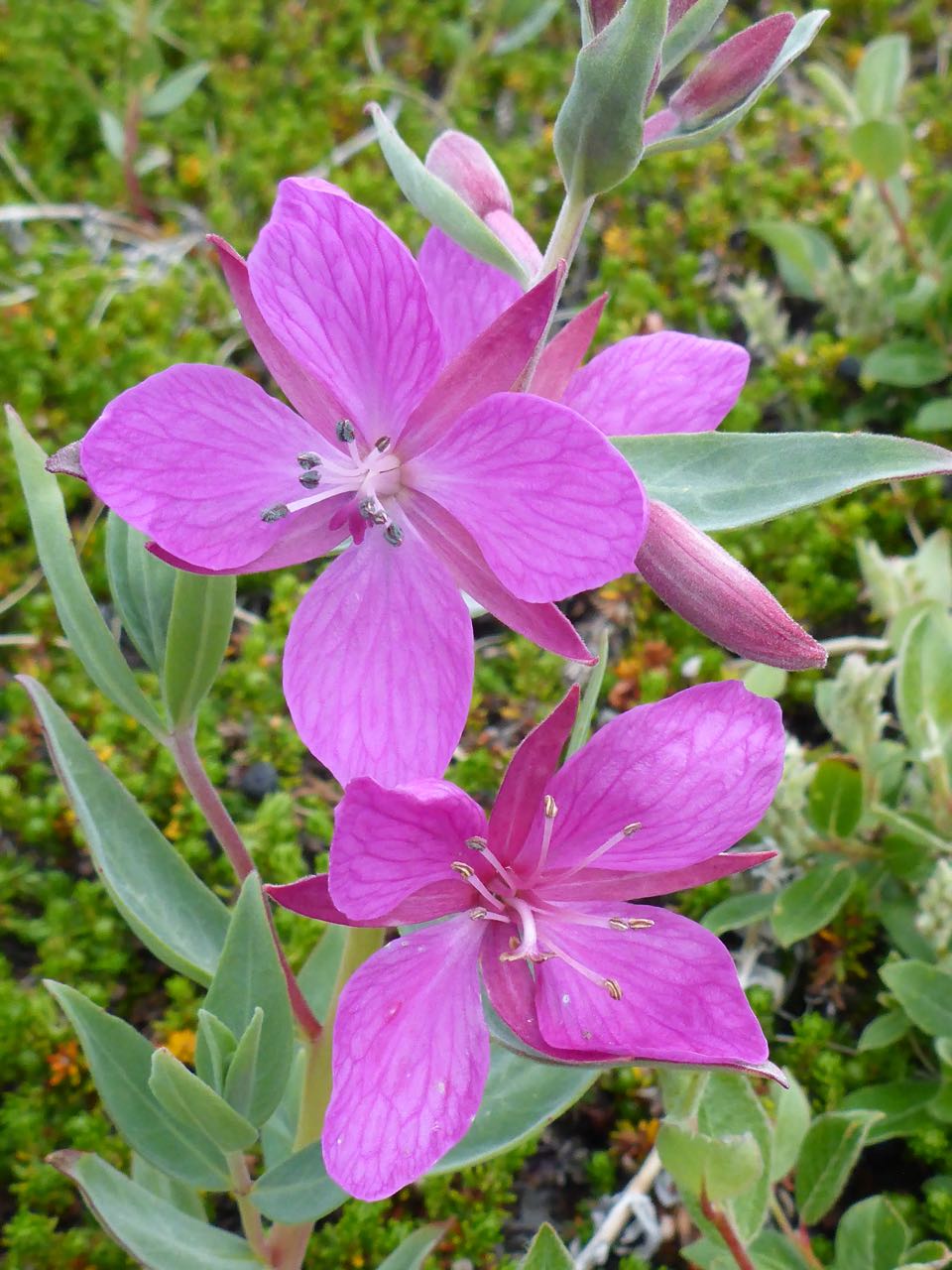
We had a comfortable night and woke up at 5.00 am to a windless, glassy-still lake and some high altostratus cloud. We got ourselves organised and set off for a 2-hour paddle to Qingeq Kujalleg Valley. This valley system leads over a 418m pass to Kangerluk Fjord close to Prins Christian Sund. That evening we camped under a huge over-hanging rock by the moraine wall on the other side of the pass. It was a delightful location, complemented by the resplendent, pink flowers of Moss Campion and the white ice of the nearby glacier.


Next day, under altostratus cloud, we walked down the valley flats towards Kangerluk Fjord. Our descent was easy to a rocky shore that we boulder-hopped to a beach below peak 969m. There was a sandy beach protected on the south by large boulders – an ideal sheltered campsite.


Next day we climbed peak 969m. The view that opened up was breath-taking of all the surrounding fjords including the arrow- straight 70 km long Prins Christian Sund. There was an immensity of silence as though the heavens themselves were holding their breath. In silence, we stared in awe at the wild, ineffable power of nature, feeling empowered by the surrounding energies, in a state of transcendence.


After lunch, in better weather, we set off for the Issortusut Valley and climbed up this to a small lake at 300m where we camped. This was partly frozen and Archadian in grandeur.


The following day we reached a col and we saw below us the astonishing sight of a huge frozen lake with striations on its glassy surface leading down a rocky valley to Aappilattup Avanna Fjord. We descended this to the fjord and crossed to Stordalens Havn.


I was concerned about sea fog and wind in the fjord and thought it might be best to camp but there did not appear to be any good places when we reached the shore. Then we decided it might be prudent to cross while conditions were plausible. We did the 1.5 km open crossing that evening.

It rained next morning but towards evening it eased off so we decided to make a move and cover some of the ground to Tasiusaq. We broke camp in light drizzle and set off up the valley. We tramped for 4 difficult hours in cold, wet, misty conditions, crossing swollen glacial rivers, often having to climb up into the headwaters to find crossable braids. Even then it was touch and go as we struggled across thigh-deep, fast, milky-white rivers and scrambled across slippery moraine fields of large mossy, rocks.


The next day we reached Tasiusaq before closing time and carried on to the Kuussuaq River and portaged over to the Tasermiut side to camp. Bruce caught an Arctic Char for dinner.


Next day we paddled to Klosterdalen . It was about a 25 km paddle that we covered in 8 hours. There is a big river spilling into the fjord here and we landed on a small beach on the TR of this and carried our gear up a steep bank to camp on a nice level area near the monastery ruins. Klosterdalen was the site of a Norse monastery for monks of the Augustinian order, a millennium ago. The day was splendid and we lazed around in the sun marvelling at the stupendous 2000m wall of Ketil rising above us. We met 2 lovely Belgian people Frank and Heidi who had been hiking in the area.


We arose to a cold, clear morning and quickly had breakfast and packed up. The 2 Belgians were still in their tent but appeared down at the beach just as we were preparing to launch. After some group photos, we paddled off. It was a 10 km paddle to the valley, which took us a few hours. Ahead the Sermeq Icefall filled the head of the fjord.
In the afternoon, we set off up the valley following an easy open bank on the TL to camp on the side of a hill just before a lake filling the head of the valley. After setting up camp, I checked the InReach forecast and it still looked promising.


We got away at 7.00 am and cresting the hill, reached a large lake and descended the Ippatit Kuua Valley mostly following the riverbed. Cloud was now filling the sky and the wind rising. Nearing the Sondre Sermilik, katabatic winds, with unfettered fury, had turned the sea into a mass of whitecaps and lashed the slopes of the valley with abandoned restraint. It was drizzling and the storm was worrying, to say the least.


The Kugssuatsiaq valley was easy initially as we followed close to the river, scrambling up large slabs, which led to a rocky flat valley floor with a river coursing down the middle. After a few hundred metres we struck lateral moraines and then we had a few hours of difficult boulder hopping up to the 650m level high above the creek in the valley below us, where we reached a sort of flat floodplain, partially covered in snow banks. Then the valley bent around to the right through moraine fields to a glacier. We reached a col and then a second one at about 1200m. A steep snow descent took us down and we managed to find a tiny flat site next to a lake.


We dropped from our lake into the head of the Isortup Qorup Valley and walked down the open flats. It was another fine day, blue sky, warm and stunning mountains all around. Apart from the murmur of the river coursing down the flats, there was the caw, caw of some ravens flying along the cliffs above us. We came in sight of hill 440m marked on our map. We were now cruising down an open upland and reached a rocky plain with some tarns so I called it a day here.


The 27th was to be a day of grief. Just as we were preparing to leave a mist rolled in obscuring everything. We descended from the sunshine into a quelling miasma of dankness, bitter cold and uncertainty. We reached the Sioragdlip Qorua River. There was an air of oppression that obscured the surroundings as if something was exerting a malign influence upon us. The river then entered a series of impenetrable gorges.

Later that day we reached the Isortup Qorup river again and entered another canyon. We forced our way through shoulder height birch scrub along a terrace high above a gorge with a huge glacial river rushing with unfettered haste to the Sioralik Fjord. Now the sky darkened and rain was coming. We crossed a narrow ledge butting up against a cliff with a stupendous drop to the raging river far below. We eventually retreated to camp on a small flat before the gorge.


Next day we packed up and climbed directly over small cliffs and slopes to a terrace that led across the top of the cliffs. We found a wild sheep trail here and followed it. This led to the lake-studded plateau that I’d seen the previous day. We dropped down to it and camped by a small lake. I went for a recce and found an ancient stone cairn possibly built by the Norse that marked a route down the bluffs to the valley bottom. I felt an ineffable, transcendental joy seeing this pile of rocks, covered in lichen that might be a millennium old in such a wild location. I gazed out over the lonely fjord and could see a Norse longship, the dragon head of its prow and hear the rams horn bugle call of their arrival. I watched it for a while and then quietly slipped back to the tent.


The 29th was fine, blue sky and mist lifting off the fjord, revealing high mountains. We crossed the Itivdleq valley to the Amitsuarssuk Fjord and paddled to the dam on Qordlortorssup Lake which we crossed.


Two days later we paddled to Igaliko and stayed in the Bygde Hotel 2 nights. on 3rd August we crossed the
Qooqqut Ice Fjord and on 6th reached Narsarsuag. From there we climbed Akuliaruseq 970m high above Narsarsuaq to a great view of the Kiattuut Sermiat and the Qooqqup Sermia glaciers. On 9th we flew to Copenhagen.


Acknowledgements: Thanks to Bruce for his good humour and strength in often challenging conditions. He was longanimous in the face of hardship and my vagaries. Thanks to Niels Jepsen for helping with logistics in Nanortalik and for looking after Tara when she was there. Thanks to Marius Borg, a sheep farmer at Tasia; Jacky Simoud of Blue Ice; to the staff at the Bygde Hotel. You all helped make this journey happen.
Photographs: I took all of these apart from 4 at Klosterdalen taken by Frank Leuentop for which I'm grateful.
Photographs: I took all of these apart from 4 at Klosterdalen taken by Frank Leuentop for which I'm grateful.