-->
-->
In November 2014, Paula and I attempted to
reach Ivory Lake via the Tuke Valley and turned around on top of ice-bound Mt
Beaumont in the face of deteriorating weather. Then by a process of mental
telepathy we independently proposed another trip to approach Ivory Lake via the
Wanganui River, Bracken Snowfields, Seddon Col and exit via the Hitchen range.
Matthew Humphries and Reece McKenzie were keen to join us.
On 2nd January 2016 we set off
from Invercargill in Reece’s Hilux double cab for the 8 hour drive to Harihari
where we stayed at the local hotel. Reece did all the driving, bless his soul.
We dropped off a bike at the last farmhouse on Waitaha Road. Next morning the
hotel manager came with us to the road end in the Wanganui valley and drove the
car back to the hotel.
On 3rd we set off up the true
right of the Wanganui River to Jones Flat mostly walking on slippery wet rocks
on the side of the river. The highlight of the day was the flying fox across
the river just past the Lambert Junction. From here it was a short walk to
Hunters Hut. When we arrived there was a pile of possum fur drying on a bunk
and gear spread around the hut. Presently a girl from Belfast and an American schoolteacher
from Balclutha arrived. They had been here a few days trapping possums.


On 4th we set off up the true
left of the Wanganui River to Smyth Hut. We read reports of slips and difficult
travel just before the hut and travel times varying from 9-12 hours. Soon we
came to Poker Bluff and took the high route mentioned in the guide, which was a
rude start to the day. Next we came to the ‘Gut’ that we down climbed with a
distinct lack of grace at least on my part. This was a crumbly slot of greywacke
rock. Sensibly, Paula and Matthew lowered their packs on a rope. Then it was an
interminable slog up and down loose rocks in the riverbed to Devastation Creek.
A lead up through the bush marked by mossy cairns took us into it for maybe 50
meters above the creek. On the other side we had difficulty in finding the track,
as it was not marked on the map or signposted. Eventually we took an unmarked
trail into the bush on the other side and this was the route. Further on were a
series of slips to Smyth Hut in an island of bush in the middle of the riverbed.
It took us 9 hours.


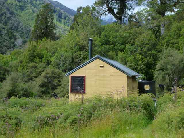
The hut was a welcome sight, a typical 6
bunk DOC hut in good condition and clean. A few minutes below it were the hot
pools, deliciously warm which we soaked in. I noticed in the hut book that
Henriette Beikirch had stayed here on 2
and 3rd December 2012 on her traverse of the Southern Alps, having
come from Reischek Hut over Erewhon Saddle, to walk out down the Wanganui for a
resupply. What a tough woman!
Next day we had an early start leaving at
5.00am by headlight following up and around huge boulders to the Vane/Evans
junction. We knew this would be a difficult crossing and were not disappointed.
We eventually forced a crossing and started up the easier boulders on the true
left of the Evans to a small lake and beyond it the Evans Glacier. Then it was
a slow grind up to Full Moon Saddle at 2098m. It was very hot and dazzlingly
bright. Reece had gone ahead kicking steps, a power machine. The scenery was
superb, to our left Mt Evans 2620m with the massive Shelf Glacier breaking into
the Wilkinson and straight ahead the line of the Whitcombe valley and to our
right the Amazon Breasts.


After a short rest we roped up for crevasse
travel and headed for the Katzenbach Ridge. The route guide suggested cross a
spur at 2020m and this took us to rather steep snow slopes, step enough to need
a rope. Further on we dropped down snowfields and missed an easy descent to
lower shelves below us and reached a nearly vertical snow face and rock walls.
We decided to climb up through the gathering mist to the tops only to find
frighteningly steep rotten rock ridges just past peak 2068m. Clearly, this was
not the way and after studying the map we decided the route must be well below
us. Down we went again this time to the
left of the big drop and sure enough here was the snow lead. About 100m below
we found a lovely patch of tussock for our tent. Paula and Matthew had to dig
out a platform just below us for their tent. We had been on the go for 13.5
hours.


On 6th we struck camp at 7.00am
and descended snow and rocky slopes down and to the right to the large gully
below peak 1826m. Presently we came to a spur flanking the steep gully/slip,
and after a reconnaissance we worked our way down leftwards into a steep boulder
slope to a shelf far below us. From here a steep drop off took us to easier
slopes down to Lake Wilkinson. Here we walked around the lake and crossed the
outlet easily, then around the far side and up to the west of Agfa Knob.


West of Agfa Knob, we entered some awful
subalpine scrub and spent a lot of time and sweat fighting our way up Seddon
Creek to the scrub line. Matthew described this as “diabolical and
demoralizing”. I would have used more colourful language. I think Paula may
have used some ‘bad words’! In the
jungle I lost the knob of my monopod Leki pole which was a bit annoying. Higher
up we got back to the creek and found it much easier. Turning a corner we came
in view of North Seddon Col, a moderate snow slope leading to a symmetrical
curved col. I set the pace for this as it was getting on in the day and I
figured we needed to climb the 500m plus in no more than 2 hours if we wanted
to have enough daylight to descend on the other side and find a decent
campsite. So off I strode zig zagging up the steeping slope. Near the top I
crossed onto a rubbly rocky ridge and stopped to put on more clothes as it was
now quite cold and cloud was drifting in. Reece passed me and got to the col at
8.00pm and myself shortly afterwards. I was anxious to press on as visibility
was deteriorating rapidly.


Over to our right below peaks 1956 and 2058
was a narrow snow gully now obscured by cloud and down this we headed for
several hundred metres to camp on a wide shelf below the snowline at 1460m. It
has been a 14.5 hour day. We even had some tussock and were sheltered by huge
rocks. It was a relief to be over as clearly the weather was packing up now.


The following day dawned cloudy with the
tops hidden. Off we set crossing Stag Creek and following down tussock slopes
and benches to opposite the cliffs bordering Ivory Lake across the river. We
could see the hut perched far above. To the east of it was a spur that led
easily to the hut. Much to our surprise the hut was full with a hunter and a
tramping party from Canterbury. They were all very nice and helpful and the hunter
made us a hot drink. The 4-day weather forecast was poor so we decided to
forget about the Hitchin Range and go out via the Waitaha and to head down
straight away to the Top Waitaha Hut, which was empty. The descent was
straightforward and we arrived after 3 hours. That evening the rain set in.


On 8th we woke to rain and the
river in flood and pooling around the hut door. Luckily the hut is on piles so
water does not enter. This was providential, as we needed a rest day in any
case. By lunchtime the rain has stopped and we even had some sun peeping
through the cloud cover. We knew that travel down the valley to Moonbeam Hut
was difficult and there was no real track before Chainman Creek where the track
started to Moonbeam had been recut by the Permolat people last year.


Next morning the river was down but we
still needed to cross together. Then it was mostly along the river and into the
bush around bluffs on the true right. Eventually the river dropped off in a
series of waterfalls down to the Chainman junction. Here the Windhover Gorge
started and a track headed up a spur above it and then dropped steeply down to
a footbridge over the Waitaha. Another hour took us to Moonbeam Hut. This took
us 9 hours and was somewhat tiring with all the scrambling up giant boulders and
dense scrub.


Later that day the Christchurch party
arrived from Ivory Lake so we had a full house that night. Reece and Matthew
camped outside. Next morning an early start saw us traipsing off in drizzle,
boulder hopping on greasy rocks by the river. I took a fall and bruised my hip
and Matthew fell into a pool. Everyone has bruises on their legs from falls.
Thankfully after an hour we left the river and started a massive sidle on the
slopes all the way down to Kiwi Flat Hut. It was not the most pleasant of
country with lots of up and downs and the river a long way below us. Then it
was down to the Morgan Gorge to cross on a swing bridge and a grind down the
lower Waitaha. Here, I managed to climb along some river cliffs after missing
the track over them. It was somewhat scary as a watery death was waiting below
me.


Arriving back at the farm Reece had left
his pack and biked off earlier. We were all sore and weary and Matthew’s feet were
destroyed. An hour later Reece arrived in the car having biked 40 kilometers to
Harihari to get the car. That evening we drove to the Porter Lodge at Fox
Glacier and next day back to Invercargill.
Acknowledgments: Thanks to Paula, Reece and
Matthew for your great company and a great trip. To Reece especial thanks from
all of us for doing all the driving and biking back to Harihari when the rest
of us were very tired. Photos are by Recce and myself.
Stanley Mulvany
Invercargill 16/1/2016