Friday, December 8, 2017

The Great Southern Lakes Expedition, Part 2


The ridge was very narrow with nearly vertical sides falling away to tussock benches far below us. The deer trail led resolutely forward along this knife-edge to a vertical, exposed buttress above us covered in scrub and rock. Surely there was a way up this but our packs were heavy and I knew Gavin was apprehensive. I looked again and the deer trail had vanished. Where was this ephemeral track?
Lake Mouat is a big lake tucked away into the Cameron Mountains of Southern Fiordland. In January 2016 Danilo Hegg and two companions packrafted it on their great journey to Lake Hakapoua. In October this year, we did a packrafting trip to Lake Poteriteri, down the Waitutu River and on to Lake Hakapoua. Gavin suggested a second trip taking in the Cameron Mountains, Lake Monk and Mouat, which rekindled my interest. Once I had a good look at the map, I realised this was entirely practical so the trip was born.
On 22 October, we met at Joyce and Johan’s place at Clifden. This time there was just Gavin, Belinda and me. Bruce was unable to join us, as he was to leave for Canada shortly. Presently, Johan appeared and off we went to Lake Hauroko. Then it was back down the lake in his jet boat to the beach where the Wairaurahiri River starts its plunge down to the sea. With a feeling of deja vu, we set off again for the Rastus Burn, crossed the walkwire and found the track to Poteriteri Hut. The day was sunny, still and humid as we set off over familiar territory. 9 hours later we reached the hut, dehydrated and tired.


We had discussed the weather forecast on the walk over and it seemed that after a few days there was some changeable weather predicted so we altered our plans and decided to paddle next day to the Princess Burn, instead of heading directly to Lake Mouat. We had a comfortable night at the hut and planned an early start.
On 23rd we awoke to a flat lake and set off in our packrafts directly to the western shore and then paddled north to the mouth of Mouat Creek. By the time we arrived off Mouat Creek, the wind had come away from the south, so we carried on northwards along the western shore with a following breeze. It took us 6 hours to complete the 24-kilometre paddle.


We were able to paddle up the Princess Burn a little way and land at the first rapid. Just ahead was the junction of Kakapo Creek so we walked up this to the gorge and climbed out on the true left up a deer trail on steep cliffs. It is a 140m climb to the upper valley and in places, there are deer trails but it was slow going. After about a kilometre we reached a shallow muddy pond, which we skirted around. Then it was another 2 kilometres to Kakapo Lake. Here, we blew up the rafts and paddled up the calm lake, looking for my old campsite of 2005. Once Gavin and I landed at the top near an old deer enclosure, Belinda set off to paddle around the lake. When she returned she had found the old campsite on the northern side. We all moved camp there to spend a pleasant evening.


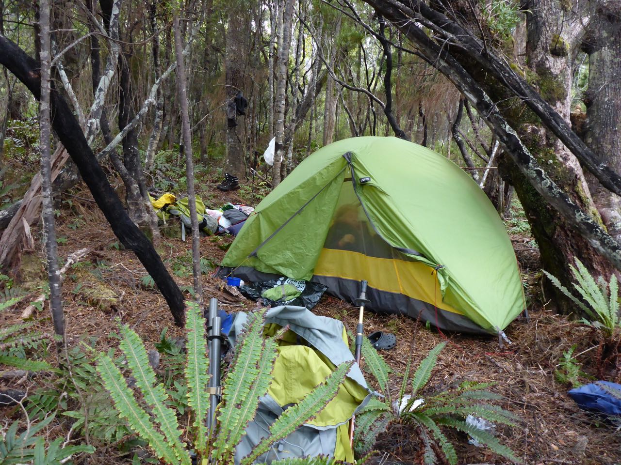
On 24th we paddled across the lake and set off for Crescent Lake on the Richard Burn Saddle. Once we crossed the stream just west of the lake we climbed up the true left bank on good deer trails. Eventually, the bush gave way to scrub and we arrived on a rocky knoll. I was a bit confused here as all I could see was bush running up to rocky ridges ahead and to the north. I had expected a wide deer tail and open flats of my previous visit. We then set off towards a rocky, bush-covered ridge to the west. This was quite scrubby and slow going.  We arrived at a rocky cliff-line and once this was climbed, we found the aforementioned wide deer trail and this led to the open flats. By following these to the south we were able to avoid any further bush bashing and arrived at a lovely glade on the south side of the lake where we set up camp. Belinda set off to paddle around this lake while I pitched our tent. It was overcast and drizzled a bit.


The 26th looked a better day as we set off for the Cameron Mountains. From Crescent Lake, we dropped down some clearings and then made for point 738m marking the start of the Camerons. We had a tussle with dense scrub and after a while, I saw a clearing down below us so dropped off to find a clear route to the rocky spur just on the other side of the obvious saddle. The sun was shining now and it was a beautiful day under blue skies as we started up the granite spur. Ahead a chamois surveyed us and slowly led the way upward. On point 925 we found an old cairn of stones. Beyond this, we had to drop into a saddle with a tarn and then it was a climb of over 100m to a saddle where we came to a cliff face. This had some exposed scrambling but once over this, it led to some delightful tarns, where we stopped for lunch.


It was a steady climb towards peak 1181 but just short of it, we arrived at a small, very exposed buttress. Oddly enough, a good deer trail continued right to its base but then vanished. I could see Gavin was worried so we back-tracked and dropped off down to the south side where we started a long 2 km sidle keeping our height to peak 1299m. Although this was steep it was easy going. On the boulder field under the peak, we startled a hind and her year-old fawn that dashed off downhill to the bushline.   Sidling around to the left we arrived above a beautiful alpine lake. I suggested we camp here so we dropped down around cliffs to arrive on the lakeshore, where we found a comfortable area to camp on. By now it had clouded over and we had 1 hour of heavy rain as we set up the tents. Belinda had a fall earlier and had a laceration on her shin which I dressed later. Then Belinda and Gavin set off to paddle around the lake as a wall of mist drifted in from the narrow slot where the lake emptied out into a valley far below.


The next morning it was a 60m climb to a saddle that led us down to another lake at 620m to the south surrounded by bush. The weather was brilliant again and warm. At the head of it on tussock flats, we got out the packrafts and paddled down to the end. The original plan was to moved camp up to the open tops on the way to Lake Monk and for Belinda to paddle around it and come back to the saddle but the bush looked very scrubby and we were already quite tired, so we decided to carry on downwards. Just below the lake there was a waterfall and rapid over granite cliffs and we descended down the true left well away from the cataract down to the next lake 60m below. Then it was a short paddle down this to the bush at the far end where we stopped for lunch.


We followed deer trails down the true right to about the 500m level where the land dropped away steeply. From here we went over to the true left and followed easy slopes down to the junction of the West and North branches of Mouat Creek. We had another snack here and then continued on down the valley through some difficult sections till we arrived at some very dense scrub just before Lake Mouat. Here we launched the packrafts and paddled the last bit of river to the lake.


There was a sandbank on the true left of the river entrance and here we stopped late in the day to camp. The sandflies were vicious and I was not keen on stopping. Gavin had his InReach communicator and received a message from his wife informing him of an impending “rain event” that night of 40mm of rain. “ We can’t stay here” was my reply. Secretly, I was happy to leave. About a kilometre down the lake on the right I could see a white sandy beach and this proved a much nicer campsite. The sky stayed clear that night and the front never reached us.


On  27th, Belinda left to paddle around Lake Mouat while I had a leisurely breakfast and tidy up. Once back, we all set off down to the far end of the lake and set off down Mouat Creek. It was a slow bush bash of about 5 kilometres to the lake through some chest high crown ferns, through swamps and scrubby sections to Lake Poteriteri. I noticed it was increasingly breezy near the lake and sure enough when we arrived on the beach there was a mass of white water out on the lake. We camped near an old deer hunter’s camp at the mouth of the creek and I did not mind the wind as it kept the sandflies off.


Next morning it was calm as we paddled down the lake to Poteriteri Hut, where we stopped for breakfast. Then it was a slow walk over the range to a lovely camp on the banks of a stream about 3 hours from Teal Bay at NZTM E1155673, N4879589. I was feeling quite tired even though Belinda took some of the tent, so glad to stop. Next morning it was an easy day back to Hauroko and a short paddle Teal Bay Hut. At 3.00pm exactly Johan arrived to pick us up.


My thanks again to Belinda and Gavin for a great trip and to Johan for his good humour and trusty jet boat.


Friday, November 17, 2017

The Great Southern Lakes Expedition, Part 1


It was a warm sunny day on the banks of the Slaughterburn Creek and as I turned I caught a movement in the waters of the stream. I peered closely as a black wriggling, back broke the surface of the water near my feet … a shortfin eel about 35 cm long had been attracted by my body odour from my bath. It swam closer and I marveled at this iconic denizen of our remote rivers. Then, I looked at the olive green forest and the blue sky and felt a deep satisfaction of sharing this environment with a native creature, silently gliding in the pure waters of this faraway stream.
I’d planned this trip months ago and my main reason was to help Belinda paddle some remote lakes. She has a passion for paddling lakes in the South Island and has probably paddled more than anyone else. Then Alastair formed “Permolat Southland” and I remembered my epic trip to Lake Poteriteri with Simon Marwick way back in 2005 when we set off on our journey to Deep Cove via the southwestern fjords.  Here was a possible project for Permolat Southland … to cut a track across from Lake Hauroko, maybe!
The trip got underway on 26th of October when Bruce Farmer, Gavin Sinclair and Belinda and I met at Johan and Joyce’s place at Clifden. I had done an epic crossing with Bruce and Penny last January from Mt Cook to Haast over Scissors and down the Landsborough Valley. Bruce had been a manager for Rio Tinto smelters all over the world, deputy leader of two Mt Everest Expeditions and on the first ascent of Molamenqing in Tibet. Gavin is a retired veterinary surgeon from Arrowtown and relatively new to packrafting and has been many places on solo trips. After introductions Joyce and Johan drove us over to the boat ramp on Hauroko, put their jet boat in the lake and off we went, heading south. At the outlet of the lake to the right of the start of the Wairaurahiri, they dropped us off on a small beach. Our packs were massively heavy with 8 days food, camping gear, and our packrafts.


With a wave, Joyce and Johan left us as we loaded up and crashed off into the crown ferns and fallen logs for a short walk down to the Rastus Burn. Here we picked up orange track markers on the track leading off to the southwest towards the range separating the Wairaurahiri from Poteriteri Lake. This was easy to follow apart from some indistinct areas around ferny gully and creek crossings. We found a good track up the range to 450m level and then sidled right to a spur that dropped steeply to the plain behind Poteriteri Lake. Here we found many trapping tracks marked in different colours and a warning sign not to follow these. After 8.5 hours we reached the nice 6-bunk Poteriteri Hut. It was fairly windy out on the lake so we were glad we did not have to paddle that first day.


The hut was empty and we settled in for a pleasant meal and early night. We were up early even Belinda who seemed eager to get on the water. We decided to launch from the beach so blew up the packrafts and set off down a very still, mirror calm lake heading south. The others had newish packrafts and I used my 8-year old boat that was no match for the new ones, hence I was much slower. It was a 9-kilometer paddle to the start of the Waitutu River. We pulled in for a breather about 2 kilometres from the river onto a nice sandy beach. It was here that Belinda saw a fern bird. This is a rare “At Risk-Declining” species.


The start of the Waitutu River is wide and slow moving between forested banks and swamps. It was surreal paddling along under blue skies and un-touched natural wilderness. After 2 kilometers, we came to the junction of the Waitutu and Slaughterburn Creeks and here we got out, left our packrafts and walked 20 minutes up the track to the Slaughterburn Hut, nestled in a nice clearing beside the creek. The hut is only a few years old and very comfortable.


In the afternoon, I went down to the creek for a wash and after my bath, noticed a small black eel wafting into where I'd been standing. It was flawlessly beautiful and sinuous and at home in this wild place. I felt very privileged to be here. There was a curious bush robin flitting around the hut and peering in the windows at us. It was unafraid and looked like the hut guardian. We had a comfortable night there.
Next morning, we walked back to the junction with the Waitutu River and decided to walk down the true right bank for aways as the river was flowing very fast. After several hundred meters we found a small beach and launched our packrafts. Once out in the current, we were swept along very fast around a bend where there was a drop-off. We beached and walked over to inspect the next section of the river, which swept into a corner, then left into a left-hand bend under some low trees. It did not look at all safe so we packed up the rafts and found the trappers track on the true right bank. We followed this up and down hills all the way to Waitutu Hut through a lovely open forest and amazing birdsong with the sun shafting through the canopy and spotlighting glades in the forest. 

It was muddy and scrubby once we dropped off the ridges onto the littoral plain. We arrived at the Waitutu Hut to find it commandeered by a big group of divers-fishermen who were away at the time. The place was a mess and numerous cartons of beer were piled up around and in the hut. I think we counted something like 36 cartons of beer … it did not bode well staying there. Clearly, these people intended to use the hut for their holiday and had moved in for a prolonged stay looking at all the gear they brought along in their jet boat. I wondered why DOC does not have a limit on stays like say 3 nights and this would make it fairer to other hut users.


As we were eating lunch, a jet boat arrived and presently some men each carrying a beer came up the bank. One of them approached us and said: "And what are you old geezers up to?” “Probably a lot more than you’ve been doing” I replied. It turns out they are not the blokes staying in the hut but locals visiting. I noticed 2 pig hunting dogs with radio collars on them accompanied these men. I thought it was time to leave.
The track carried on to the west and had recently been cut, though much of the brush was left on the track. It followed the old telegraph route to Puysegur Point lighthouse. There was still some wire and the odd insulator attached to old timber posts along the route. We walked for some hours crossing Grant Burn and the AArn Burn on swing bridges. Gavin had his GPS and noted we were not far from Westies Hut in Prices Harbour. Further on he told us we were now past it and getting further away. This was quite confusing so we dropped our packs and I went back for a kilometer as I thought we'd missed the turnoff. But there was none so I reasoned it must be further west than shown on the map. As we were now quite tired I suggested we camp which seemed a good choice. Just off the track was a nice camping place among the trees so we set up camp there and had a pleasant evening. After dusk, we heard a morepork nearby.


Next morning we woke to much birdsong, which seemed to be the norm in the Waitutu. We set off and dropped into a creek, then climbed out up a steep slope into more forest. After an hour we came to a junction where Westies Hut was marked off to the left. The location is further west than shown on the topo map and quite confusing if you’re using a GPS. This led to a platform overlooking a bay and a rope protected ledge that sloped downhill to the right. We left our packs and descended this to stony beach between tall sea cliffs. Off to the right under one of these were 2 huts - Westies. The hut was initially built by a fisherman as a land base for his craypots. Following the end of this era, a hermit named 'Westy', lived there for 5-6 years before returning to civilization, whereupon the hut fell into disrepair. Another Southland local decided to restore the hut and reached an agreement with the Department of Conservation whereby the hut was to be suitably maintained and made a public hut that travelers can stay in and experience.


As it was too early to stop we carried on to Big River, climbing a big hill further on. The track sidled left and then dropped steeply to Big River. On the far side on some flat we could see some tents but no sign of anyone. Reaching the river we inflated our packrafts and set off towards Lake Hakapoua. There was a section near a rapid that we walked around and then set off up the 8-kilometer lake with an onshore wind assisting us. We made good time and reached a nice beach at the top by lunchtime. Here we decided to camp. Bruce got a fire going and we had a pleasant time enjoying the ambiance of the place. All around us forested hills dropped steeply to the tannin-stained waters … an Arcadian scene. We discussed leaving the packrafts next day about 2 kilometers down on lake below a saddle marked 153m and tramping over to Lake Marshall and Innes that Belinda was keen to circumnavigate. We’d carry her packraft over.


Another stunning day as we set off down the true left of the lake. We landed on rocks below the pass and left our gear here and set off up easy slopes through the forest floor, covered in crown ferns. I flagged our route up as it was quite convoluted through and around a series of gullies. It was fairly open and easy going up to point 153m. From here we could see a valley falling off to the SE and into this, we descended this following our GPS. Lower down it was very swampy and eventually, we arrived at tiny Lake Marshall. It was low lying and surrounded by swamp so we built a causeway of fallen branches to get to the lake edge where Belinda launched her packraft. It only took 5-10 minutes to paddle around this. Then we climbed up a hill and down another small valley to Lake Innes, which was much larger, maybe 3 kilometers around. Belinda launched her PR here and it took more like an hour to circumnavigate it.


Our return trip went well and we managed to pick up the flagging tape. Near the saddle we found an enormous dead tree standing upright and surrounded by a huge cone of wood chips and we assumed this was caused by kakas shredding it for grubs. It was a pleasant paddle down Hakapoua to a batch called “Trev’s Inn” set in the bush on the east side of the lake. No one was around and we camped on a lawn outside as yet another glorious day came to an end.


On Tuesday we paddled down to the little rapid out of Hakapoua to Big River and landed on a beach. Once we'd packed up, we set off up the hill and back along our outward track to camp about an hour from Waitutu Hut. We did not want to stay at Waitutu knowing there were alcohol-fuelled jet boaters there. Our camp was idyllic and a flock of 7 kakas kept us amused. Bruce had another go at our Toaks wood-burning stove but apart from lots of smoke, there was not much hot water to show for his efforts.


On Wednesday we carried on to Waitutu Lodge on the Wairaurahiri Lodge where the caretakers, Pete and Rose, warmly welcomed us. Hot showers seemed luxurious, as was the comfortable lounge. Next day Johan and Joyce arrived to take us up the Wairaurahiri River on their jet boat.


Acknowledgments: First to our team Belinda, Bruce and Gavin: to Joyce and Johan of the Wairaurahiri Jet, to DOC for the wonderful birdsong in the Waitutu and to Pete and Rose for your hospitality at Waitutu Lodge.